Hazen East Topo Map North Dakota
To zoom in, hover over the map of Hazen East
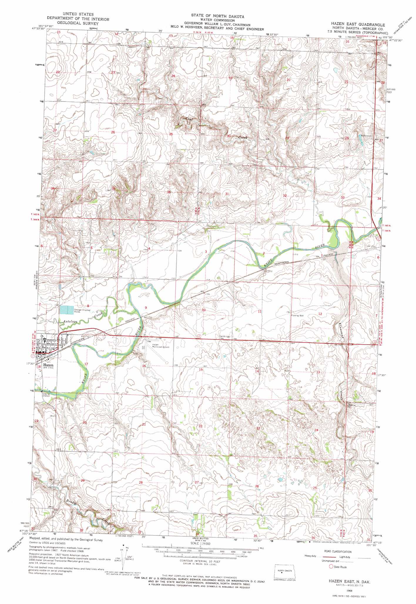
USGS Topo Quad 47101c5 - 1:24,000 scale
| Topo Map Name: | Hazen East |
| USGS Topo Quad ID: | 47101c5 |
| Print Size: | ca. 21 1/4" wide x 27" high |
| Southeast Coordinates: | 47.25° N latitude / 101.5° W longitude |
| Map Center Coordinates: | 47.3125° N latitude / 101.5625° W longitude |
| U.S. State: | ND |
| Filename: | O47101C5.jpg |
| Download Map JPG Image: | Hazen East topo map 1:24,000 scale |
| Map Type: | Topographic |
| Topo Series: | 7.5´ |
| Map Scale: | 1:24,000 |
| Source of Map Images: | United States Geological Survey (USGS) |
| Alternate Map Versions: |
Hazen East ND 1968, updated 1969 Download PDF Buy paper map Hazen East ND 2011 Download PDF Buy paper map Hazen East ND 2014 Download PDF Buy paper map |
1:24,000 Topo Quads surrounding Hazen East
Blackwater Lake Se |
Emmet Sw |
Emmet Se |
Garrison Dam North |
Riverdale North |
Beulah Ne |
Hazen Nw |
Hazen Ne |
Garrison Dam South |
Riverdale South |
Beulah |
Hazen West |
Hazen East |
Stanton |
Stanton Se |
Medicine Butte Ne |
Red Butte Nw |
Red Butte |
Hannover Nw |
Hannover Ne |
Medicine Butte Se |
Red Butte Sw |
Otter Creek |
Hannover |
Center |
> Back to 47101a1 at 1:100,000 scale
> Back to 47100a1 at 1:250,000 scale
> Back to U.S. Topo Maps home
Hazen East topo map: Gazetteer
Hazen East: Airports
Hazen Municipal Airport elevation 544m 1784′Hazen East: Populated Places
Hazen elevation 532m 1745′Hazen East: Streams
Antelope Creek elevation 522m 1712′Coal Creek elevation 516m 1692′
Kinneman Creek elevation 517m 1696′
Hazen East digital topo map on disk
Buy this Hazen East topo map showing relief, roads, GPS coordinates and other geographical features, as a high-resolution digital map file on DVD:
Eastern North Dakota & Eastern South Dakota
Buy digital topo maps: Eastern North Dakota & Eastern South Dakota