Underwood Topo Map North Dakota
To zoom in, hover over the map of Underwood
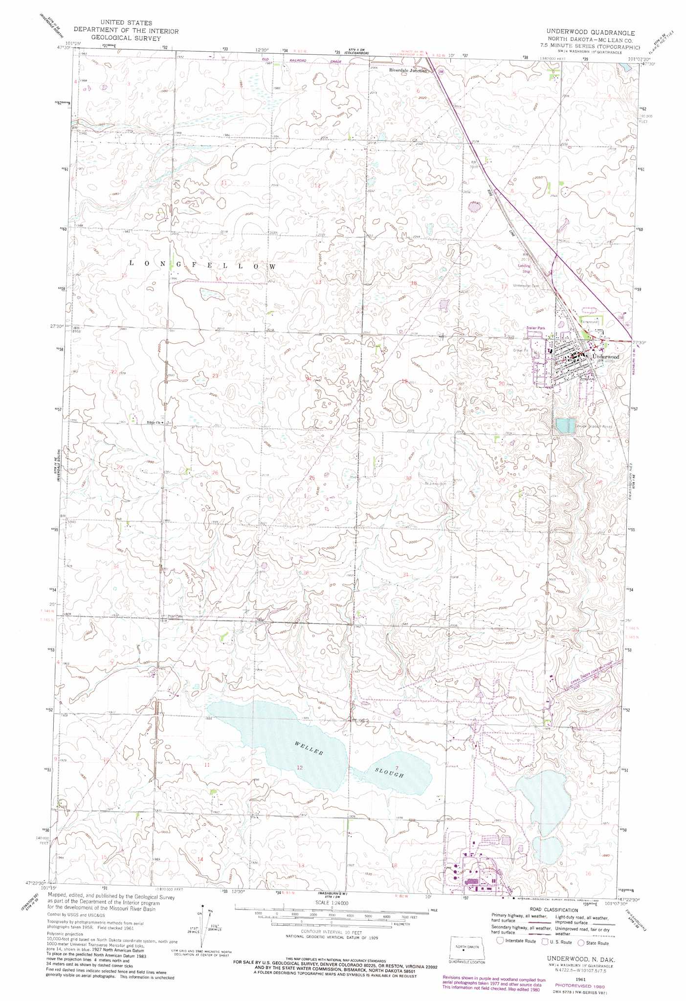
USGS Topo Quad 47101d2 - 1:24,000 scale
| Topo Map Name: | Underwood |
| USGS Topo Quad ID: | 47101d2 |
| Print Size: | ca. 21 1/4" wide x 27" high |
| Southeast Coordinates: | 47.375° N latitude / 101.125° W longitude |
| Map Center Coordinates: | 47.4375° N latitude / 101.1875° W longitude |
| U.S. State: | ND |
| Filename: | O47101D2.jpg |
| Download Map JPG Image: | Underwood topo map 1:24,000 scale |
| Map Type: | Topographic |
| Topo Series: | 7.5´ |
| Map Scale: | 1:24,000 |
| Source of Map Images: | United States Geological Survey (USGS) |
| Alternate Map Versions: |
Underwood ND 1961, updated 1963 Download PDF Buy paper map Underwood ND 1961, updated 1980 Download PDF Buy paper map Underwood ND 2011 Download PDF Buy paper map Underwood ND 2014 Download PDF Buy paper map |
1:24,000 Topo Quads surrounding Underwood
Garrison |
Garrison Ne |
Coleharbor Nw |
Coleharbor Ne |
Horseshoe Valley |
Garrison Dam North |
Riverdale North |
Coleharbor |
Lake Nettie |
Turtle Lake |
Garrison Dam South |
Riverdale South |
Underwood |
Washburn Ne |
Turtle Creek Nw |
Stanton |
Stanton Se |
Washburn Sw |
Washburn |
Turtle Creek Sw |
Hannover Nw |
Hannover Ne |
Fort Clark |
Fort Clark Ne |
Sanger |
> Back to 47101a1 at 1:100,000 scale
> Back to 47100a1 at 1:250,000 scale
> Back to U.S. Topo Maps home
Underwood topo map: Gazetteer
Underwood: Airports
Underwood Municipal Airport elevation 619m 2030′Underwood: Lakes
Weller Slough elevation 575m 1886′Underwood: Populated Places
Riverdale Junction elevation 610m 2001′Underwood elevation 616m 2020′
Underwood digital topo map on disk
Buy this Underwood topo map showing relief, roads, GPS coordinates and other geographical features, as a high-resolution digital map file on DVD:
Eastern North Dakota & Eastern South Dakota
Buy digital topo maps: Eastern North Dakota & Eastern South Dakota