Lake Vernon Topo Map North Dakota
To zoom in, hover over the map of Lake Vernon
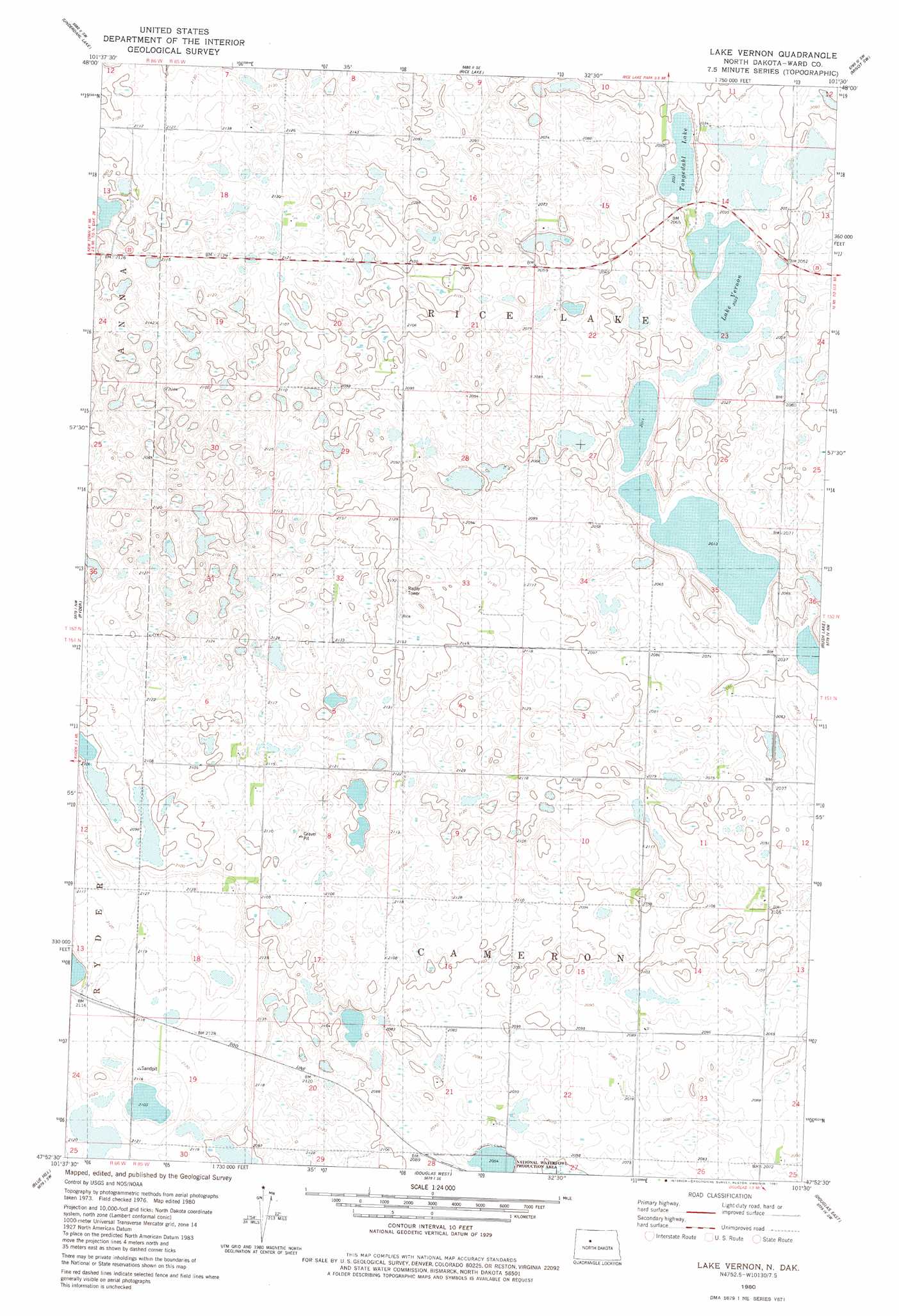
USGS Topo Quad 47101h5 - 1:24,000 scale
| Topo Map Name: | Lake Vernon |
| USGS Topo Quad ID: | 47101h5 |
| Print Size: | ca. 21 1/4" wide x 27" high |
| Southeast Coordinates: | 47.875° N latitude / 101.5° W longitude |
| Map Center Coordinates: | 47.9375° N latitude / 101.5625° W longitude |
| U.S. State: | ND |
| Filename: | O47101H5.jpg |
| Download Map JPG Image: | Lake Vernon topo map 1:24,000 scale |
| Map Type: | Topographic |
| Topo Series: | 7.5´ |
| Map Scale: | 1:24,000 |
| Source of Map Images: | United States Geological Survey (USGS) |
| Alternate Map Versions: |
Lake Vernon ND 1980, updated 1981 Download PDF Buy paper map Lake Vernon ND 2011 Download PDF Buy paper map Lake Vernon ND 2014 Download PDF Buy paper map |
1:24,000 Topo Quads surrounding Lake Vernon
Plaza Ne |
Rice Lake Nw |
Mork Lake |
Minot Nw |
Minot |
Plaza Se |
Underdahl Lake |
Rice Lake |
Minot Sw |
South Prairie |
Makoti |
Ryder |
Lake Vernon |
Rush Lake |
Max Ne |
Roseglen |
Blue Hill |
Douglas West |
Douglas East |
Max |
Blackwater Lake |
Emmet |
Emmet Ne |
Garrison |
Garrison Ne |
> Back to 47101e1 at 1:100,000 scale
> Back to 47100a1 at 1:250,000 scale
> Back to U.S. Topo Maps home
Lake Vernon topo map: Gazetteer
Lake Vernon: Lakes
Lake Vernon elevation 617m 2024′Tangedahl Lake elevation 625m 2050′
Lake Vernon digital topo map on disk
Buy this Lake Vernon topo map showing relief, roads, GPS coordinates and other geographical features, as a high-resolution digital map file on DVD:
Eastern North Dakota & Eastern South Dakota
Buy digital topo maps: Eastern North Dakota & Eastern South Dakota