Marshall Topo Map North Dakota
To zoom in, hover over the map of Marshall
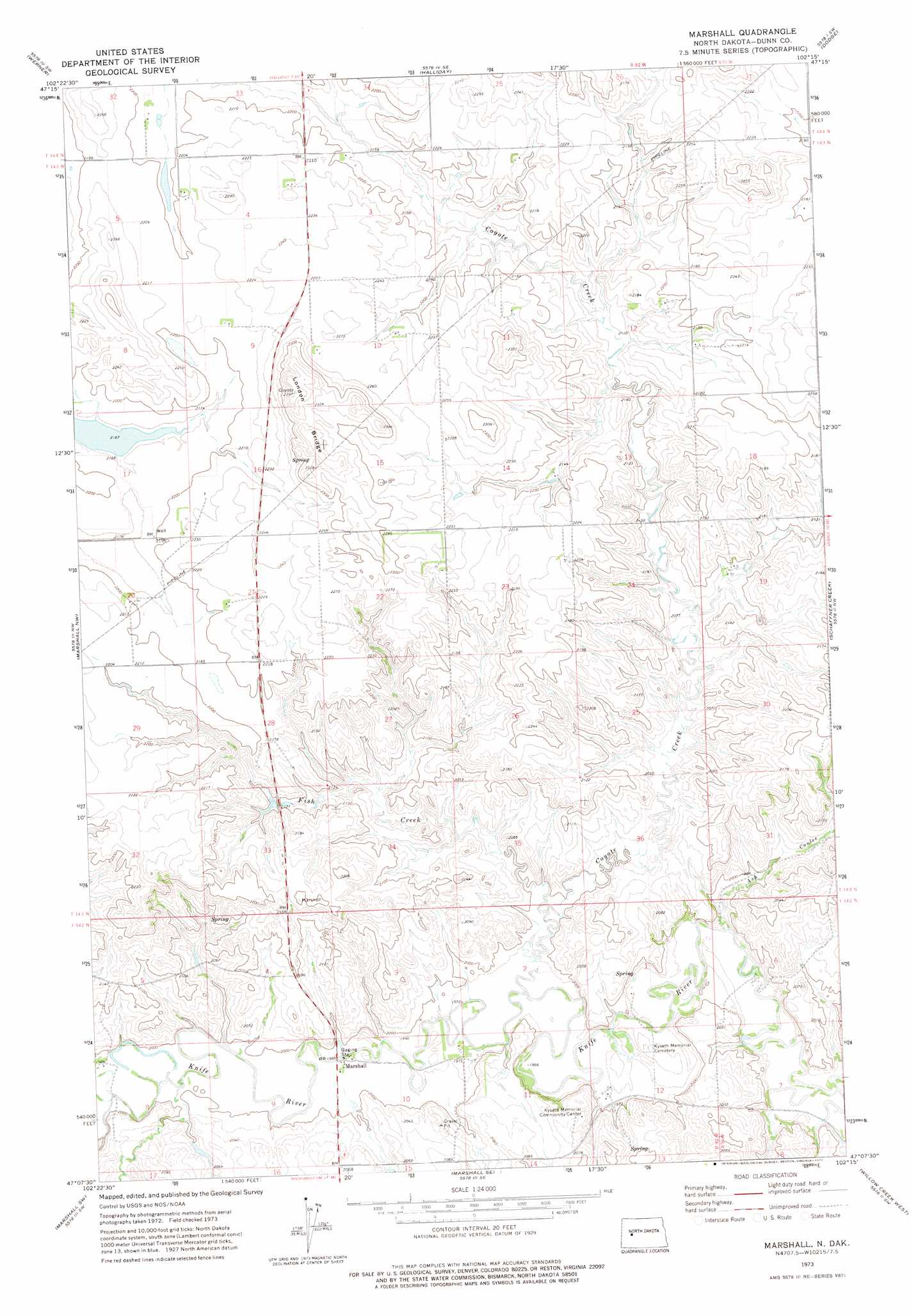
USGS Topo Quad 47102b3 - 1:24,000 scale
| Topo Map Name: | Marshall |
| USGS Topo Quad ID: | 47102b3 |
| Print Size: | ca. 21 1/4" wide x 27" high |
| Southeast Coordinates: | 47.125° N latitude / 102.25° W longitude |
| Map Center Coordinates: | 47.1875° N latitude / 102.3125° W longitude |
| U.S. State: | ND |
| Filename: | O47102B3.jpg |
| Download Map JPG Image: | Marshall topo map 1:24,000 scale |
| Map Type: | Topographic |
| Topo Series: | 7.5´ |
| Map Scale: | 1:24,000 |
| Source of Map Images: | United States Geological Survey (USGS) |
| Alternate Map Versions: |
Marshall ND 1973, updated 1977 Download PDF Buy paper map Marshall ND 2011 Download PDF Buy paper map Marshall ND 2014 Download PDF Buy paper map |
1:24,000 Topo Quads surrounding Marshall
Dunn Center Ne |
Halliday Nw |
Halliday Ne |
Golden Valley Nw |
Golden Valley Ne |
Dunn Center |
Werner |
Halliday |
Dodge |
Golden Valley |
Ziner Butte |
Marshall Nw |
Marshall |
Schaffner Creek |
Schaffner Creek Ne |
Hirschville |
Marshall Sw |
Marshall Se |
Willow Creek West |
Willow Creek East |
Boyle |
Taylor |
Richardton |
Indian Butte |
Hebron |
> Back to 47102a1 at 1:100,000 scale
> Back to 47102a1 at 1:250,000 scale
> Back to U.S. Topo Maps home
Marshall topo map: Gazetteer
Marshall: Dams
Qustafson Dam elevation 603m 1978′Marshall: Populated Places
Marshall elevation 604m 1981′Marshall: Ridges
London Bridge elevation 714m 2342′Marshall: Streams
Ash Coulee elevation 593m 1945′Coyote Creek elevation 598m 1961′
Fish Creek elevation 604m 1981′
Marshall digital topo map on disk
Buy this Marshall topo map showing relief, roads, GPS coordinates and other geographical features, as a high-resolution digital map file on DVD:
Eastern Montana & Western North Dakota
Buy digital topo maps: Eastern Montana & Western North Dakota