Golden Valley Ne Topo Map North Dakota
To zoom in, hover over the map of Golden Valley Ne
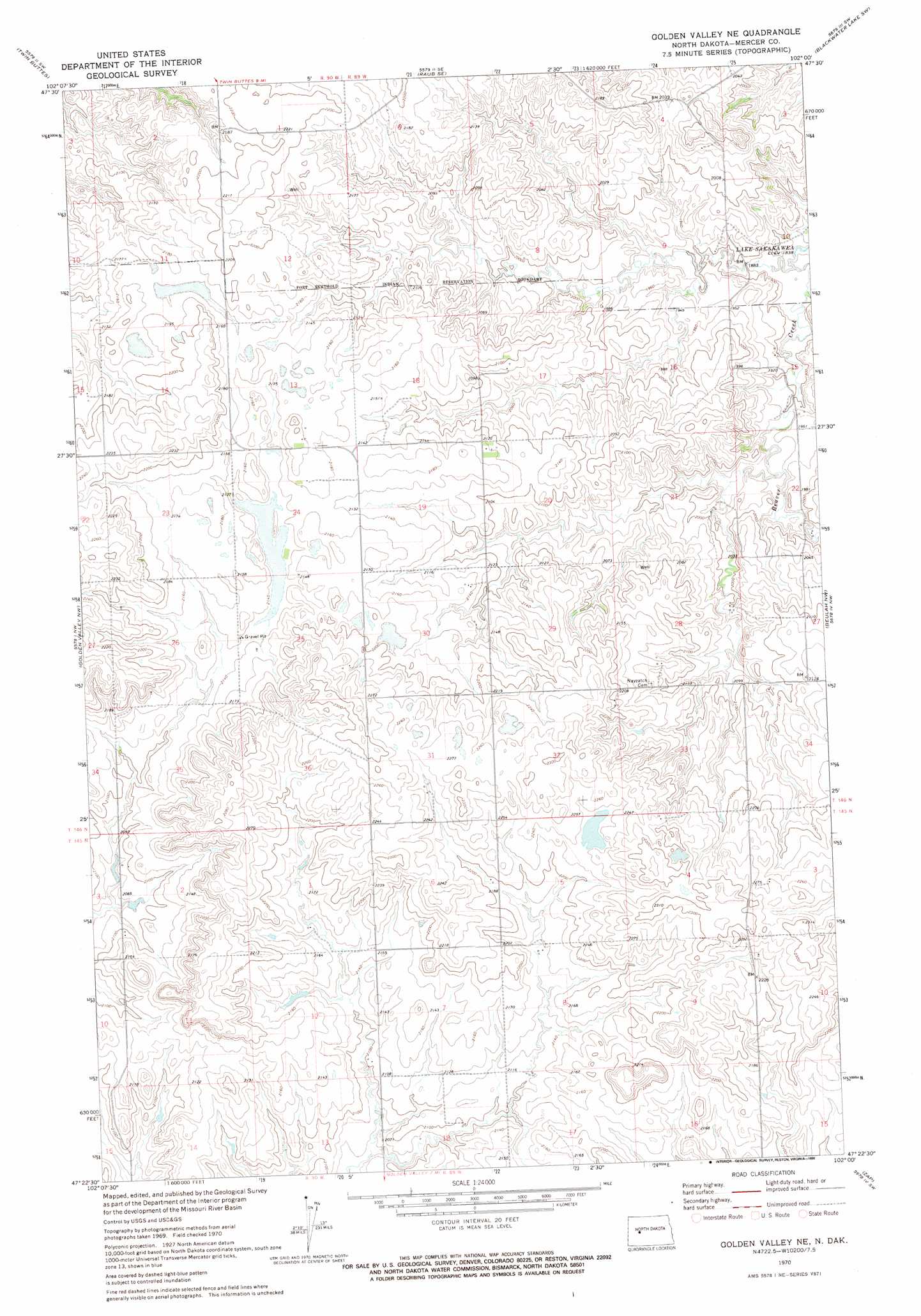
USGS Topo Quad 47102d1 - 1:24,000 scale
| Topo Map Name: | Golden Valley Ne |
| USGS Topo Quad ID: | 47102d1 |
| Print Size: | ca. 21 1/4" wide x 27" high |
| Southeast Coordinates: | 47.375° N latitude / 102° W longitude |
| Map Center Coordinates: | 47.4375° N latitude / 102.0625° W longitude |
| U.S. State: | ND |
| Filename: | O47102D1.jpg |
| Download Map JPG Image: | Golden Valley Ne topo map 1:24,000 scale |
| Map Type: | Topographic |
| Topo Series: | 7.5´ |
| Map Scale: | 1:24,000 |
| Source of Map Images: | United States Geological Survey (USGS) |
| Alternate Map Versions: |
Golden Valley NE ND 1970, updated 1973 Download PDF Buy paper map Golden Valley NE ND 1970, updated 1990 Download PDF Buy paper map Golden Valley NE ND 2011 Download PDF Buy paper map Golden Valley NE ND 2014 Download PDF Buy paper map |
1:24,000 Topo Quads surrounding Golden Valley Ne
Saddle Butte |
Raub Nw |
Raub |
Blackwater Lake Nw |
Blackwater Lake |
Hay Flat |
Twin Buttes |
Raub Se |
Blackwater Lake Sw |
Blackwater Lake Se |
Halliday Ne |
Golden Valley Nw |
Golden Valley Ne |
Beulah Nw |
Beulah Ne |
Halliday |
Dodge |
Golden Valley |
Zap |
Beulah |
Marshall |
Schaffner Creek |
Schaffner Creek Ne |
Medicine Butte |
Medicine Butte Ne |
> Back to 47102a1 at 1:100,000 scale
> Back to 47102a1 at 1:250,000 scale
> Back to U.S. Topo Maps home
Golden Valley Ne digital topo map on disk
Buy this Golden Valley Ne topo map showing relief, roads, GPS coordinates and other geographical features, as a high-resolution digital map file on DVD:
Eastern Montana & Western North Dakota
Buy digital topo maps: Eastern Montana & Western North Dakota