Figure 4 Ranch Topo Map North Dakota
To zoom in, hover over the map of Figure 4 Ranch
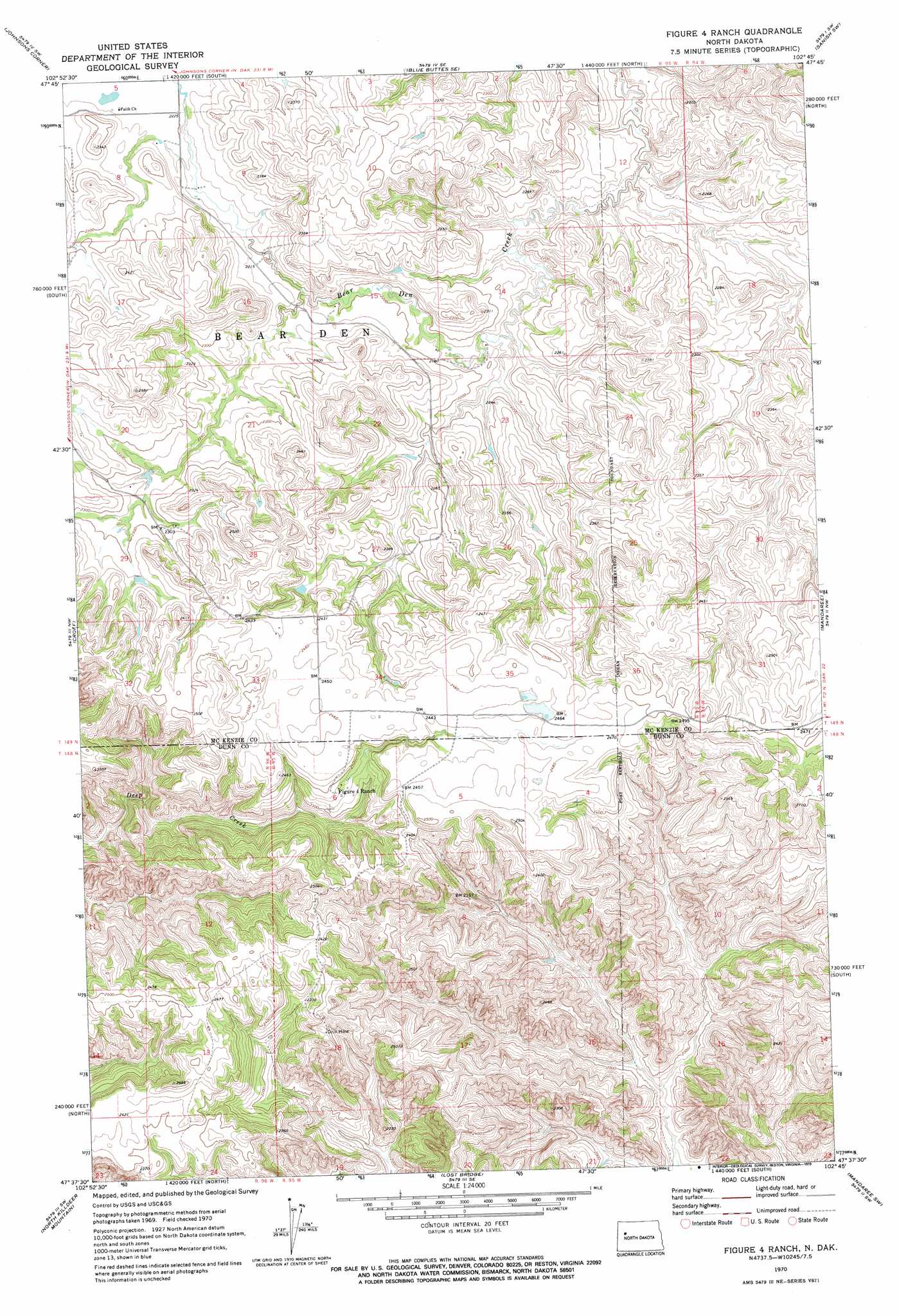
USGS Topo Quad 47102f7 - 1:24,000 scale
| Topo Map Name: | Figure 4 Ranch |
| USGS Topo Quad ID: | 47102f7 |
| Print Size: | ca. 21 1/4" wide x 27" high |
| Southeast Coordinates: | 47.625° N latitude / 102.75° W longitude |
| Map Center Coordinates: | 47.6875° N latitude / 102.8125° W longitude |
| U.S. State: | ND |
| Filename: | O47102F7.jpg |
| Download Map JPG Image: | Figure 4 Ranch topo map 1:24,000 scale |
| Map Type: | Topographic |
| Topo Series: | 7.5´ |
| Map Scale: | 1:24,000 |
| Source of Map Images: | United States Geological Survey (USGS) |
| Alternate Map Versions: |
Figure 4 Ranch ND 1970, updated 1973 Download PDF Buy paper map Figure 4 Ranch ND 1997, updated 2001 Download PDF Buy paper map Figure 4 Ranch ND 2011 Download PDF Buy paper map Figure 4 Ranch ND 2014 Download PDF Buy paper map |
| FStopo: | US Forest Service topo Figure 4 Ranch is available: Download FStopo PDF Download FStopo TIF |
1:24,000 Topo Quads surrounding Figure 4 Ranch
Demicks Lake |
Keene |
Blue Buttes |
Sanish Nw |
Sanish |
Schafer Se |
Johnsons Corner |
Blue Buttes Se |
Sanish Sw |
Sanish Se |
Lone Butte Ne |
Croff |
Figure 4 Ranch |
Mandaree |
Mandaree Ne |
Lone Butte Se |
North Killdeer Mountain |
Lost Bridge |
Mandaree Sw |
Mandaree Se |
Petes Creek |
Killdeer Mountains |
Oakdale |
Dunn Center Nw |
Dunn Center Ne |
> Back to 47102e1 at 1:100,000 scale
> Back to 47102a1 at 1:250,000 scale
> Back to U.S. Topo Maps home
No gazetteer data is available for the Figure 4 Ranch topo map sheet.
Figure 4 Ranch digital topo map on disk
Buy this Figure 4 Ranch topo map showing relief, roads, GPS coordinates and other geographical features, as a high-resolution digital map file on DVD:
Eastern Montana & Western North Dakota
Buy digital topo maps: Eastern Montana & Western North Dakota