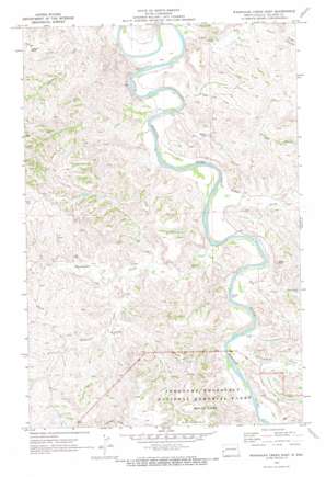
Wannagan Creek East Topo Map North Dakota
To zoom in, hover over the map of Wannagan Creek East
USGS Topo Quad 47103a5 - 1:24,000 scale
| Topo Map Name: | Wannagan Creek East |
| USGS Topo Quad ID: | 47103a5 |
| Print Size: | ca. 21 1/4" wide x 27" high |
| Southeast Coordinates: | 47° N latitude / 103.5° W longitude |
| Map Center Coordinates: | 47.0625° N latitude / 103.5625° W longitude |
| U.S. State: | ND |
| Filename: | O47103A5.jpg |
| Download Map JPG Image: | Wannagan Creek East topo map 1:24,000 scale |
| Map Type: | Topographic |
| Topo Series: | 7.5´ |
| Map Scale: | 1:24,000 |
| Source of Map Images: | United States Geological Survey (USGS) |
| Alternate Map Versions: |
Wannagan Creek East ND 1970, updated 1972 Download PDF Buy paper map Wannagan Creek East ND 1997, updated 2001 Download PDF Buy paper map Wannagan Creek East ND 2011 Download PDF Buy paper map Wannagan Creek East ND 2014 Download PDF Buy paper map |
| FStopo: | US Forest Service topo Wannagan Creek East is available: Download FStopo PDF Download FStopo TIF |
1:24,000 Topo Quads surrounding Wannagan Creek East
> Back to 47103a1 at 1:100,000 scale
> Back to 47102a1 at 1:250,000 scale
> Back to U.S. Topo Maps home
Wannagan Creek East topo map: Gazetteer
Wannagan Creek East: Areas
Little Missouri Badlands elevation 741m 2431′Wannagan Creek East: Cliffs
Pikes Peak elevation 785m 2575′Wannagan Creek East: Streams
Ash Coulee elevation 666m 2185′Dawsons Waterhole elevation 694m 2276′
Dry Creek elevation 673m 2208′
Franks Creek elevation 668m 2191′
Government Creek elevation 676m 2217′
Little Wannagan Creek elevation 693m 2273′
Wannagan Creek elevation 671m 2201′
Wannagan Creek East: Summits
Grassy Butte elevation 793m 2601′Wannagan Creek East: Valleys
Hay Draw elevation 673m 2208′Wolf Draw elevation 706m 2316′
Wannagan Creek East digital topo map on disk
Buy this Wannagan Creek East topo map showing relief, roads, GPS coordinates and other geographical features, as a high-resolution digital map file on DVD:
Eastern Montana & Western North Dakota
Buy digital topo maps: Eastern Montana & Western North Dakota


