Phillip Spring Topo Map North Dakota
To zoom in, hover over the map of Phillip Spring
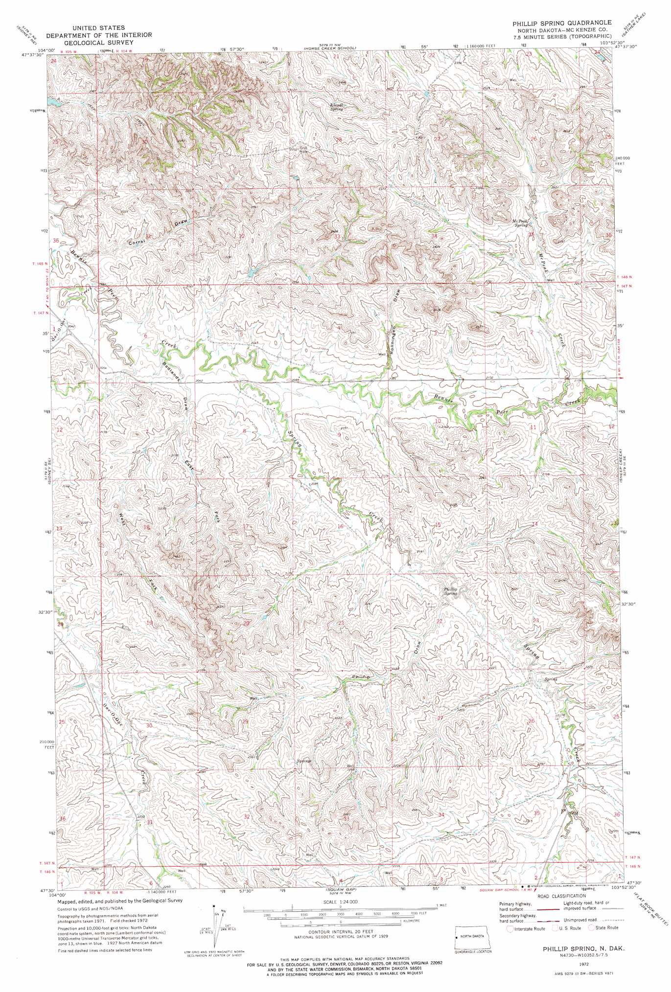
USGS Topo Quad 47103e8 - 1:24,000 scale
| Topo Map Name: | Phillip Spring |
| USGS Topo Quad ID: | 47103e8 |
| Print Size: | ca. 21 1/4" wide x 27" high |
| Southeast Coordinates: | 47.5° N latitude / 103.875° W longitude |
| Map Center Coordinates: | 47.5625° N latitude / 103.9375° W longitude |
| U.S. State: | ND |
| Filename: | O47103E8.jpg |
| Download Map JPG Image: | Phillip Spring topo map 1:24,000 scale |
| Map Type: | Topographic |
| Topo Series: | 7.5´ |
| Map Scale: | 1:24,000 |
| Source of Map Images: | United States Geological Survey (USGS) |
| Alternate Map Versions: |
Phillip Spring ND 1972, updated 1975 Download PDF Buy paper map Phillip Spring ND 1997, updated 2001 Download PDF Buy paper map Phillip Spring ND 2011 Download PDF Buy paper map Phillip Spring ND 2014 Download PDF Buy paper map |
| FStopo: | US Forest Service topo Phillip Spring is available: Download FStopo PDF Download FStopo TIF |
1:24,000 Topo Quads surrounding Phillip Spring
Fairview Sw |
Fairview |
Cartwright |
Charbonneau |
Alexander |
Sidney |
Sidney Ne |
Horse Creek School |
Sather Lake |
Moline School |
Piche |
Sidney Se |
Phillip Spring |
Sheep Creek |
Burning Mine Butte |
Skaar Nw |
Skaar Ne |
Squaw Gap |
Flat Rock Butte |
Cinnamon Creek |
Parson Creek |
Skaar |
Trotters |
Trotters Se |
Eagle Draw |
> Back to 47103e1 at 1:100,000 scale
> Back to 47102a1 at 1:250,000 scale
> Back to U.S. Topo Maps home
Phillip Spring topo map: Gazetteer
Phillip Spring: Springs
Klandl Spring elevation 697m 2286′McPeak Spring elevation 665m 2181′
Phillip Spring elevation 645m 2116′
Phillip Spring: Streams
McPeak Creek elevation 638m 2093′One-O-One Creek elevation 610m 2001′
Spring Creek elevation 615m 2017′
Phillip Spring: Valleys
Badlands Draw elevation 613m 2011′Corral Draw elevation 609m 1998′
East Fork Badlands Draw elevation 624m 2047′
Phillip Draw elevation 645m 2116′
Ronningen Draw elevation 629m 2063′
West Fork Badlands Draw elevation 624m 2047′
Phillip Spring digital topo map on disk
Buy this Phillip Spring topo map showing relief, roads, GPS coordinates and other geographical features, as a high-resolution digital map file on DVD:
Eastern Montana & Western North Dakota
Buy digital topo maps: Eastern Montana & Western North Dakota