Watford City Topo Map North Dakota
To zoom in, hover over the map of Watford City
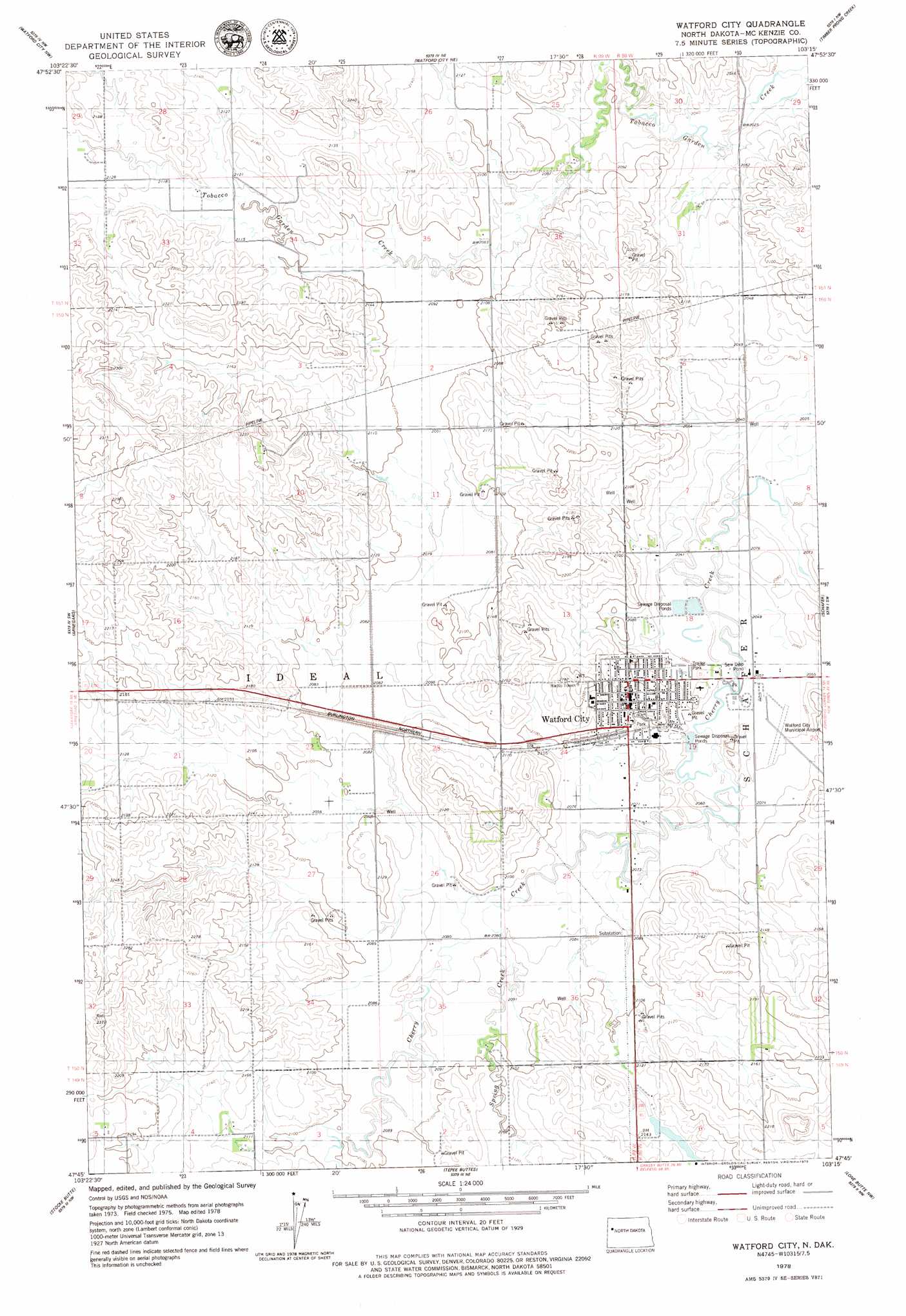
USGS Topo Quad 47103g3 - 1:24,000 scale
| Topo Map Name: | Watford City |
| USGS Topo Quad ID: | 47103g3 |
| Print Size: | ca. 21 1/4" wide x 27" high |
| Southeast Coordinates: | 47.75° N latitude / 103.25° W longitude |
| Map Center Coordinates: | 47.8125° N latitude / 103.3125° W longitude |
| U.S. State: | ND |
| Filename: | O47103G3.jpg |
| Download Map JPG Image: | Watford City topo map 1:24,000 scale |
| Map Type: | Topographic |
| Topo Series: | 7.5´ |
| Map Scale: | 1:24,000 |
| Source of Map Images: | United States Geological Survey (USGS) |
| Alternate Map Versions: |
Watford City ND 1978, updated 1979 Download PDF Buy paper map Watford City ND 2011 Download PDF Buy paper map Watford City ND 2014 Download PDF Buy paper map |
1:24,000 Topo Quads surrounding Watford City
Williston Se |
Lake Jessie |
Chris Creek |
Banks |
Tobacco Garden Bay |
Camp Creek East |
Watford City Nw |
Watford City Ne |
Timber Prong Creek |
Demicks Lake |
Rawson |
Arnegard |
Watford City |
Schafer |
Schafer Se |
Bear Butte |
Stocke Butte |
Tepee Buttes |
Lone Butte Nw |
Lone Butte Ne |
Red Wing Creek |
Sperati Point |
Long X Divide |
Lone Butte |
Lone Butte Se |
> Back to 47103e1 at 1:100,000 scale
> Back to 47102a1 at 1:250,000 scale
> Back to U.S. Topo Maps home
Watford City topo map: Gazetteer
Watford City: Airports
Watford City Municipal Airport elevation 627m 2057′Watford City: Populated Places
Watford City elevation 646m 2119′Watford City: Streams
Spring Creek elevation 630m 2066′Watford City digital topo map on disk
Buy this Watford City topo map showing relief, roads, GPS coordinates and other geographical features, as a high-resolution digital map file on DVD:
Eastern Montana & Western North Dakota
Buy digital topo maps: Eastern Montana & Western North Dakota