Arnegard Topo Map North Dakota
To zoom in, hover over the map of Arnegard
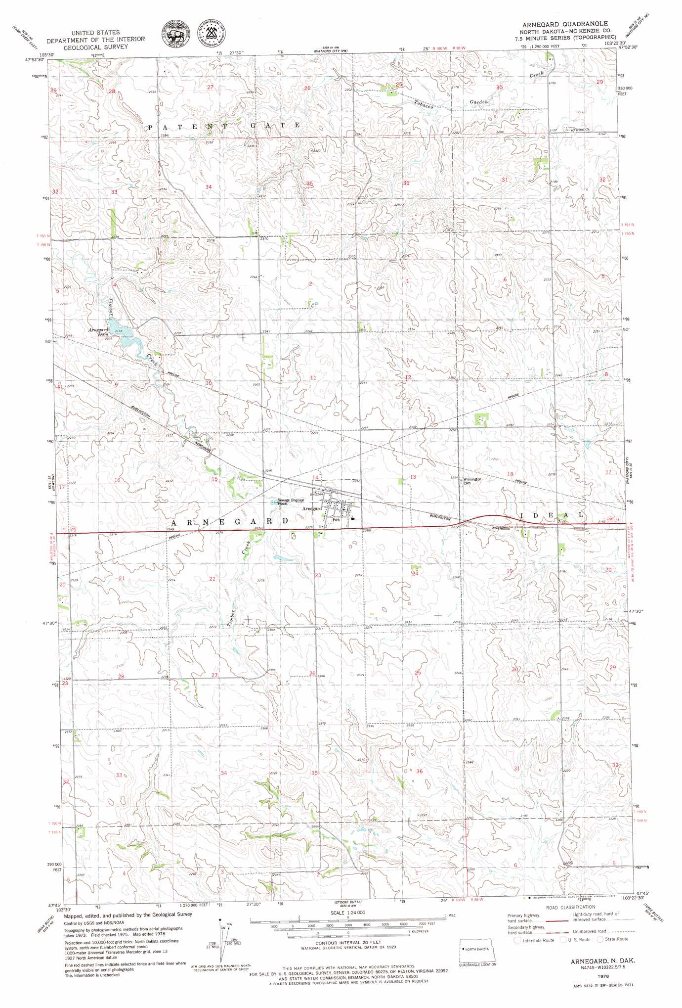
USGS Topo Quad 47103g4 - 1:24,000 scale
| Topo Map Name: | Arnegard |
| USGS Topo Quad ID: | 47103g4 |
| Print Size: | ca. 21 1/4" wide x 27" high |
| Southeast Coordinates: | 47.75° N latitude / 103.375° W longitude |
| Map Center Coordinates: | 47.8125° N latitude / 103.4375° W longitude |
| U.S. State: | ND |
| Filename: | O47103G4.jpg |
| Download Map JPG Image: | Arnegard topo map 1:24,000 scale |
| Map Type: | Topographic |
| Topo Series: | 7.5´ |
| Map Scale: | 1:24,000 |
| Source of Map Images: | United States Geological Survey (USGS) |
| Alternate Map Versions: |
Arnegard ND 1978, updated 1979 Download PDF Buy paper map Arnegard ND 2011 Download PDF Buy paper map Arnegard ND 2014 Download PDF Buy paper map |
1:24,000 Topo Quads surrounding Arnegard
Williston Sw |
Williston Se |
Lake Jessie |
Chris Creek |
Banks |
Camp Creek West |
Camp Creek East |
Watford City Nw |
Watford City Ne |
Timber Prong Creek |
Alexander |
Rawson |
Arnegard |
Watford City |
Schafer |
Moline School |
Bear Butte |
Stocke Butte |
Tepee Buttes |
Lone Butte Nw |
Burning Mine Butte |
Red Wing Creek |
Sperati Point |
Long X Divide |
Lone Butte |
> Back to 47103e1 at 1:100,000 scale
> Back to 47102a1 at 1:250,000 scale
> Back to U.S. Topo Maps home
Arnegard topo map: Gazetteer
Arnegard: Dams
Arnegard Dam elevation 678m 2224′Arnegard: Populated Places
Arnegard elevation 687m 2253′Arnegard: Reservoirs
Arnegard Dam elevation 663m 2175′Lake Pechek elevation 678m 2224′
Arnegard digital topo map on disk
Buy this Arnegard topo map showing relief, roads, GPS coordinates and other geographical features, as a high-resolution digital map file on DVD:
Eastern Montana & Western North Dakota
Buy digital topo maps: Eastern Montana & Western North Dakota