Cartwright Topo Map North Dakota
To zoom in, hover over the map of Cartwright
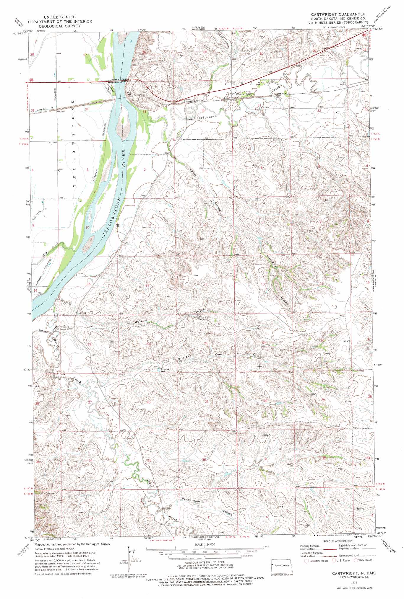
USGS Topo Quad 47103g8 - 1:24,000 scale
| Topo Map Name: | Cartwright |
| USGS Topo Quad ID: | 47103g8 |
| Print Size: | ca. 21 1/4" wide x 27" high |
| Southeast Coordinates: | 47.75° N latitude / 103.875° W longitude |
| Map Center Coordinates: | 47.8125° N latitude / 103.9375° W longitude |
| U.S. State: | ND |
| Filename: | O47103G8.jpg |
| Download Map JPG Image: | Cartwright topo map 1:24,000 scale |
| Map Type: | Topographic |
| Topo Series: | 7.5´ |
| Map Scale: | 1:24,000 |
| Source of Map Images: | United States Geological Survey (USGS) |
| Alternate Map Versions: |
Cartwright ND 1972, updated 1976 Download PDF Buy paper map Cartwright ND 1997, updated 2001 Download PDF Buy paper map Cartwright ND 2011 Download PDF Buy paper map Cartwright ND 2014 Download PDF Buy paper map |
| FStopo: | US Forest Service topo Cartwright is available: Download FStopo PDF Download FStopo TIF |
1:24,000 Topo Quads surrounding Cartwright
Bainville Sw |
Bainville Se |
Trenton Sw |
Trenton |
Williston Sw |
Fairview Nw |
Dore |
Buford |
Cartwright Ne |
Camp Creek West |
Fairview Sw |
Fairview |
Cartwright |
Charbonneau |
Alexander |
Sidney |
Sidney Ne |
Horse Creek School |
Sather Lake |
Moline School |
Piche |
Sidney Se |
Phillip Spring |
Sheep Creek |
Burning Mine Butte |
> Back to 47103e1 at 1:100,000 scale
> Back to 47102a1 at 1:250,000 scale
> Back to U.S. Topo Maps home
Cartwright topo map: Gazetteer
Cartwright: Bridges
Hjalmer Nelson Memorial Bridge elevation 570m 1870′Cartwright: Parks
Sundheim Park elevation 577m 1893′Cartwright: Populated Places
Cartwright elevation 581m 1906′Cartwright: Streams
Charbonneau Creek elevation 570m 1870′Hay Creek elevation 571m 1873′
Hay Creek elevation 571m 1873′
Horse Creek elevation 571m 1873′
Mule Creek elevation 571m 1873′
Cartwright: Valleys
Number One Coulee elevation 587m 1925′Sheep Coulee elevation 575m 1886′
Sweening Coulee elevation 616m 2020′
Vanderhoof Coulee elevation 610m 2001′
Cartwright digital topo map on disk
Buy this Cartwright topo map showing relief, roads, GPS coordinates and other geographical features, as a high-resolution digital map file on DVD:
Eastern Montana & Western North Dakota
Buy digital topo maps: Eastern Montana & Western North Dakota