Demicks Lake Topo Map North Dakota
To zoom in, hover over the map of Demicks Lake
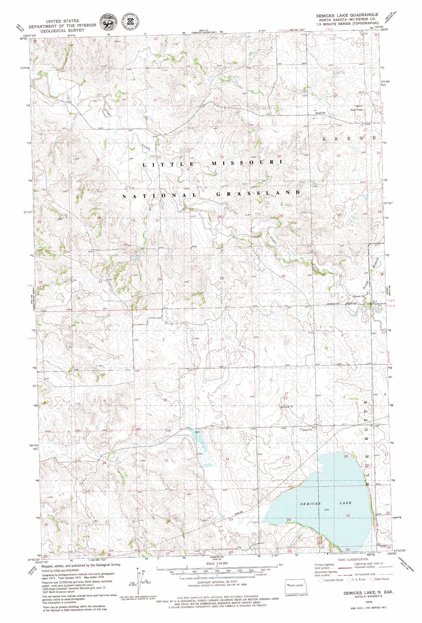
USGS Topo Quad 47103h1 - 1:24,000 scale
| Topo Map Name: | Demicks Lake |
| USGS Topo Quad ID: | 47103h1 |
| Print Size: | ca. 21 1/4" wide x 27" high |
| Southeast Coordinates: | 47.875° N latitude / 103° W longitude |
| Map Center Coordinates: | 47.9375° N latitude / 103.0625° W longitude |
| U.S. State: | ND |
| Filename: | O47103H1.jpg |
| Download Map JPG Image: | Demicks Lake topo map 1:24,000 scale |
| Map Type: | Topographic |
| Topo Series: | 7.5´ |
| Map Scale: | 1:24,000 |
| Source of Map Images: | United States Geological Survey (USGS) |
| Alternate Map Versions: |
Demicks Lake ND 1997, updated 2001 Download PDF Buy paper map Demicks Lake ND 2011 Download PDF Buy paper map Demicks Lake ND 2014 Download PDF Buy paper map |
| FStopo: | US Forest Service topo Demicks Lake is available: Download FStopo PDF Download FStopo TIF |
1:24,000 Topo Quads surrounding Demicks Lake
Gamache Creek |
Cussicks Spring |
Red Mike Hill |
Charlson Nw |
Charlson Ne |
Chris Creek |
Banks |
Tobacco Garden Bay |
Charlson Sw |
Charlson |
Watford City Ne |
Timber Prong Creek |
Demicks Lake |
Keene |
Blue Buttes |
Watford City |
Schafer |
Schafer Se |
Johnsons Corner |
Blue Buttes Se |
Tepee Buttes |
Lone Butte Nw |
Lone Butte Ne |
Croff |
Figure 4 Ranch |
> Back to 47103e1 at 1:100,000 scale
> Back to 47102a1 at 1:250,000 scale
> Back to U.S. Topo Maps home
Demicks Lake topo map: Gazetteer
Demicks Lake: Forests
Little Missouri National Grassland elevation 633m 2076′Demicks Lake: Lakes
Demicks Lake elevation 687m 2253′Demicks Lake: Streams
Bartall Creek elevation 610m 2001′Greenieu Coulee elevation 618m 2027′
Jackson Coulee elevation 636m 2086′
North Branch Clear Creek elevation 670m 2198′
Demicks Lake digital topo map on disk
Buy this Demicks Lake topo map showing relief, roads, GPS coordinates and other geographical features, as a high-resolution digital map file on DVD:
Eastern Montana & Western North Dakota
Buy digital topo maps: Eastern Montana & Western North Dakota