Cluster Buttes Nw Topo Map Montana
To zoom in, hover over the map of Cluster Buttes Nw
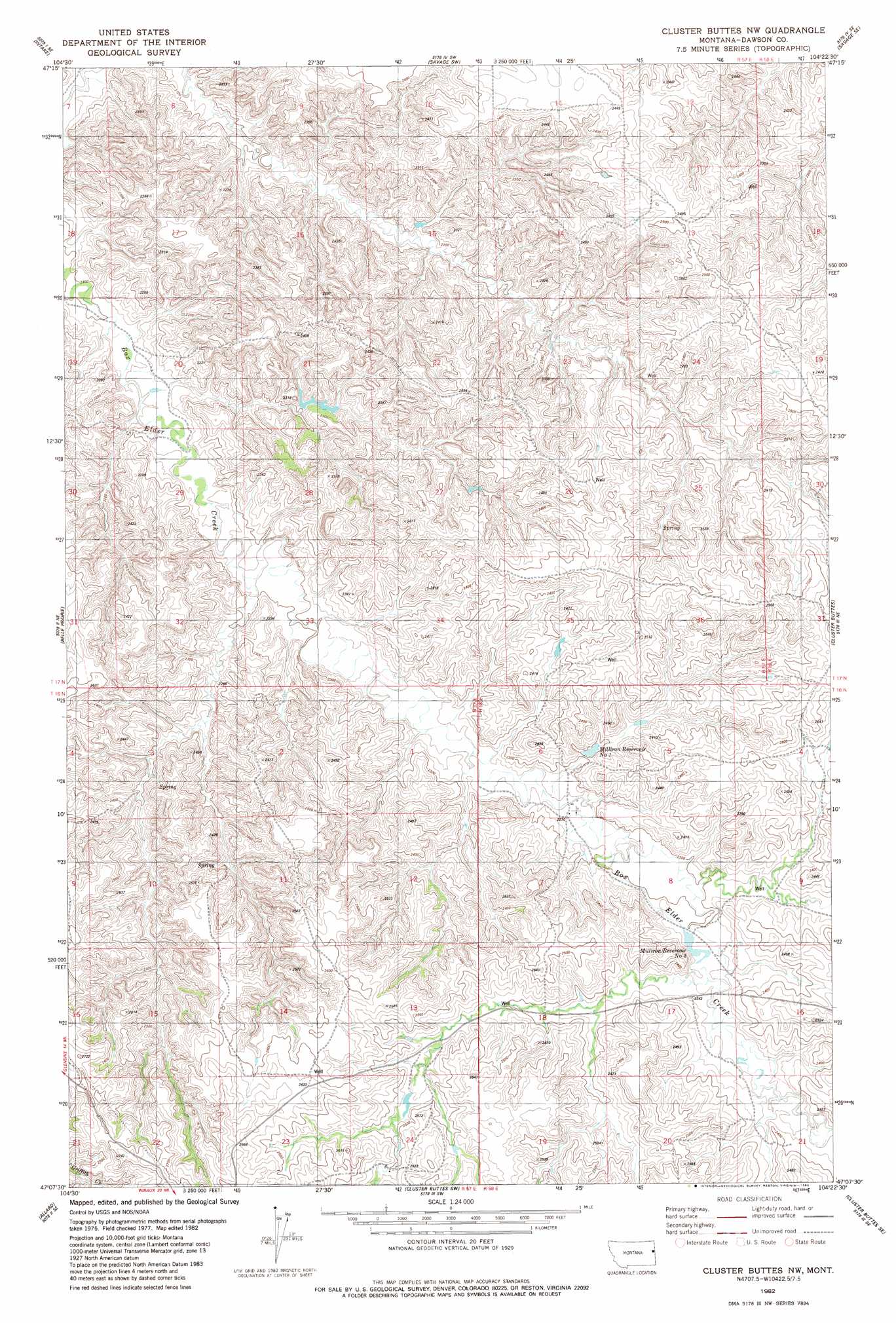
USGS Topo Quad 47104b4 - 1:24,000 scale
| Topo Map Name: | Cluster Buttes Nw |
| USGS Topo Quad ID: | 47104b4 |
| Print Size: | ca. 21 1/4" wide x 27" high |
| Southeast Coordinates: | 47.125° N latitude / 104.375° W longitude |
| Map Center Coordinates: | 47.1875° N latitude / 104.4375° W longitude |
| U.S. State: | MT |
| Filename: | o47104b4.jpg |
| Download Map JPG Image: | Cluster Buttes Nw topo map 1:24,000 scale |
| Map Type: | Topographic |
| Topo Series: | 7.5´ |
| Map Scale: | 1:24,000 |
| Source of Map Images: | United States Geological Survey (USGS) |
| Alternate Map Versions: |
Cluster Buttes NW MT 1982, updated 1983 Download PDF Buy paper map Cluster Buttes NW MT 2011 Download PDF Buy paper map Cluster Buttes NW MT 2014 Download PDF Buy paper map |
1:24,000 Topo Quads surrounding Cluster Buttes Nw
Intake Nw |
Allard Ranch |
Knife River Mine |
Savage |
Skaar Nw |
Kolberg Ranch |
Intake |
Savage Sw |
Savage Se |
Parson Creek |
Stipek |
Belle Prairie |
Cluster Buttes Nw |
Cluster Buttes |
Odland Dam Nw |
Glendive |
Allard |
Cluster Buttes Sw |
Cluster Buttes Se |
Odland Dam Sw |
Upper Magpie Reservoir |
Twin Forks Reservoir |
Hodges |
Freeman Creek |
Wibaux |
> Back to 47104a1 at 1:100,000 scale
> Back to 47104a1 at 1:250,000 scale
> Back to U.S. Topo Maps home
Cluster Buttes Nw topo map: Gazetteer
Cluster Buttes Nw: Dams
Box Elder Number 2 Dam elevation 769m 2522′Mill Iron Dam elevation 704m 2309′
Cluster Buttes Nw: Reservoirs
Milliron Reservoir Number 1 elevation 699m 2293′Milliron Reservoir Number 2 elevation 703m 2306′
Cluster Buttes Nw: Wells
16N57E27AAC_01 Well elevation 659m 2162′16N58E18BD__01 Well elevation 746m 2447′
17N58E19CAA_01 Well elevation 761m 2496′
Cluster Buttes Nw digital topo map on disk
Buy this Cluster Buttes Nw topo map showing relief, roads, GPS coordinates and other geographical features, as a high-resolution digital map file on DVD:
Eastern Montana & Western North Dakota
Buy digital topo maps: Eastern Montana & Western North Dakota