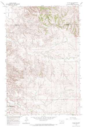
Savage Se Topo Map Montana
To zoom in, hover over the map of Savage Se
USGS Topo Quad 47104c3 - 1:24,000 scale
| Topo Map Name: | Savage Se |
| USGS Topo Quad ID: | 47104c3 |
| Print Size: | ca. 21 1/4" wide x 27" high |
| Southeast Coordinates: | 47.25° N latitude / 104.25° W longitude |
| Map Center Coordinates: | 47.3125° N latitude / 104.3125° W longitude |
| U.S. State: | MT |
| Filename: | o47104c3.jpg |
| Download Map JPG Image: | Savage Se topo map 1:24,000 scale |
| Map Type: | Topographic |
| Topo Series: | 7.5´ |
| Map Scale: | 1:24,000 |
| Source of Map Images: | United States Geological Survey (USGS) |
| Alternate Map Versions: |
Savage SE MT 1966, updated 1970 Download PDF Buy paper map Savage SE MT 2011 Download PDF Buy paper map Savage SE MT 2014 Download PDF Buy paper map |
1:24,000 Topo Quads surrounding Savage Se
> Back to 47104a1 at 1:100,000 scale
> Back to 47104a1 at 1:250,000 scale
> Back to U.S. Topo Maps home
Savage Se topo map: Gazetteer
Savage Se: Dams
Smith Creek Grazing District Dam elevation 711m 2332′Temple Dam elevation 711m 2332′
Savage Se: Flats
Valentine Flat elevation 633m 2076′Savage Se: Streams
Castle Creek elevation 656m 2152′North Fork Dry Creek elevation 659m 2162′
Savage Se: Wells
17N58E09BABA01 Well elevation 672m 2204′18N58E01CCC_01 Well elevation 726m 2381′
18N58E02DADD01 Well elevation 724m 2375′
18N58E08DABA01 Well elevation 647m 2122′
18N58E14CDBB01 Well elevation 679m 2227′
18N58E15BDAC01 Well elevation 675m 2214′
18N58E21CDDD01 Well elevation 710m 2329′
18N58E27BAAD01 Well elevation 730m 2395′
18N58E32BADD01 Well elevation 677m 2221′
18N58E34DCCD01 Well elevation 705m 2312′
Savage Se digital topo map on disk
Buy this Savage Se topo map showing relief, roads, GPS coordinates and other geographical features, as a high-resolution digital map file on DVD:
Eastern Montana & Western North Dakota
Buy digital topo maps: Eastern Montana & Western North Dakota


