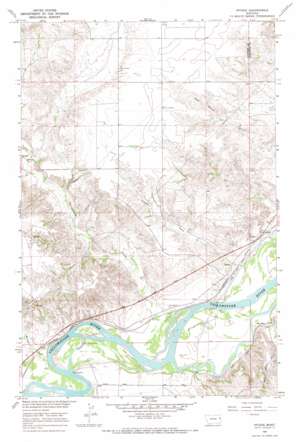
Intake Topo Map Montana
To zoom in, hover over the map of Intake
USGS Topo Quad 47104c5 - 1:24,000 scale
| Topo Map Name: | Intake |
| USGS Topo Quad ID: | 47104c5 |
| Print Size: | ca. 21 1/4" wide x 27" high |
| Southeast Coordinates: | 47.25° N latitude / 104.5° W longitude |
| Map Center Coordinates: | 47.3125° N latitude / 104.5625° W longitude |
| U.S. State: | MT |
| Filename: | o47104c5.jpg |
| Download Map JPG Image: | Intake topo map 1:24,000 scale |
| Map Type: | Topographic |
| Topo Series: | 7.5´ |
| Map Scale: | 1:24,000 |
| Source of Map Images: | United States Geological Survey (USGS) |
| Alternate Map Versions: |
Intake MT 1966, updated 1970 Download PDF Buy paper map Intake MT 2011 Download PDF Buy paper map Intake MT 2014 Download PDF Buy paper map |
1:24,000 Topo Quads surrounding Intake
> Back to 47104a1 at 1:100,000 scale
> Back to 47104a1 at 1:250,000 scale
> Back to U.S. Topo Maps home
Intake topo map: Gazetteer
Intake: Dams
Lower Yellowstone Diversion Dam elevation 605m 1984′Intake: Islands
Joes Island elevation 615m 2017′Intake: Populated Places
Intake elevation 612m 2007′Intake: Post Offices
Intake Post Office (historical) elevation 617m 2024′Intake: Streams
Box Elder Creek elevation 605m 1984′Corom Creek elevation 632m 2073′
Linden Creek elevation 611m 2004′
Morgan Creek elevation 608m 1994′
Thirteenmile Creek elevation 605m 1984′
Intake: Valleys
Elm Coulee elevation 610m 2001′Intake: Wells
17N56E04BDC_01 Well elevation 612m 2007′17N56E04DC__01 Well elevation 636m 2086′
17N56E04DC__02 Well elevation 636m 2086′
17N56E04DC__03 Well elevation 636m 2086′
17N56E11BBBB01 Well elevation 641m 2103′
18N56E15BDBD01 Well elevation 691m 2267′
18N56E24DCDD01 Well elevation 620m 2034′
18N56E24DCDD02 Well elevation 620m 2034′
18N56E25ADBA01 Well elevation 610m 2001′
18N56E25ADBA02 Well elevation 610m 2001′
18N56E25CB__01 Well elevation 639m 2096′
18N56E25DB__01 Well elevation 616m 2020′
18N56E26DD__01 Well elevation 639m 2096′
18N56E26DD__02 Well elevation 639m 2096′
18N56E29ADBA01 Well elevation 663m 2175′
18N56E34AB__01 Well elevation 623m 2043′
18N56E34ABDB01 Well elevation 622m 2040′
18N56E36BB__01 Well elevation 605m 1984′
18N57E18CBDB01 Well elevation 617m 2024′
18N57E19CA__01 Well elevation 606m 1988′
19N56E26CBCA01 Well elevation 739m 2424′
Intake digital topo map on disk
Buy this Intake topo map showing relief, roads, GPS coordinates and other geographical features, as a high-resolution digital map file on DVD:
Eastern Montana & Western North Dakota
Buy digital topo maps: Eastern Montana & Western North Dakota


