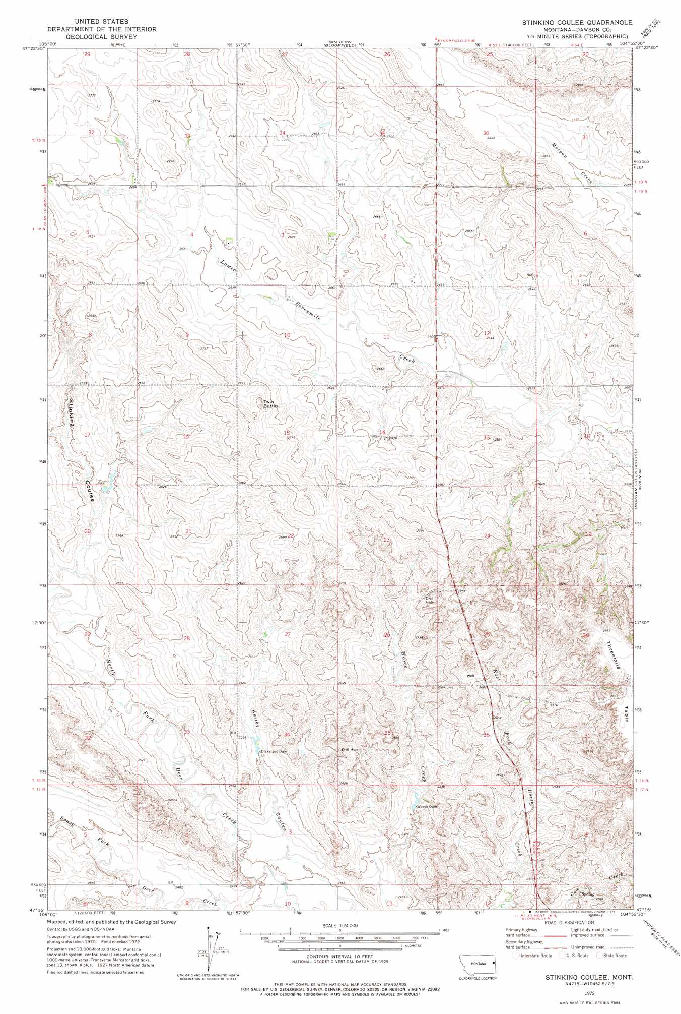
Stinking Coulee Topo Map Montana
To zoom in, hover over the map of Stinking Coulee
USGS Topo Quad 47104c8 - 1:24,000 scale
| Topo Map Name: | Stinking Coulee |
| USGS Topo Quad ID: | 47104c8 |
| Print Size: | ca. 21 1/4" wide x 27" high |
| Southeast Coordinates: | 47.25° N latitude / 104.875° W longitude |
| Map Center Coordinates: | 47.3125° N latitude / 104.9375° W longitude |
| U.S. State: | MT |
| Filename: | o47104c8.jpg |
| Download Map JPG Image: | Stinking Coulee topo map 1:24,000 scale |
| Map Type: | Topographic |
| Topo Series: | 7.5´ |
| Map Scale: | 1:24,000 |
| Source of Map Images: | United States Geological Survey (USGS) |
| Alternate Map Versions: |
Stinking Coulee MT 1972, updated 1976 Download PDF Buy paper map Stinking Coulee MT 2011 Download PDF Buy paper map Stinking Coulee MT 2014 Download PDF Buy paper map |
1:24,000 Topo Quads surrounding Stinking Coulee
Circle Reservoir |
Richey Se |
Clay Butte |
Enid Se |
Butler Table |
Johnson Reservoir Nw |
Johnson Reservoir Ne |
Bloomfield |
Red Top |
Intake Nw |
Deer Creek Church |
Johnson Reservoir |
Stinking Coulee |
Morgan Creek School |
Kolberg Ranch |
Lindsay |
Woodrow |
Poverty Flat West |
Poverty Flat East |
Stipek |
Lindsay Sw |
Upper Cracker Box School |
Pleasant View |
Forest Park |
Glendive |
> Back to 47104a1 at 1:100,000 scale
> Back to 47104a1 at 1:250,000 scale
> Back to U.S. Topo Maps home
Stinking Coulee topo map: Gazetteer
Stinking Coulee: Dams
Brain Dam elevation 775m 2542′Dickerson Dam elevation 759m 2490′
Iehl Dam elevation 803m 2634′
Kubesh Dam elevation 773m 2536′
Kubesh Dam elevation 760m 2493′
Stinking Coulee: Post Offices
Thomas Post Office (historical) elevation 808m 2650′Stinking Coulee: Streams
North Fork Deer Creek elevation 740m 2427′South Fork Deer Creek elevation 740m 2427′
Stinking Coulee: Summits
Twin Buttes elevation 847m 2778′Stinking Coulee: Valleys
Stinking Coulee elevation 760m 2493′Stinking Coulee: Wells
17N53E01CBAD01 Well elevation 785m 2575′17N53E02DBAC01 Well elevation 830m 2723′
18N53E01DDDA01 Well elevation 805m 2641′
18N53E12CCAC01 Well elevation 787m 2582′
18N53E35CCCB01 Well elevation 785m 2575′
18N54E30DDDB01 Well elevation 865m 2837′
19N53E32DDDD01 Well elevation 816m 2677′
Stinking Coulee digital topo map on disk
Buy this Stinking Coulee topo map showing relief, roads, GPS coordinates and other geographical features, as a high-resolution digital map file on DVD:
Eastern Montana & Western North Dakota
Buy digital topo maps: Eastern Montana & Western North Dakota