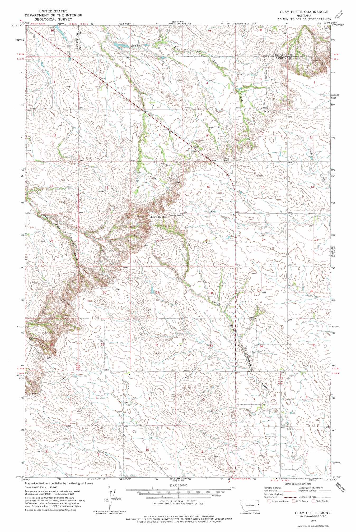
Clay Butte Topo Map Montana
To zoom in, hover over the map of Clay Butte
USGS Topo Quad 47104e8 - 1:24,000 scale
| Topo Map Name: | Clay Butte |
| USGS Topo Quad ID: | 47104e8 |
| Print Size: | ca. 21 1/4" wide x 27" high |
| Southeast Coordinates: | 47.5° N latitude / 104.875° W longitude |
| Map Center Coordinates: | 47.5625° N latitude / 104.9375° W longitude |
| U.S. State: | MT |
| Filename: | o47104e8.jpg |
| Download Map JPG Image: | Clay Butte topo map 1:24,000 scale |
| Map Type: | Topographic |
| Topo Series: | 7.5´ |
| Map Scale: | 1:24,000 |
| Source of Map Images: | United States Geological Survey (USGS) |
| Alternate Map Versions: |
Clay Butte MT 1972, updated 1975 Download PDF Buy paper map Clay Butte MT 2011 Download PDF Buy paper map Clay Butte MT 2014 Download PDF Buy paper map |
1:24,000 Topo Quads surrounding Clay Butte
Lisk Creek |
Duplisse Creek South |
Elmdale Sw |
Carda Coulee |
Three Buttes Creek West |
Richey Nw |
Richey |
Kuester Lake |
Enid |
Fox Lake |
Circle Reservoir |
Richey Se |
Clay Butte |
Enid Se |
Butler Table |
Johnson Reservoir Nw |
Johnson Reservoir Ne |
Bloomfield |
Red Top |
Intake Nw |
Deer Creek Church |
Johnson Reservoir |
Stinking Coulee |
Morgan Creek School |
Kolberg Ranch |
> Back to 47104e1 at 1:100,000 scale
> Back to 47104a1 at 1:250,000 scale
> Back to U.S. Topo Maps home
Clay Butte topo map: Gazetteer
Clay Butte: Summits
Clay Butte elevation 947m 3106′Clay Butte: Wells
20N53E04DAAA01 Well elevation 852m 2795′20N53E12BBAB01 Well elevation 843m 2765′
20N54E06DCCA01 Well elevation 815m 2673′
21N53E06CAAA01 Well elevation 796m 2611′
21N53E08ADCC01 Well elevation 823m 2700′
21N53E08CCBB01 Well elevation 838m 2749′
21N53E10BBAD01 Well elevation 840m 2755′
21N53E21CAAB01 Well elevation 897m 2942′
21N53E22DAAB01 Well elevation 869m 2851′
21N53E29ADAD01 Well elevation 848m 2782′
22N53E35CCCD01 Well elevation 836m 2742′
Clay Butte digital topo map on disk
Buy this Clay Butte topo map showing relief, roads, GPS coordinates and other geographical features, as a high-resolution digital map file on DVD:
Eastern Montana & Western North Dakota
Buy digital topo maps: Eastern Montana & Western North Dakota