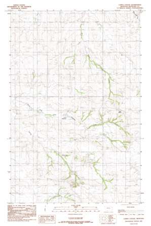
Carda Coulee Topo Map Montana
To zoom in, hover over the map of Carda Coulee
USGS Topo Quad 47104g7 - 1:24,000 scale
| Topo Map Name: | Carda Coulee |
| USGS Topo Quad ID: | 47104g7 |
| Print Size: | ca. 21 1/4" wide x 27" high |
| Southeast Coordinates: | 47.75° N latitude / 104.75° W longitude |
| Map Center Coordinates: | 47.8125° N latitude / 104.8125° W longitude |
| U.S. State: | MT |
| Filename: | o47104g7.jpg |
| Download Map JPG Image: | Carda Coulee topo map 1:24,000 scale |
| Map Type: | Topographic |
| Topo Series: | 7.5´ |
| Map Scale: | 1:24,000 |
| Source of Map Images: | United States Geological Survey (USGS) |
| Alternate Map Versions: |
Carda Coulee MT 1983, updated 1983 Download PDF Buy paper map Carda Coulee MT 2011 Download PDF Buy paper map Carda Coulee MT 2014 Download PDF Buy paper map |
1:24,000 Topo Quads surrounding Carda Coulee
> Back to 47104e1 at 1:100,000 scale
> Back to 47104a1 at 1:250,000 scale
> Back to U.S. Topo Maps home
Carda Coulee topo map: Gazetteer
Carda Coulee: Dams
Latka Dam elevation 721m 2365′Latka Number 5 Dam elevation 744m 2440′
Carda Coulee: Reservoirs
Latka Reservoir elevation 723m 2372′Carda Coulee: Summits
Flag Butte elevation 835m 2739′Carda Coulee: Valleys
Carda Coulee elevation 691m 2267′Carda Coulee: Wells
23N53E01ABAA01 Well elevation 734m 2408′23N54E07ABAB01 Well elevation 747m 2450′
23N54E08ACDB01 Well elevation 746m 2447′
23N54E18ADBC01 Well elevation 778m 2552′
23N54E18ADDA01 Well elevation 772m 2532′
23N54E18CADC01 Well elevation 749m 2457′
24N53E01DACD01 Well elevation 714m 2342′
24N53E01DACD02 Well elevation 714m 2342′
24N53E03CBCB01 Well elevation 753m 2470′
24N53E12ABBC01 Well elevation 731m 2398′
24N53E13BCCC01 Well elevation 731m 2398′
24N53E24DDCB01 Well elevation 694m 2276′
24N53E24DDCB02 Well elevation 694m 2276′
24N53E25BCBB01 Well elevation 736m 2414′
24N53E25DADD01 Well elevation 708m 2322′
24N54E08BAAA01 Well elevation 726m 2381′
24N54E09CDDD01 Well elevation 736m 2414′
24N54E16CCCD01 Well elevation 747m 2450′
24N54E19DAAB01 Well elevation 728m 2388′
24N54E20BCDD01 Well elevation 737m 2417′
24N54E21DB__01 Well elevation 787m 2582′
24N54E21DBDC01 Well elevation 774m 2539′
24N54E21DBDD01 Well elevation 787m 2582′
24N54E29CACB01 Well elevation 721m 2365′
24N54E30CBCA01 Well elevation 747m 2450′
24N54E30DCBC01 Well elevation 747m 2450′
Carda Coulee digital topo map on disk
Buy this Carda Coulee topo map showing relief, roads, GPS coordinates and other geographical features, as a high-resolution digital map file on DVD:
Eastern Montana & Western North Dakota
Buy digital topo maps: Eastern Montana & Western North Dakota


