Becker Dam Topo Map Montana
To zoom in, hover over the map of Becker Dam
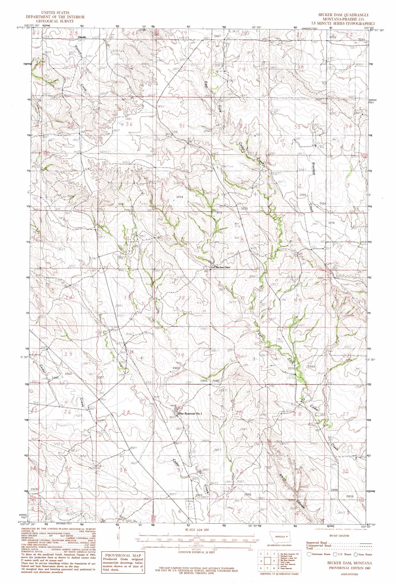
USGS Topo Quad 47105a5 - 1:24,000 scale
| Topo Map Name: | Becker Dam |
| USGS Topo Quad ID: | 47105a5 |
| Print Size: | ca. 21 1/4" wide x 27" high |
| Southeast Coordinates: | 47° N latitude / 105.5° W longitude |
| Map Center Coordinates: | 47.0625° N latitude / 105.5625° W longitude |
| U.S. State: | MT |
| Filename: | o47105a5.jpg |
| Download Map JPG Image: | Becker Dam topo map 1:24,000 scale |
| Map Type: | Topographic |
| Topo Series: | 7.5´ |
| Map Scale: | 1:24,000 |
| Source of Map Images: | United States Geological Survey (USGS) |
| Alternate Map Versions: |
Becker Dam MT 1983, updated 1983 Download PDF Buy paper map Becker Dam MT 2011 Download PDF Buy paper map Becker Dam MT 2014 Download PDF Buy paper map |
1:24,000 Topo Quads surrounding Becker Dam
Brockway |
Circle Sw |
Quick Reservoir |
Mount Antelope |
Olson Coulee South |
Watkins |
Big Sheep Mountain Nw |
Bearshack Creek |
Diamond G Butte Nw |
Union School |
Watkins Se |
Big Sheep Mountain |
Becker Dam |
North Coulee |
Diamond G Butte |
Little Sheep Mountain |
South Fork Reservoir |
Mccloud |
Papps Reservoir |
Diamond G Creek |
Morehouse Creek |
Physic Creek |
Mcclure Reservoir |
Calypso |
Terry |
> Back to 47105a1 at 1:100,000 scale
> Back to 47104a1 at 1:250,000 scale
> Back to U.S. Topo Maps home
Becker Dam topo map: Gazetteer
Becker Dam: Dams
Agate Flat Dam elevation 920m 3018′Ban Dam elevation 861m 2824′
Becker Dam elevation 909m 2982′
Spider Dam elevation 927m 3041′
Becker Dam: Populated Places
Olanda (historical) elevation 960m 3149′Becker Dam: Post Offices
Olanda Post Office (historical) elevation 960m 3149′Becker Dam: Reservoirs
Ban Reservoir Number 1 elevation 861m 2824′Becker Dam: Wells
14N48E01ACB_01 Well elevation 850m 2788′15N48E12BDD_01 Well elevation 964m 3162′
15N48E24BAB_01 Well elevation 900m 2952′
15N49E05BBCD01 Well elevation 981m 3218′
15N49E18CBC_01 Well elevation 892m 2926′
15N49E28ACBA01 Well elevation 886m 2906′
15N49E28DBD_01 Well elevation 892m 2926′
Becker Dam digital topo map on disk
Buy this Becker Dam topo map showing relief, roads, GPS coordinates and other geographical features, as a high-resolution digital map file on DVD:
Eastern Montana & Western North Dakota
Buy digital topo maps: Eastern Montana & Western North Dakota