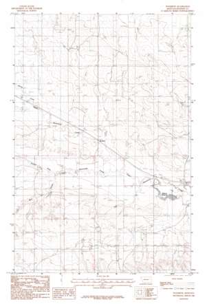
Woodrow Topo Map Montana
To zoom in, hover over the map of Woodrow
USGS Topo Quad 47105b1 - 1:24,000 scale
| Topo Map Name: | Woodrow |
| USGS Topo Quad ID: | 47105b1 |
| Print Size: | ca. 21 1/4" wide x 27" high |
| Southeast Coordinates: | 47.125° N latitude / 105° W longitude |
| Map Center Coordinates: | 47.1875° N latitude / 105.0625° W longitude |
| U.S. State: | MT |
| Filename: | o47105b1.jpg |
| Download Map JPG Image: | Woodrow topo map 1:24,000 scale |
| Map Type: | Topographic |
| Topo Series: | 7.5´ |
| Map Scale: | 1:24,000 |
| Source of Map Images: | United States Geological Survey (USGS) |
| Alternate Map Versions: |
Woodrow MT 1983, updated 1983 Download PDF Buy paper map Woodrow MT 2011 Download PDF Buy paper map Woodrow MT 2014 Download PDF Buy paper map |
1:24,000 Topo Quads surrounding Woodrow
> Back to 47105a1 at 1:100,000 scale
> Back to 47104a1 at 1:250,000 scale
> Back to U.S. Topo Maps home
Woodrow topo map: Gazetteer
Woodrow: Dams
Deer Creek Dam elevation 830m 2723′Jack Downs Dam elevation 800m 2624′
Timber Dam elevation 781m 2562′
Wolff Dam elevation 797m 2614′
Woodrow: Post Offices
Woodrow Post Office (historical) elevation 784m 2572′Woodrow: Reservoirs
Deer Creek Reservoir elevation 830m 2723′Jack Downs Reservoir elevation 800m 2624′
Malkuch Reservoir elevation 763m 2503′
Wolff Reservoir elevation 797m 2614′
Woodrow: Streams
Spring Creek elevation 809m 2654′Timber Fork elevation 776m 2545′
Woodrow: Valleys
Wolf Coulee elevation 782m 2565′Woodrow: Wells
16N52E13DAB_01 Well elevation 809m 2654′16N53E03CBD_01 Well elevation 782m 2565′
16N53E20ADD_01 Well elevation 821m 2693′
17N52E20ADDD01 Well elevation 812m 2664′
17N52E25DCA_01 Well elevation 814m 2670′
17N53E18BCD_01 Well elevation 794m 2604′
28N52E09CDDC01 Well elevation 798m 2618′
Woodrow digital topo map on disk
Buy this Woodrow topo map showing relief, roads, GPS coordinates and other geographical features, as a high-resolution digital map file on DVD:
Eastern Montana & Western North Dakota
Buy digital topo maps: Eastern Montana & Western North Dakota


