Mount Antelope Topo Map Montana
To zoom in, hover over the map of Mount Antelope
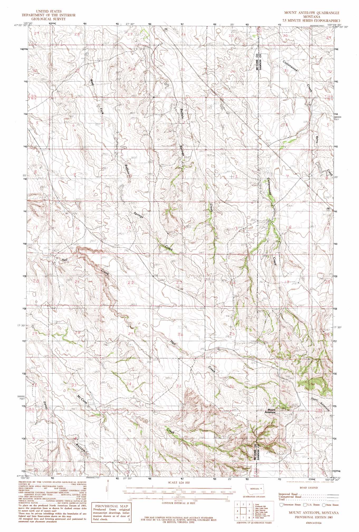
USGS Topo Quad 47105c4 - 1:24,000 scale
| Topo Map Name: | Mount Antelope |
| USGS Topo Quad ID: | 47105c4 |
| Print Size: | ca. 21 1/4" wide x 27" high |
| Southeast Coordinates: | 47.25° N latitude / 105.375° W longitude |
| Map Center Coordinates: | 47.3125° N latitude / 105.4375° W longitude |
| U.S. State: | MT |
| Filename: | o47105c4.jpg |
| Download Map JPG Image: | Mount Antelope topo map 1:24,000 scale |
| Map Type: | Topographic |
| Topo Series: | 7.5´ |
| Map Scale: | 1:24,000 |
| Source of Map Images: | United States Geological Survey (USGS) |
| Alternate Map Versions: |
Mount Antelope MT 1983, updated 1983 Download PDF Buy paper map Mount Antelope MT 2011 Download PDF Buy paper map Mount Antelope MT 2014 Download PDF Buy paper map |
1:24,000 Topo Quads surrounding Mount Antelope
Haynie Reservoir |
Hudiburgh Res. Se |
Buffalo Creek |
Buffalo Creek Se |
Circle Reservoir |
Youngquist Mine |
Circle |
Woodworth Hill |
Olson Coulee North |
Johnson Reservoir Nw |
Circle Sw |
Quick Reservoir |
Mount Antelope |
Olson Coulee South |
Deer Creek Church |
Big Sheep Mountain Nw |
Bearshack Creek |
Diamond G Butte Nw |
Union School |
Lindsay |
Big Sheep Mountain |
Becker Dam |
North Coulee |
Diamond G Butte |
Lindsay Sw |
> Back to 47105a1 at 1:100,000 scale
> Back to 47104a1 at 1:250,000 scale
> Back to U.S. Topo Maps home
Mount Antelope topo map: Gazetteer
Mount Antelope: Dams
Floyd Quick Number 2 Dam elevation 859m 2818′Mount Antelope: Reservoirs
Quick Reservoir elevation 859m 2818′Mount Antelope: Streams
Berry Creek elevation 821m 2693′Mount Antelope: Summits
Mount Antelope elevation 1051m 3448′Mount Antelope: Wells
18N49E09CCBC01 Well elevation 843m 2765′18N49E15ACBB01 Well elevation 866m 2841′
18N49E28DADC01 Well elevation 856m 2808′
19N49E27DDBD01 Well elevation 812m 2664′
19N49E33ACAA01 Well elevation 803m 2634′
19N49E34AABD01 Well elevation 831m 2726′
Mount Antelope digital topo map on disk
Buy this Mount Antelope topo map showing relief, roads, GPS coordinates and other geographical features, as a high-resolution digital map file on DVD:
Eastern Montana & Western North Dakota
Buy digital topo maps: Eastern Montana & Western North Dakota