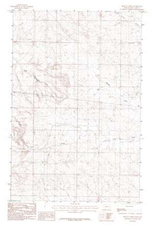
Beauty Creek Topo Map Montana
To zoom in, hover over the map of Beauty Creek
USGS Topo Quad 47105c8 - 1:24,000 scale
| Topo Map Name: | Beauty Creek |
| USGS Topo Quad ID: | 47105c8 |
| Print Size: | ca. 21 1/4" wide x 27" high |
| Southeast Coordinates: | 47.25° N latitude / 105.875° W longitude |
| Map Center Coordinates: | 47.3125° N latitude / 105.9375° W longitude |
| U.S. State: | MT |
| Filename: | o47105c8.jpg |
| Download Map JPG Image: | Beauty Creek topo map 1:24,000 scale |
| Map Type: | Topographic |
| Topo Series: | 7.5´ |
| Map Scale: | 1:24,000 |
| Source of Map Images: | United States Geological Survey (USGS) |
| Alternate Map Versions: |
Beauty Creek MT 1983, updated 1983 Download PDF Buy paper map Beauty Creek MT 2011 Download PDF Buy paper map Beauty Creek MT 2014 Download PDF Buy paper map |
1:24,000 Topo Quads surrounding Beauty Creek
> Back to 47105a1 at 1:100,000 scale
> Back to 47104a1 at 1:250,000 scale
> Back to U.S. Topo Maps home
Beauty Creek topo map: Gazetteer
Beauty Creek: Wells
17N45E01DCAA01 Well elevation 827m 2713′17N45E04BDBB01 Well elevation 848m 2782′
18N45E10CCBB01 Well elevation 806m 2644′
18N45E10CCBB02 Well elevation 806m 2644′
18N45E24CDDC01 Well elevation 820m 2690′
18N45E25BAAC01 Well elevation 823m 2700′
18N45E27DADD01 Well elevation 840m 2755′
18N45E34ACCD01 Well elevation 867m 2844′
18N45E34DBBB01 Well elevation 873m 2864′
18N45E34DBBB02 Well elevation 873m 2864′
18N46E08CBBC01 Well elevation 827m 2713′
18N46E17ADBB01 Well elevation 818m 2683′
18N46E18ADCA01 Well elevation 810m 2657′
18N46E18ADCA02 Well elevation 810m 2657′
18N46E19ABBC01 Well elevation 830m 2723′
18N46E30ADAC01 Well elevation 811m 2660′
19N45E35DBCA01 Well elevation 858m 2814′
19N46E32CCCD01 Well elevation 832m 2729′
19N46E32DCDD01 Well elevation 822m 2696′
Beauty Creek digital topo map on disk
Buy this Beauty Creek topo map showing relief, roads, GPS coordinates and other geographical features, as a high-resolution digital map file on DVD:
Eastern Montana & Western North Dakota
Buy digital topo maps: Eastern Montana & Western North Dakota


