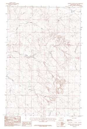
Johnson Coulee East Topo Map Montana
To zoom in, hover over the map of Johnson Coulee East
USGS Topo Quad 47105d8 - 1:24,000 scale
| Topo Map Name: | Johnson Coulee East |
| USGS Topo Quad ID: | 47105d8 |
| Print Size: | ca. 21 1/4" wide x 27" high |
| Southeast Coordinates: | 47.375° N latitude / 105.875° W longitude |
| Map Center Coordinates: | 47.4375° N latitude / 105.9375° W longitude |
| U.S. State: | MT |
| Filename: | o47105d8.jpg |
| Download Map JPG Image: | Johnson Coulee East topo map 1:24,000 scale |
| Map Type: | Topographic |
| Topo Series: | 7.5´ |
| Map Scale: | 1:24,000 |
| Source of Map Images: | United States Geological Survey (USGS) |
| Alternate Map Versions: |
Johnson Coulee East MT 1983, updated 1983 Download PDF Buy paper map Johnson Coulee East MT 2011 Download PDF Buy paper map Johnson Coulee East MT 2014 Download PDF Buy paper map |
1:24,000 Topo Quads surrounding Johnson Coulee East
> Back to 47105a1 at 1:100,000 scale
> Back to 47104a1 at 1:250,000 scale
> Back to U.S. Topo Maps home
Johnson Coulee East topo map: Gazetteer
Johnson Coulee East: Dams
L Quick Dam elevation 856m 2808′Murphy and Sons Number 2 Dam elevation 770m 2526′
Murphy Number 1 Dam elevation 766m 2513′
Waller Dam elevation 779m 2555′
Johnson Coulee East: Post Offices
Nelson Creek Post Office (historical) elevation 857m 2811′Johnson Coulee East: Wells
19N45E04ABBA01 Well elevation 769m 2522′19N45E09DCCD01 Well elevation 774m 2539′
19N45E10DDCA01 Well elevation 793m 2601′
19N45E11ACCD01 Well elevation 793m 2601′
19N45E16ABAB01 Well elevation 774m 2539′
19N45E22BBAC01 Well elevation 783m 2568′
19N46E08ACDA01 Well elevation 838m 2749′
19N46E08CDAC01 Well elevation 829m 2719′
19N46E08CDDB01 Well elevation 835m 2739′
19N46E17ADBD01 Well elevation 830m 2723′
19N46E29CAAA01 Well elevation 824m 2703′
20N45E10DCCD01 Well elevation 812m 2664′
20N45E22BCCA01 Well elevation 779m 2555′
20N45E22DACC01 Well elevation 804m 2637′
20N45E27ACCC01 Well elevation 787m 2582′
20N45E28BABD01 Well elevation 766m 2513′
20N45E34CAAB01 Well elevation 789m 2588′
20N45E35DAAB01 Well elevation 774m 2539′
20N46E19BBAC01 Well elevation 830m 2723′
20N46E20CADA01 Well elevation 840m 2755′
Johnson Coulee East digital topo map on disk
Buy this Johnson Coulee East topo map showing relief, roads, GPS coordinates and other geographical features, as a high-resolution digital map file on DVD:
Eastern Montana & Western North Dakota
Buy digital topo maps: Eastern Montana & Western North Dakota


