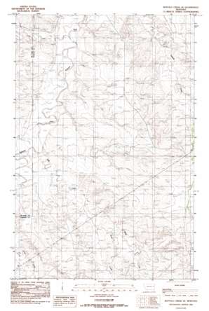
Buffalo Creek Se Topo Map Montana
To zoom in, hover over the map of Buffalo Creek Se
USGS Topo Quad 47105e3 - 1:24,000 scale
| Topo Map Name: | Buffalo Creek Se |
| USGS Topo Quad ID: | 47105e3 |
| Print Size: | ca. 21 1/4" wide x 27" high |
| Southeast Coordinates: | 47.5° N latitude / 105.25° W longitude |
| Map Center Coordinates: | 47.5625° N latitude / 105.3125° W longitude |
| U.S. State: | MT |
| Filename: | o47105e3.jpg |
| Download Map JPG Image: | Buffalo Creek Se topo map 1:24,000 scale |
| Map Type: | Topographic |
| Topo Series: | 7.5´ |
| Map Scale: | 1:24,000 |
| Source of Map Images: | United States Geological Survey (USGS) |
| Alternate Map Versions: |
Buffalo Creek SE MT 1983, updated 1983 Download PDF Buy paper map Buffalo Creek SE MT 2011 Download PDF Buy paper map Buffalo Creek SE MT 2014 Download PDF Buy paper map |
1:24,000 Topo Quads surrounding Buffalo Creek Se
> Back to 47105e1 at 1:100,000 scale
> Back to 47104a1 at 1:250,000 scale
> Back to U.S. Topo Maps home
Buffalo Creek Se topo map: Gazetteer
Buffalo Creek Se: Post Offices
Rose Valley Post Office (historical) elevation 732m 2401′Buffalo Creek Se: Streams
Bluff Creek elevation 698m 2290′Brush Creek elevation 715m 2345′
Duck Creek elevation 685m 2247′
Buffalo Creek Se: Wells
20N50E11ACCC01 Well elevation 735m 2411′20N50E12BABA01 Well elevation 740m 2427′
20N50E13ABBC01 Well elevation 749m 2457′
20N50E16ABBD01 Well elevation 756m 2480′
20N51E07ADAB01 Well elevation 804m 2637′
21N50E10DAAA01 Well elevation 721m 2365′
21N50E10DAAC01 Well elevation 726m 2381′
21N50E10DAAC02 Well elevation 726m 2381′
21N50E15ACAD01 Well elevation 742m 2434′
21N50E23CDDC01 Well elevation 774m 2539′
21N50E23DDDC01 Well elevation 756m 2480′
21N50E25CCDA01 Well elevation 745m 2444′
21N50E25CCDA02 Well elevation 745m 2444′
21N50E25CCDD01 Well elevation 747m 2450′
Buffalo Creek Se digital topo map on disk
Buy this Buffalo Creek Se topo map showing relief, roads, GPS coordinates and other geographical features, as a high-resolution digital map file on DVD:
Eastern Montana & Western North Dakota
Buy digital topo maps: Eastern Montana & Western North Dakota


