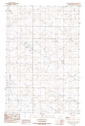
Haynie Reservoir Topo Map Montana
To zoom in, hover over the map of Haynie Reservoir
USGS Topo Quad 47105e6 - 1:24,000 scale
| Topo Map Name: | Haynie Reservoir |
| USGS Topo Quad ID: | 47105e6 |
| Print Size: | ca. 21 1/4" wide x 27" high |
| Southeast Coordinates: | 47.5° N latitude / 105.625° W longitude |
| Map Center Coordinates: | 47.5625° N latitude / 105.6875° W longitude |
| U.S. State: | MT |
| Filename: | o47105e6.jpg |
| Download Map JPG Image: | Haynie Reservoir topo map 1:24,000 scale |
| Map Type: | Topographic |
| Topo Series: | 7.5´ |
| Map Scale: | 1:24,000 |
| Source of Map Images: | United States Geological Survey (USGS) |
| Alternate Map Versions: |
Haynie Reservoir MT 1983, updated 1983 Download PDF Buy paper map Haynie Reservoir MT 2011 Download PDF Buy paper map Haynie Reservoir MT 2014 Download PDF Buy paper map |
1:24,000 Topo Quads surrounding Haynie Reservoir
> Back to 47105e1 at 1:100,000 scale
> Back to 47104a1 at 1:250,000 scale
> Back to U.S. Topo Maps home
Haynie Reservoir topo map: Gazetteer
Haynie Reservoir: Dams
Angie Dam elevation 762m 2500′Hainie Reservoir Dam elevation 801m 2627′
Nerud Ranch Number 1 Dam elevation 765m 2509′
Wahl Stock Reservoir Dam elevation 745m 2444′
Haynie Reservoir: Reservoirs
Haynie Reservoir elevation 777m 2549′Haynie Reservoir: Wells
20N47E04BBBB01 Well elevation 776m 2545′20N47E04DCBD01 Well elevation 774m 2539′
20N47E04DCCB01 Well elevation 771m 2529′
20N47E10ACBD01 Well elevation 773m 2536′
20N48E06CAAC01 Well elevation 762m 2500′
20N48E06DCDD01 Well elevation 776m 2545′
20N48E07BDAC01 Well elevation 773m 2536′
20N48E08CDCA01 Well elevation 770m 2526′
21N47E03CDAC01 Well elevation 801m 2627′
21N47E03CDCC01 Well elevation 798m 2618′
21N47E04BCAA01 Well elevation 789m 2588′
21N47E08CDCD01 Well elevation 785m 2575′
21N47E10ABBC01 Well elevation 798m 2618′
21N47E10ADDD01 Well elevation 807m 2647′
21N47E17BDDA01 Well elevation 776m 2545′
21N47E17DAAB01 Well elevation 783m 2568′
21N47E17DAAD01 Well elevation 777m 2549′
21N47E18DCAA01 Well elevation 786m 2578′
21N47E21DBAC01 Well elevation 775m 2542′
21N47E31CACC01 Well elevation 787m 2582′
21N47E31CCCC01 Well elevation 782m 2565′
21N47E36ABBC01 Well elevation 741m 2431′
Haynie Reservoir digital topo map on disk
Buy this Haynie Reservoir topo map showing relief, roads, GPS coordinates and other geographical features, as a high-resolution digital map file on DVD:
Eastern Montana & Western North Dakota
Buy digital topo maps: Eastern Montana & Western North Dakota


