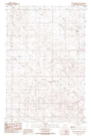
Beery Reservoir Topo Map Montana
To zoom in, hover over the map of Beery Reservoir
USGS Topo Quad 47105f4 - 1:24,000 scale
| Topo Map Name: | Beery Reservoir |
| USGS Topo Quad ID: | 47105f4 |
| Print Size: | ca. 21 1/4" wide x 27" high |
| Southeast Coordinates: | 47.625° N latitude / 105.375° W longitude |
| Map Center Coordinates: | 47.6875° N latitude / 105.4375° W longitude |
| U.S. State: | MT |
| Filename: | o47105f4.jpg |
| Download Map JPG Image: | Beery Reservoir topo map 1:24,000 scale |
| Map Type: | Topographic |
| Topo Series: | 7.5´ |
| Map Scale: | 1:24,000 |
| Source of Map Images: | United States Geological Survey (USGS) |
| Alternate Map Versions: |
Beery Reservoir MT 1983, updated 1983 Download PDF Buy paper map Beery Reservoir MT 2011 Download PDF Buy paper map Beery Reservoir MT 2014 Download PDF Buy paper map |
1:24,000 Topo Quads surrounding Beery Reservoir
> Back to 47105e1 at 1:100,000 scale
> Back to 47104a1 at 1:250,000 scale
> Back to U.S. Topo Maps home
Beery Reservoir topo map: Gazetteer
Beery Reservoir: Dams
Berrys Land Dam elevation 712m 2335′Berrys Land Number 4 Dam elevation 730m 2395′
Tillman Number 3 Dam elevation 742m 2434′
Voegele Number 1 Dam elevation 730m 2395′
Beery Reservoir: Reservoirs
Beery Reservoir elevation 715m 2345′Beery Reservoir: Wells
22N49E06CABA01 Well elevation 711m 2332′22N49E08ADDC01 Well elevation 711m 2332′
22N49E08BDDD01 Well elevation 705m 2312′
22N49E18BCCB01 Well elevation 721m 2365′
22N49E20AACC01 Well elevation 737m 2417′
22N49E21CABD01 Well elevation 723m 2372′
22N49E28BCCB01 Well elevation 768m 2519′
22N49E29CCDC01 Well elevation 735m 2411′
22N49E30ACCC01 Well elevation 758m 2486′
23N49E14CDCC01 Well elevation 735m 2411′
23N49E25BC__01 Well elevation 715m 2345′
23N49E28ABAB01 Well elevation 753m 2470′
Beery Reservoir digital topo map on disk
Buy this Beery Reservoir topo map showing relief, roads, GPS coordinates and other geographical features, as a high-resolution digital map file on DVD:
Eastern Montana & Western North Dakota
Buy digital topo maps: Eastern Montana & Western North Dakota


