Sullivan Coulee Topo Map Montana
To zoom in, hover over the map of Sullivan Coulee
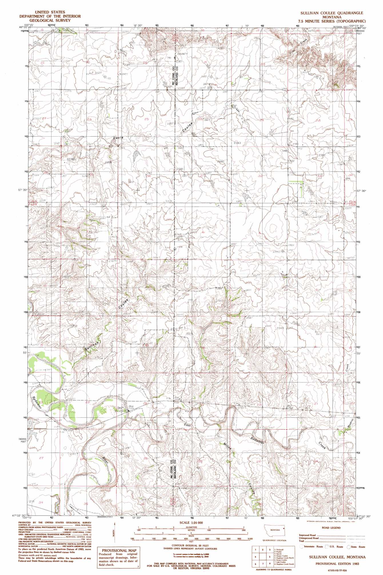
USGS Topo Quad 47105h2 - 1:24,000 scale
| Topo Map Name: | Sullivan Coulee |
| USGS Topo Quad ID: | 47105h2 |
| Print Size: | ca. 21 1/4" wide x 27" high |
| Southeast Coordinates: | 47.875° N latitude / 105.125° W longitude |
| Map Center Coordinates: | 47.9375° N latitude / 105.1875° W longitude |
| U.S. State: | MT |
| Filename: | o47105h2.jpg |
| Download Map JPG Image: | Sullivan Coulee topo map 1:24,000 scale |
| Map Type: | Topographic |
| Topo Series: | 7.5´ |
| Map Scale: | 1:24,000 |
| Source of Map Images: | United States Geological Survey (USGS) |
| Alternate Map Versions: |
Sullivan Coulee MT 1983, updated 1983 Download PDF Buy paper map Sullivan Coulee MT 2011 Download PDF Buy paper map Sullivan Coulee MT 2014 Download PDF Buy paper map |
1:24,000 Topo Quads surrounding Sullivan Coulee
Chelsea Nw |
Chelsea |
Badger Creek |
Poplar Ne |
Brockton |
Chelsea Sw |
Nickwall |
Poplar |
Sprole |
Mortarstone Bluff |
Gady Coulee |
Dowse Coulee |
Sullivan Coulee |
Duplisse Creek North |
Elmdale Nw |
Vida |
Kraut Coulee |
Lisk Creek |
Duplisse Creek South |
Elmdale Sw |
Beery Reservoir |
Buffalo Creek Ne |
Richey Nw |
Richey |
Kuester Lake |
> Back to 47105e1 at 1:100,000 scale
> Back to 47104a1 at 1:250,000 scale
> Back to U.S. Topo Maps home
Sullivan Coulee topo map: Gazetteer
Sullivan Coulee: Dams
Newman Dam elevation 710m 2329′Willough Dam elevation 625m 2050′
Win Number 1 Dam elevation 717m 2352′
Sullivan Coulee: Streams
Boardman Ditch elevation 647m 2122′East Redwater Creek elevation 633m 2076′
Long Grass Creek elevation 648m 2125′
Muskrat Creek elevation 648m 2125′
Sullivan Coulee: Valleys
Milne Coulee elevation 638m 2093′Sullivan Coulee elevation 621m 2037′
Sullivan Coulee: Wells
25N50E24CABC01 Well elevation 632m 2073′25N50E24CBDA01 Well elevation 633m 2076′
25N50E25DB__01 Well elevation 658m 2158′
26N50E14CDCC01 Well elevation 683m 2240′
26N51E29BA__01 Well elevation 719m 2358′
Sullivan Coulee digital topo map on disk
Buy this Sullivan Coulee topo map showing relief, roads, GPS coordinates and other geographical features, as a high-resolution digital map file on DVD:
Eastern Montana & Western North Dakota
Buy digital topo maps: Eastern Montana & Western North Dakota