Crow Springs Topo Map Montana
To zoom in, hover over the map of Crow Springs
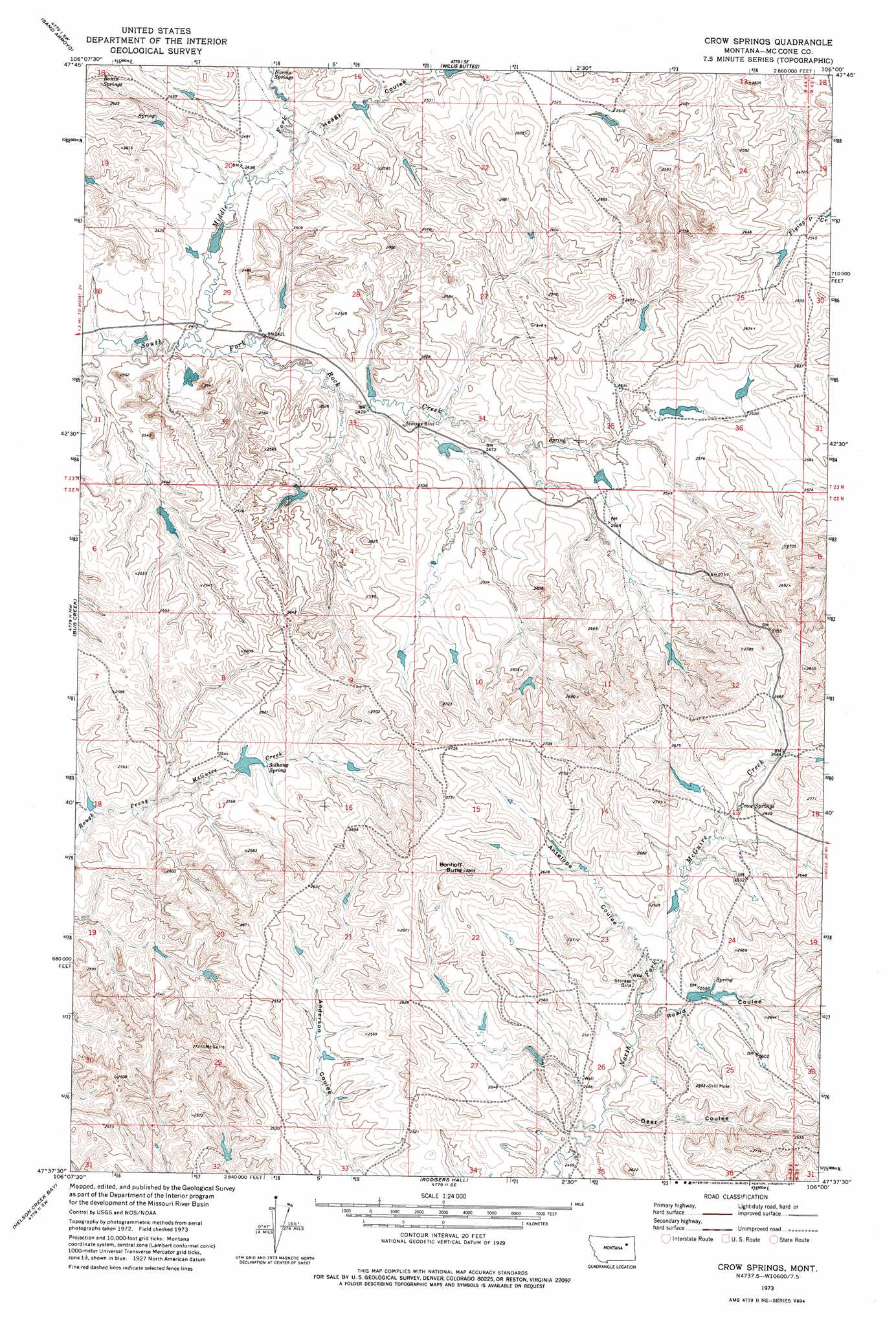
USGS Topo Quad 47106f1 - 1:24,000 scale
| Topo Map Name: | Crow Springs |
| USGS Topo Quad ID: | 47106f1 |
| Print Size: | ca. 21 1/4" wide x 27" high |
| Southeast Coordinates: | 47.625° N latitude / 106° W longitude |
| Map Center Coordinates: | 47.6875° N latitude / 106.0625° W longitude |
| U.S. State: | MT |
| Filename: | o47106f1.jpg |
| Download Map JPG Image: | Crow Springs topo map 1:24,000 scale |
| Map Type: | Topographic |
| Topo Series: | 7.5´ |
| Map Scale: | 1:24,000 |
| Source of Map Images: | United States Geological Survey (USGS) |
| Alternate Map Versions: |
Crow Springs MT 1973, updated 1977 Download PDF Buy paper map Crow Springs MT 2011 Download PDF Buy paper map Crow Springs MT 2014 Download PDF Buy paper map |
1:24,000 Topo Quads surrounding Crow Springs
Bobcat Creek |
Mcrae Springs |
Pasture Creek |
Turtle Creek |
Emily Coulee |
Spring Creek Bay |
Sand Arroyo |
Willis Buttes |
Shade Creek |
Sadie Coulee |
Ash Creek East |
Bug Creek |
Crow Springs |
Figure Eight Creek |
Pedigo Coulee |
Short Creek |
Nelson Creek Bay |
Rodgers Hall |
Weldon |
North Fork Horse Creek |
Frank Coulee |
Fortyfour Coulee |
Johnson Coulee West |
Johnson Coulee East |
Brockway Ne |
> Back to 47106e1 at 1:100,000 scale
> Back to 47106a1 at 1:250,000 scale
> Back to U.S. Topo Maps home
Crow Springs topo map: Gazetteer
Crow Springs: Dams
Bobcat Reservoir Dam elevation 790m 2591′Crow Number 1 Dam elevation 744m 2440′
Crow Number 2 Dam elevation 729m 2391′
Horse Trough Dam elevation 765m 2509′
L Pawlowski Number 3 Dam elevation 766m 2513′
Late Creek Reservoir Dam elevation 739m 2424′
Moonlight Reservoir Dam elevation 762m 2500′
South Rock Creek Reservoir Dam elevation 739m 2424′
Towe Farms Number 4 Dam elevation 763m 2503′
W Pawlowski Reservoir Dam elevation 783m 2568′
Wayne Number 2 Dam elevation 797m 2614′
Crow Springs: Post Offices
Quam Post Office (historical) elevation 807m 2647′Crow Springs: Springs
Bonin Springs elevation 790m 2591′Crow Springs elevation 785m 2575′
Norris Springs elevation 743m 2437′
Solhaug Spring elevation 765m 2509′
Crow Springs: Streams
Middle Fork South Fork Rock Creek elevation 722m 2368′Crow Springs: Summits
Bonhoff Butte elevation 857m 2811′Crow Springs: Valleys
Antelope Coulee elevation 758m 2486′Deer Coulee elevation 752m 2467′
Heagy Coulee elevation 735m 2411′
Roald Coulee elevation 757m 2483′
Crow Springs: Wells
22N45E31BBDB01 Well elevation 829m 2719′Crow Springs digital topo map on disk
Buy this Crow Springs topo map showing relief, roads, GPS coordinates and other geographical features, as a high-resolution digital map file on DVD:
Eastern Montana & Western North Dakota
Buy digital topo maps: Eastern Montana & Western North Dakota