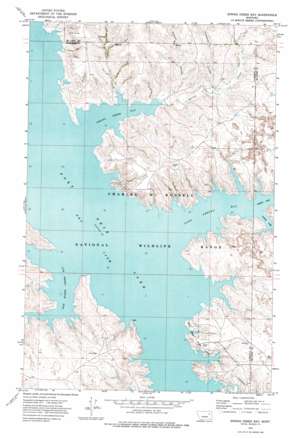
Spring Creek Bay Topo Map Montana
To zoom in, hover over the map of Spring Creek Bay
USGS Topo Quad 47106g3 - 1:24,000 scale
| Topo Map Name: | Spring Creek Bay |
| USGS Topo Quad ID: | 47106g3 |
| Print Size: | ca. 21 1/4" wide x 27" high |
| Southeast Coordinates: | 47.75° N latitude / 106.25° W longitude |
| Map Center Coordinates: | 47.8125° N latitude / 106.3125° W longitude |
| U.S. State: | MT |
| Filename: | o47106g3.jpg |
| Download Map JPG Image: | Spring Creek Bay topo map 1:24,000 scale |
| Map Type: | Topographic |
| Topo Series: | 7.5´ |
| Map Scale: | 1:24,000 |
| Source of Map Images: | United States Geological Survey (USGS) |
| Alternate Map Versions: |
Spring Creek Bay MT 1972, updated 1975 Download PDF Buy paper map Spring Creek Bay MT 2011 Download PDF Buy paper map Spring Creek Bay MT 2014 Download PDF Buy paper map |
1:24,000 Topo Quads surrounding Spring Creek Bay
> Back to 47106e1 at 1:100,000 scale
> Back to 47106a1 at 1:250,000 scale
> Back to U.S. Topo Maps home
Spring Creek Bay topo map: Gazetteer
Spring Creek Bay: Bays
Box Elder Creek Bay elevation 685m 2247′Dry Arm elevation 685m 2247′
Sand Arroyo Bay elevation 685m 2247′
South Arm Sand Arroyo Bay elevation 685m 2247′
Spring Creek Bay elevation 685m 2247′
Spring Creek Bay: Parks
Rock Creek State Park elevation 706m 2316′Spring Creek Bay: Post Offices
Hay Coulee Post Office (historical) elevation 689m 2260′Spring Creek Bay: Streams
Spring Creek elevation 685m 2247′Stole Creek elevation 688m 2257′
Spring Creek Bay: Valleys
Humphrey Coulee elevation 708m 2322′Polecat Coulee elevation 689m 2260′
Spring Creek Bay digital topo map on disk
Buy this Spring Creek Bay topo map showing relief, roads, GPS coordinates and other geographical features, as a high-resolution digital map file on DVD:
Eastern Montana & Western North Dakota
Buy digital topo maps: Eastern Montana & Western North Dakota


