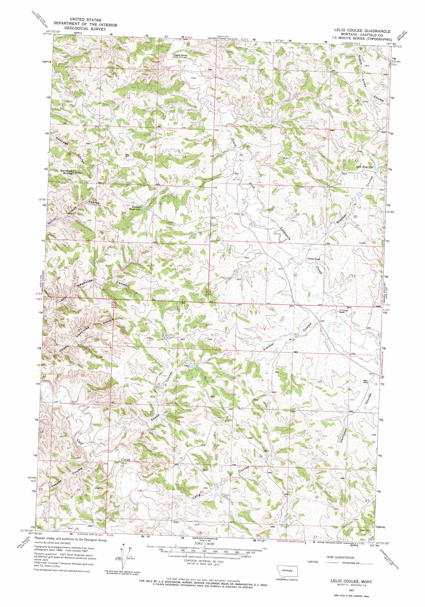
Lelig Coulee Topo Map Montana
To zoom in, hover over the map of Lelig Coulee
USGS Topo Quad 47107b7 - 1:24,000 scale
| Topo Map Name: | Lelig Coulee |
| USGS Topo Quad ID: | 47107b7 |
| Print Size: | ca. 21 1/4" wide x 27" high |
| Southeast Coordinates: | 47.125° N latitude / 107.75° W longitude |
| Map Center Coordinates: | 47.1875° N latitude / 107.8125° W longitude |
| U.S. State: | MT |
| Filename: | o47107b7.jpg |
| Download Map JPG Image: | Lelig Coulee topo map 1:24,000 scale |
| Map Type: | Topographic |
| Topo Series: | 7.5´ |
| Map Scale: | 1:24,000 |
| Source of Map Images: | United States Geological Survey (USGS) |
| Alternate Map Versions: |
Lelig Coulee MT 1967, updated 1970 Download PDF Buy paper map Lelig Coulee MT 2011 Download PDF Buy paper map Lelig Coulee MT 2014 Download PDF Buy paper map |
1:24,000 Topo Quads surrounding Lelig Coulee
Weingart Place |
Germaine Coulee West |
Germaine Coulee East |
Cap Rock Butte |
Spring Creek School |
Kirkendal Flat |
Nelson Coulee |
Seventynine Coulee |
Benzien |
Hay Coulee |
Tin Can Hill |
Bridge Coulee |
Lelig Coulee |
Searl Coulee |
Coffin Butte |
Cat Creek |
Fail Ranch |
Barney Pinnacle |
Froehlich Butte |
Cox Butte |
Breed Spring |
Mosby |
Hill Ranch |
Dutton Ranch |
Mcwilliams Springs |
> Back to 47107a1 at 1:100,000 scale
> Back to 47106a1 at 1:250,000 scale
> Back to U.S. Topo Maps home
Lelig Coulee topo map: Gazetteer
Lelig Coulee: Dams
Split Dam elevation 885m 2903′Lelig Coulee: Reservoirs
Ezekial Reservoir elevation 875m 2870′Split Reservoir elevation 883m 2896′
Lelig Coulee: Summits
Sandage Buttes elevation 921m 3021′Lelig Coulee: Valleys
Henryson Coulee elevation 860m 2821′Kimmel Coulee elevation 849m 2785′
Lelig Coulee elevation 781m 2562′
Sheep Coulee elevation 763m 2503′
Stocker Coulee elevation 833m 2732′
Teepee Coulee elevation 763m 2503′
Lelig Coulee digital topo map on disk
Buy this Lelig Coulee topo map showing relief, roads, GPS coordinates and other geographical features, as a high-resolution digital map file on DVD:
Eastern Montana & Western North Dakota
Buy digital topo maps: Eastern Montana & Western North Dakota