Blackfoot School Topo Map Montana
To zoom in, hover over the map of Blackfoot School
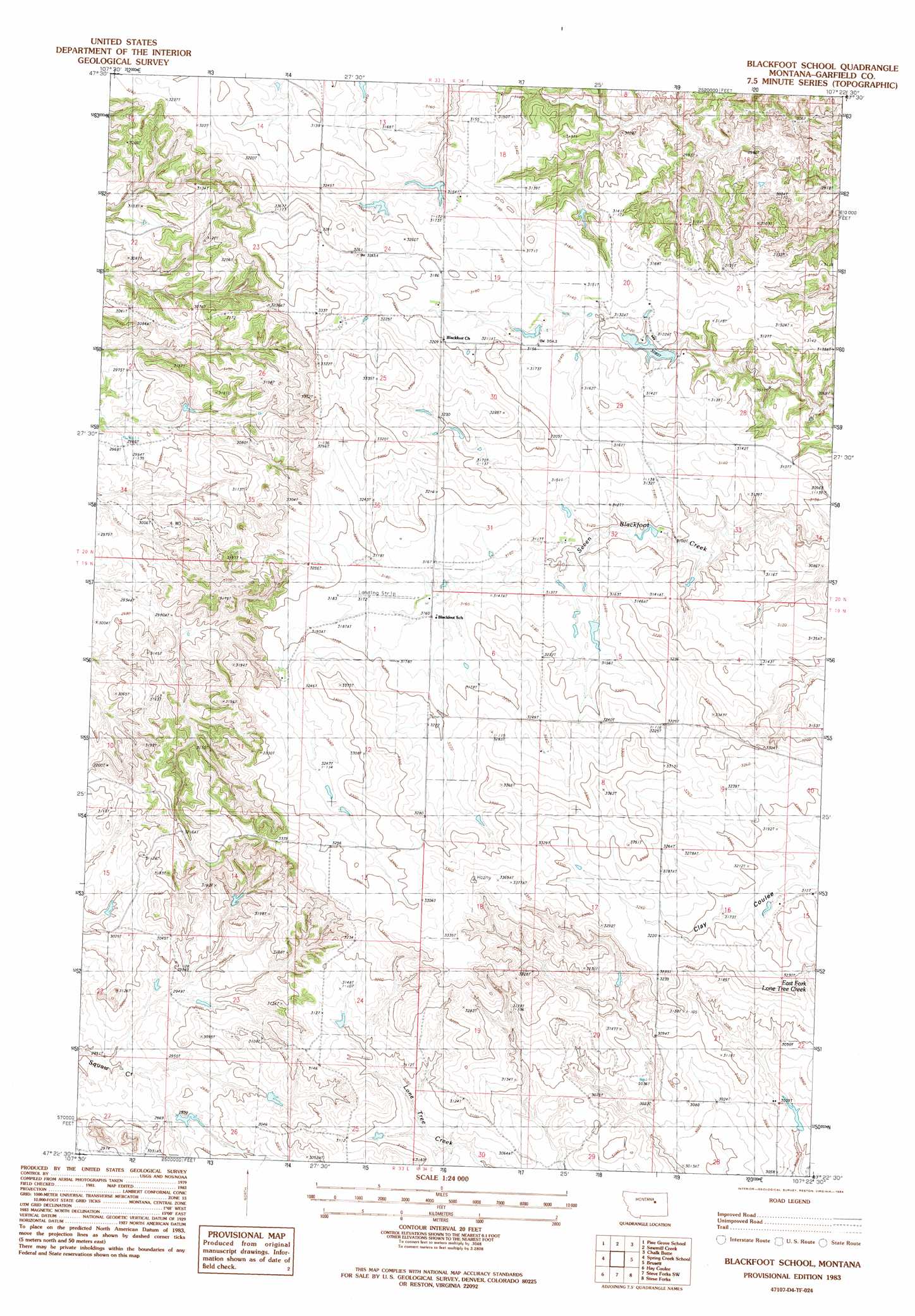
USGS Topo Quad 47107d4 - 1:24,000 scale
| Topo Map Name: | Blackfoot School |
| USGS Topo Quad ID: | 47107d4 |
| Print Size: | ca. 21 1/4" wide x 27" high |
| Southeast Coordinates: | 47.375° N latitude / 107.375° W longitude |
| Map Center Coordinates: | 47.4375° N latitude / 107.4375° W longitude |
| U.S. State: | MT |
| Filename: | o47107d4.jpg |
| Download Map JPG Image: | Blackfoot School topo map 1:24,000 scale |
| Map Type: | Topographic |
| Topo Series: | 7.5´ |
| Map Scale: | 1:24,000 |
| Source of Map Images: | United States Geological Survey (USGS) |
| Alternate Map Versions: |
Blackfoot School MT 1983, updated 1984 Download PDF Buy paper map Blackfoot School MT 2011 Download PDF Buy paper map Blackfoot School MT 2014 Download PDF Buy paper map |
1:24,000 Topo Quads surrounding Blackfoot School
Herman Point |
Schuyler Butte |
Swede Ridge |
Wolfe Coulee |
Wagon Coulee |
Lost Creek |
Pine Grove School |
Sawmill Creek |
Chalk Butte |
Hell Hollow |
Cap Rock Butte |
Spring Creek School |
Blackfoot School |
Brusett |
Moonlight Creek |
Benzien |
Hay Coulee |
Steve Forks Sw |
Steve Forks |
Smoky Butte Creek |
Searl Coulee |
Coffin Butte |
Twin Buttes |
Edwards |
Big Dry School |
> Back to 47107a1 at 1:100,000 scale
> Back to 47106a1 at 1:250,000 scale
> Back to U.S. Topo Maps home
Blackfoot School topo map: Gazetteer
Blackfoot School: Dams
Aberta Dam elevation 1010m 3313′Clark Dam elevation 960m 3149′
D Loomis Number 3 Dam elevation 985m 3231′
Loomis D Number 1 Dam elevation 964m 3162′
Ralph Clark Number 1 Dam elevation 952m 3123′
Blackfoot School: Populated Places
Blackfoot (historical) elevation 964m 3162′Blackfoot School: Post Offices
Antrim Post Office (historical) elevation 975m 3198′Blackfoot School: Wells
19N34E18ACC_01 Well elevation 1012m 3320′20N33E26BA__01 Well elevation 941m 3087′
20N34E18CC__01 Well elevation 964m 3162′
20N34E32AD__01 Well elevation 940m 3083′
20N34E34ADCC01 Well elevation 941m 3087′
Blackfoot School digital topo map on disk
Buy this Blackfoot School topo map showing relief, roads, GPS coordinates and other geographical features, as a high-resolution digital map file on DVD:
Eastern Montana & Western North Dakota
Buy digital topo maps: Eastern Montana & Western North Dakota