Grass Range Nw Topo Map Montana
To zoom in, hover over the map of Grass Range Nw
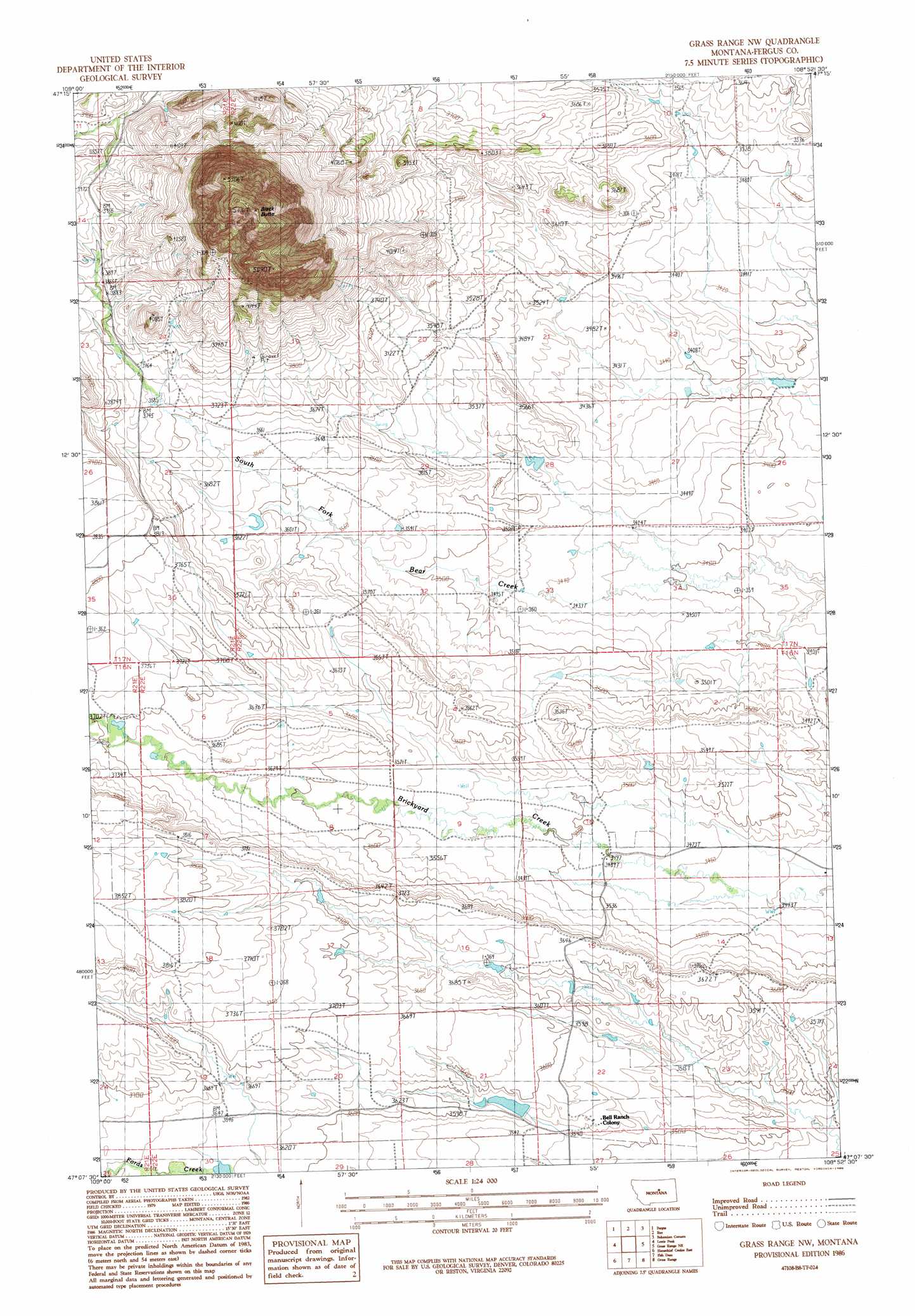
USGS Topo Quad 47108b8 - 1:24,000 scale
| Topo Map Name: | Grass Range Nw |
| USGS Topo Quad ID: | 47108b8 |
| Print Size: | ca. 21 1/4" wide x 27" high |
| Southeast Coordinates: | 47.125° N latitude / 108.875° W longitude |
| Map Center Coordinates: | 47.1875° N latitude / 108.9375° W longitude |
| U.S. State: | MT |
| Filename: | o47108b8.jpg |
| Download Map JPG Image: | Grass Range Nw topo map 1:24,000 scale |
| Map Type: | Topographic |
| Topo Series: | 7.5´ |
| Map Scale: | 1:24,000 |
| Source of Map Images: | United States Geological Survey (USGS) |
| Alternate Map Versions: |
Grass Range NW MT 1986, updated 1986 Download PDF Buy paper map Grass Range NW MT 2011 Download PDF Buy paper map Grass Range NW MT 2014 Download PDF Buy paper map |
1:24,000 Topo Quads surrounding Grass Range Nw
The Horse Ranch |
Fergus Ne |
Roy Nw |
Griffee Coulee |
Sloan Reservoir |
Armells |
Fergus |
Roy |
Bohemian Corners |
Bear Creek Reservoir |
Judith Peak |
Lewis Peak |
Grass Range Nw |
Grass Range Ne |
Teigen Nw |
Horsethief Coulee W. |
Horsethief Coulee E. |
Fish Dam |
Grass Range |
Briggs Coulee |
Loco Ridge |
Forestgrove |
Becket |
Becket Ne |
Milk Springs |
> Back to 47108a1 at 1:100,000 scale
> Back to 47108a1 at 1:250,000 scale
> Back to U.S. Topo Maps home
Grass Range Nw topo map: Gazetteer
Grass Range Nw: Dams
Ruseteun Number 2 Dam elevation 1083m 3553′Grass Range Nw: Populated Places
Bell Ranch Colony elevation 1083m 3553′Grass Range Nw: Streams
Edwards Creek elevation 1132m 3713′Grass Range Nw: Summits
Black Butte elevation 1687m 5534′Grass Range Nw digital topo map on disk
Buy this Grass Range Nw topo map showing relief, roads, GPS coordinates and other geographical features, as a high-resolution digital map file on DVD: