Kirkendal Flat Topo Map Montana
To zoom in, hover over the map of Kirkendal Flat
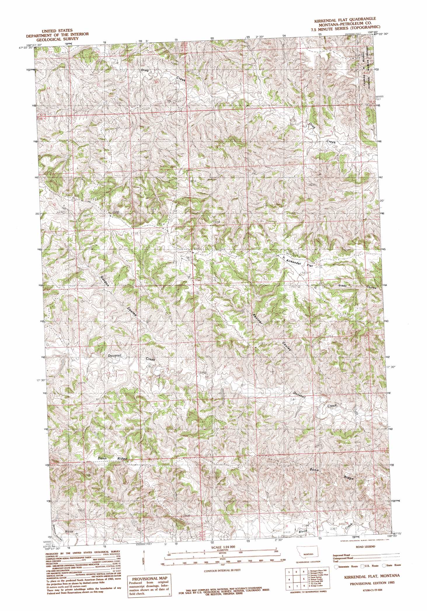
USGS Topo Quad 47108c1 - 1:24,000 scale
| Topo Map Name: | Kirkendal Flat |
| USGS Topo Quad ID: | 47108c1 |
| Print Size: | ca. 21 1/4" wide x 27" high |
| Southeast Coordinates: | 47.25° N latitude / 108° W longitude |
| Map Center Coordinates: | 47.3125° N latitude / 108.0625° W longitude |
| U.S. State: | MT |
| Filename: | o47108c1.jpg |
| Download Map JPG Image: | Kirkendal Flat topo map 1:24,000 scale |
| Map Type: | Topographic |
| Topo Series: | 7.5´ |
| Map Scale: | 1:24,000 |
| Source of Map Images: | United States Geological Survey (USGS) |
| Alternate Map Versions: |
Kirkendal Flat MT 1985, updated 1985 Download PDF Buy paper map Kirkendal Flat MT 2011 Download PDF Buy paper map Kirkendal Flat MT 2014 Download PDF Buy paper map |
1:24,000 Topo Quads surrounding Kirkendal Flat
Hanson Flat |
Dry Coulee |
Chain Buttes |
Locke Ranch |
Mickey Butte |
Dovetail Butte |
Weingart Place Nw |
Weingart Place |
Germaine Coulee West |
Germaine Coulee East |
Brown Spring |
Davis Spring |
Kirkendal Flat |
Nelson Coulee |
Seventynine Coulee |
Dry Blood Creek East |
Cat Creek Nw |
Tin Can Hill |
Bridge Coulee |
Lelig Coulee |
Winnett North |
Ingals Dam |
Cat Creek |
Fail Ranch |
Barney Pinnacle |
> Back to 47108a1 at 1:100,000 scale
> Back to 47108a1 at 1:250,000 scale
> Back to U.S. Topo Maps home
Kirkendal Flat topo map: Gazetteer
Kirkendal Flat: Flats
Kirkendal Flat elevation 882m 2893′Kirkendal Flat: Valleys
Gordon Coulee elevation 756m 2480′Kastner Coulee elevation 738m 2421′
Swanson Coulee elevation 769m 2522′
Kirkendal Flat digital topo map on disk
Buy this Kirkendal Flat topo map showing relief, roads, GPS coordinates and other geographical features, as a high-resolution digital map file on DVD: