Dovetail Butte Topo Map Montana
To zoom in, hover over the map of Dovetail Butte
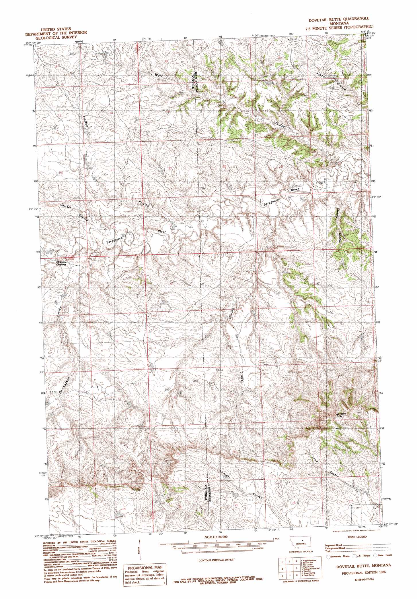
USGS Topo Quad 47108d3 - 1:24,000 scale
| Topo Map Name: | Dovetail Butte |
| USGS Topo Quad ID: | 47108d3 |
| Print Size: | ca. 21 1/4" wide x 27" high |
| Southeast Coordinates: | 47.375° N latitude / 108.25° W longitude |
| Map Center Coordinates: | 47.4375° N latitude / 108.3125° W longitude |
| U.S. State: | MT |
| Filename: | o47108d3.jpg |
| Download Map JPG Image: | Dovetail Butte topo map 1:24,000 scale |
| Map Type: | Topographic |
| Topo Series: | 7.5´ |
| Map Scale: | 1:24,000 |
| Source of Map Images: | United States Geological Survey (USGS) |
| Alternate Map Versions: |
Dovetail Butte MT 1985, updated 1985 Download PDF Buy paper map Dovetail Butte MT 2011 Download PDF Buy paper map Dovetail Butte MT 2014 Download PDF Buy paper map |
1:24,000 Topo Quads surrounding Dovetail Butte
Bell Ridge East |
Sagebrush Reservoir |
Blizzard Reservoir |
Lake Reservoir |
Karsten Coulee |
Carter Coulee |
Kepple Bottoms |
Hanson Flat |
Dry Coulee |
Chain Buttes |
Kachia Reservoir |
Pipes Coulee |
Dovetail Butte |
Weingart Place Nw |
Weingart Place |
Bear Creek Reservoir Se |
Valentine |
Brown Spring |
Davis Spring |
Kirkendal Flat |
Wild Horse Lake |
Dry Blood Creek West |
Dry Blood Creek East |
Cat Creek Nw |
Tin Can Hill |
> Back to 47108a1 at 1:100,000 scale
> Back to 47108a1 at 1:250,000 scale
> Back to U.S. Topo Maps home
Dovetail Butte topo map: Gazetteer
Dovetail Butte: Summits
Dovetail Butte elevation 986m 3234′Dovetail Butte: Valleys
Krafton Coulee elevation 787m 2582′Pickerd Coulee elevation 777m 2549′
Rasmussen Coulee elevation 799m 2621′
Whisker Coulee elevation 786m 2578′
Wolf Coulee elevation 761m 2496′
Woods Coulee elevation 763m 2503′
Dovetail Butte digital topo map on disk
Buy this Dovetail Butte topo map showing relief, roads, GPS coordinates and other geographical features, as a high-resolution digital map file on DVD: