Griffee Coulee Topo Map Montana
To zoom in, hover over the map of Griffee Coulee
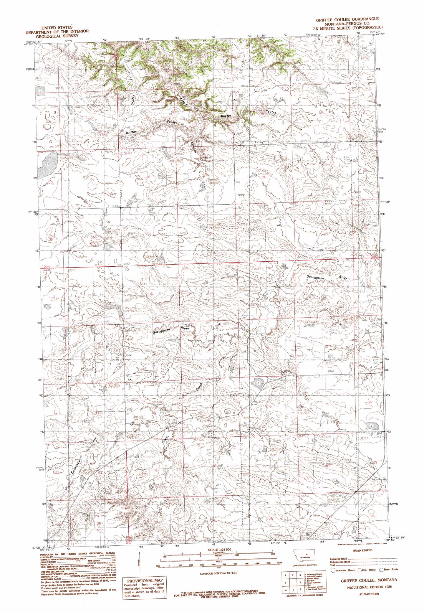
USGS Topo Quad 47108d7 - 1:24,000 scale
| Topo Map Name: | Griffee Coulee |
| USGS Topo Quad ID: | 47108d7 |
| Print Size: | ca. 21 1/4" wide x 27" high |
| Southeast Coordinates: | 47.375° N latitude / 108.75° W longitude |
| Map Center Coordinates: | 47.4375° N latitude / 108.8125° W longitude |
| U.S. State: | MT |
| Filename: | o47108d7.jpg |
| Download Map JPG Image: | Griffee Coulee topo map 1:24,000 scale |
| Map Type: | Topographic |
| Topo Series: | 7.5´ |
| Map Scale: | 1:24,000 |
| Source of Map Images: | United States Geological Survey (USGS) |
| Alternate Map Versions: |
Griffee Coulee MT 1985, updated 1985 Download PDF Buy paper map Griffee Coulee MT 2011 Download PDF Buy paper map Griffee Coulee MT 2014 Download PDF Buy paper map |
1:24,000 Topo Quads surrounding Griffee Coulee
Reppe Butte |
Baker Monument |
Grand Island |
Bell Ridge West |
Bell Ridge East |
Bakers Spring |
Thompson Coulee |
Mitchell Crossing |
Hessler Ridge |
Carter Coulee |
Fergus Ne |
Roy Nw |
Griffee Coulee |
Sloan Reservoir |
Kachia Reservoir |
Fergus |
Roy |
Bohemian Corners |
Bear Creek Reservoir |
Bear Creek Reservoir Se |
Lewis Peak |
Grass Range Nw |
Grass Range Ne |
Teigen Nw |
Wild Horse Lake |
> Back to 47108a1 at 1:100,000 scale
> Back to 47108a1 at 1:250,000 scale
> Back to U.S. Topo Maps home
Griffee Coulee topo map: Gazetteer
Griffee Coulee: Dams
Cimrhakl Number 3 Dam elevation 939m 3080′Cimrhakle Number 2 Dam elevation 939m 3080′
Lazy JD Number 10 Dam elevation 970m 3182′
Willmore Dam elevation 938m 3077′
Griffee Coulee: Ridges
Griffee Ridge elevation 940m 3083′Griffee Coulee: Valleys
Dexter Coulee elevation 891m 2923′Griffee Coulee elevation 899m 2949′
Griffee Coulee: Wells
19N23E06BC__01 Well elevation 946m 3103′20N23E21BBD_01 Well elevation 933m 3061′
Griffee Coulee digital topo map on disk
Buy this Griffee Coulee topo map showing relief, roads, GPS coordinates and other geographical features, as a high-resolution digital map file on DVD: