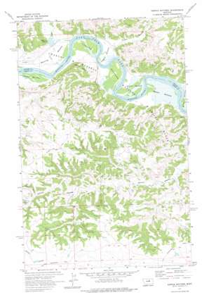
Kepple Bottoms Topo Map Montana
To zoom in, hover over the map of Kepple Bottoms
USGS Topo Quad 47108e4 - 1:24,000 scale
| Topo Map Name: | Kepple Bottoms |
| USGS Topo Quad ID: | 47108e4 |
| Print Size: | ca. 21 1/4" wide x 27" high |
| Southeast Coordinates: | 47.5° N latitude / 108.375° W longitude |
| Map Center Coordinates: | 47.5625° N latitude / 108.4375° W longitude |
| U.S. State: | MT |
| Filename: | o47108e4.jpg |
| Download Map JPG Image: | Kepple Bottoms topo map 1:24,000 scale |
| Map Type: | Topographic |
| Topo Series: | 7.5´ |
| Map Scale: | 1:24,000 |
| Source of Map Images: | United States Geological Survey (USGS) |
| Alternate Map Versions: |
Kepple Bottoms MT 1971, updated 1975 Download PDF Buy paper map Kepple Bottoms MT 2011 Download PDF Buy paper map Kepple Bottoms MT 2014 Download PDF Buy paper map |
1:24,000 Topo Quads surrounding Kepple Bottoms
> Back to 47108e1 at 1:100,000 scale
> Back to 47108a1 at 1:250,000 scale
> Back to U.S. Topo Maps home
Kepple Bottoms topo map: Gazetteer
Kepple Bottoms: Bends
Halpen Bottoms elevation 687m 2253′Johnson Bottoms elevation 687m 2253′
Kepple Bottoms elevation 688m 2257′
Manning Bottoms elevation 689m 2260′
Miller Bottoms elevation 691m 2267′
Turner Bottoms elevation 690m 2263′
Withro Bottoms elevation 688m 2257′
Kepple Bottoms: Capes
Rocky Point elevation 745m 2444′Kepple Bottoms: Dams
Prairie DOG Dam elevation 879m 2883′Kepple Bottoms: Populated Places
Rocky Point (historical) elevation 693m 2273′Kepple Bottoms: Post Offices
Wilder Post Office (historical) elevation 690m 2263′Kepple Bottoms: Reservoirs
Rock Creek Reservoir elevation 697m 2286′Kepple Bottoms: Streams
Rock Creek elevation 688m 2257′Kepple Bottoms: Trails
Old Musselshell Trail elevation 880m 2887′Wilder Trail elevation 879m 2883′
Kepple Bottoms: Valleys
Pugh Coulee elevation 703m 2306′Sandstrom Coulee elevation 825m 2706′
Tomty Coulee elevation 819m 2687′
Wilder Coulee elevation 696m 2283′
Kepple Bottoms: Wells
21N25E03CA__01 Well elevation 701m 2299′Kepple Bottoms digital topo map on disk
Buy this Kepple Bottoms topo map showing relief, roads, GPS coordinates and other geographical features, as a high-resolution digital map file on DVD:


