Hessler Ridge Topo Map Montana
To zoom in, hover over the map of Hessler Ridge
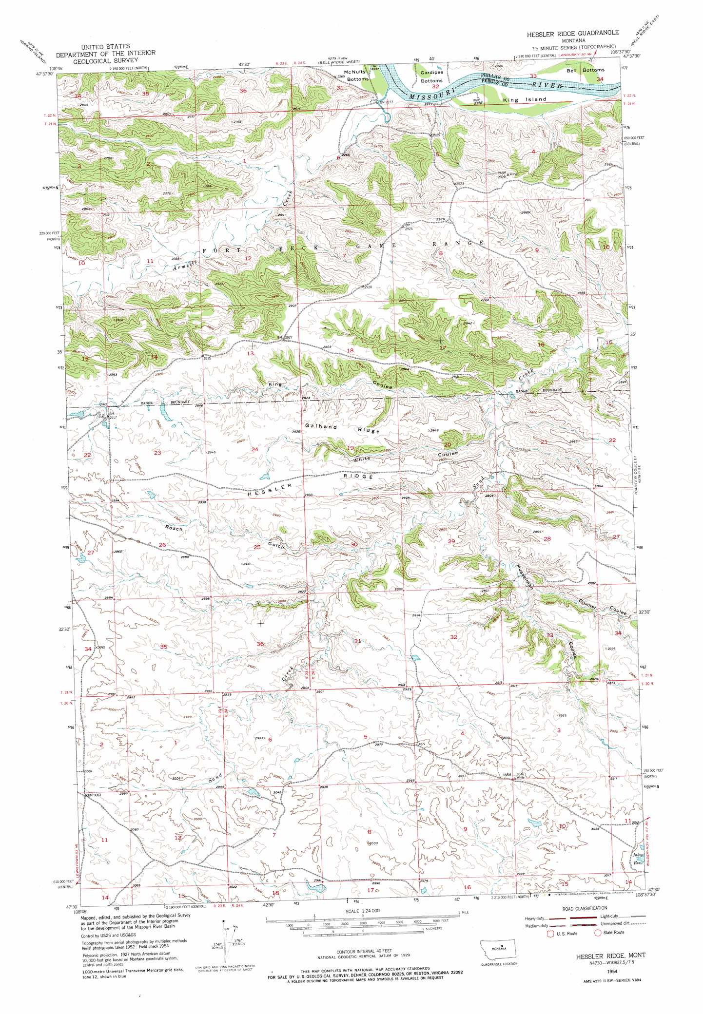
USGS Topo Quad 47108e6 - 1:24,000 scale
| Topo Map Name: | Hessler Ridge |
| USGS Topo Quad ID: | 47108e6 |
| Print Size: | ca. 21 1/4" wide x 27" high |
| Southeast Coordinates: | 47.5° N latitude / 108.625° W longitude |
| Map Center Coordinates: | 47.5625° N latitude / 108.6875° W longitude |
| U.S. State: | MT |
| Filename: | o47108e6.jpg |
| Download Map JPG Image: | Hessler Ridge topo map 1:24,000 scale |
| Map Type: | Topographic |
| Topo Series: | 7.5´ |
| Map Scale: | 1:24,000 |
| Source of Map Images: | United States Geological Survey (USGS) |
| Alternate Map Versions: |
Hessler Ridge MT 1954, updated 1956 Download PDF Buy paper map Hessler Ridge MT 1954, updated 1976 Download PDF Buy paper map Hessler Ridge MT 1954, updated 1976 Download PDF Buy paper map Hessler Ridge MT 2011 Download PDF Buy paper map Hessler Ridge MT 2014 Download PDF Buy paper map |
1:24,000 Topo Quads surrounding Hessler Ridge
Cow Island |
Shetland Divide |
D Y Junction |
Hays Se |
Robinson School |
Baker Monument |
Grand Island |
Bell Ridge West |
Bell Ridge East |
Sagebrush Reservoir |
Thompson Coulee |
Mitchell Crossing |
Hessler Ridge |
Carter Coulee |
Kepple Bottoms |
Roy Nw |
Griffee Coulee |
Sloan Reservoir |
Kachia Reservoir |
Pipes Coulee |
Roy |
Bohemian Corners |
Bear Creek Reservoir |
Bear Creek Reservoir Se |
Valentine |
> Back to 47108e1 at 1:100,000 scale
> Back to 47108a1 at 1:250,000 scale
> Back to U.S. Topo Maps home
Hessler Ridge topo map: Gazetteer
Hessler Ridge: Airports
Sand Creek Wildlife Station Airport elevation 894m 2933′Hessler Ridge: Bends
Gardipee Bottoms elevation 689m 2260′Hessler Ridge: Dams
Cope Dam elevation 881m 2890′Fergus Number 1 Dam elevation 902m 2959′
King Coulee Number 1 Dam elevation 902m 2959′
Sagebrush Number 3 Dam elevation 878m 2880′
Hessler Ridge: Islands
King Island elevation 689m 2260′Hessler Ridge: Populated Places
Mobridge (historical) elevation 701m 2299′Hessler Ridge: Ridges
Galhand Ridge elevation 879m 2883′Hessler Ridge elevation 891m 2923′
Hessler Ridge: Streams
Armells Creek elevation 685m 2247′Hessler Ridge: Valleys
Downer Coulee elevation 815m 2673′King Coulee elevation 778m 2552′
Musselman Coulee elevation 793m 2601′
Roach Gulch elevation 813m 2667′
White Coulee elevation 781m 2562′
Hessler Ridge: Wells
21N23E12AD__01 Well elevation 730m 2395′21N23E13CBBB01 Well elevation 887m 2910′
21N24E06BB__01 Well elevation 734m 2408′
Hessler Ridge digital topo map on disk
Buy this Hessler Ridge topo map showing relief, roads, GPS coordinates and other geographical features, as a high-resolution digital map file on DVD: