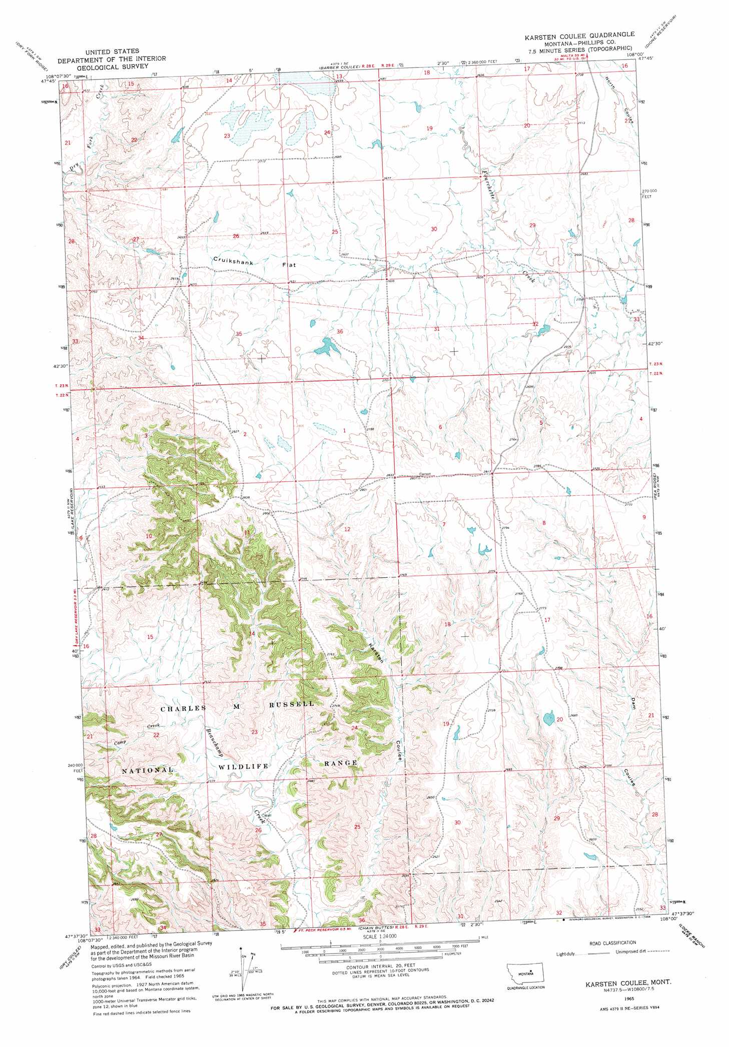
Karsten Coulee Topo Map Montana
To zoom in, hover over the map of Karsten Coulee
USGS Topo Quad 47108f1 - 1:24,000 scale
| Topo Map Name: | Karsten Coulee |
| USGS Topo Quad ID: | 47108f1 |
| Print Size: | ca. 21 1/4" wide x 27" high |
| Southeast Coordinates: | 47.625° N latitude / 108° W longitude |
| Map Center Coordinates: | 47.6875° N latitude / 108.0625° W longitude |
| U.S. State: | MT |
| Filename: | o47108f1.jpg |
| Download Map JPG Image: | Karsten Coulee topo map 1:24,000 scale |
| Map Type: | Topographic |
| Topo Series: | 7.5´ |
| Map Scale: | 1:24,000 |
| Source of Map Images: | United States Geological Survey (USGS) |
| Alternate Map Versions: |
Karsten Coulee MT 1965, updated 1968 Download PDF Buy paper map Karsten Coulee MT 2011 Download PDF Buy paper map Karsten Coulee MT 2014 Download PDF Buy paper map |
1:24,000 Topo Quads surrounding Karsten Coulee
Coburn Butte |
Veseth Reservoir |
Holzhey Reservoir |
Emond Ranch |
Whitcomb Lake |
Bison Bone Reservoir |
Dry Fork Ridge |
Barber Coulee |
Dione Reservoir |
Stratton Reservoir |
Blizzard Reservoir |
Lake Reservoir |
Karsten Coulee |
Pea Ridge |
Indian Lake |
Hanson Flat |
Dry Coulee |
Chain Buttes |
Locke Ranch |
Mickey Butte |
Dovetail Butte |
Weingart Place Nw |
Weingart Place |
Germaine Coulee West |
Germaine Coulee East |
> Back to 47108e1 at 1:100,000 scale
> Back to 47108a1 at 1:250,000 scale
> Back to U.S. Topo Maps home
Karsten Coulee topo map: Gazetteer
Karsten Coulee: Dams
Matovich One Dam elevation 817m 2680′Vesvick Dam elevation 815m 2673′
Karsten Coulee: Flats
Cruikshank Flat elevation 796m 2611′Karsten Coulee: Post Offices
Bellealta Post Office (historical) elevation 825m 2706′Karsten Coulee: Streams
Camp Creek elevation 708m 2322′Karsten Coulee: Valleys
Karsten Coulee elevation 695m 2280′Karsten Coulee: Wells
22N28E12BDC_01 Well elevation 821m 2693′22N28E26ACBC01 Well elevation 702m 2303′
23N29E33AC__01 Well elevation 782m 2565′
Karsten Coulee digital topo map on disk
Buy this Karsten Coulee topo map showing relief, roads, GPS coordinates and other geographical features, as a high-resolution digital map file on DVD: