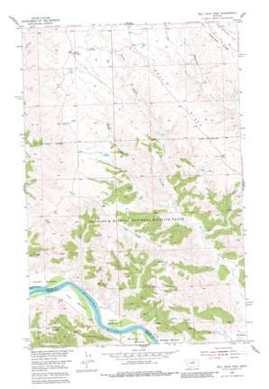
Bell Ridge West Topo Map Montana
To zoom in, hover over the map of Bell Ridge West
USGS Topo Quad 47108f6 - 1:24,000 scale
| Topo Map Name: | Bell Ridge West |
| USGS Topo Quad ID: | 47108f6 |
| Print Size: | ca. 21 1/4" wide x 27" high |
| Southeast Coordinates: | 47.625° N latitude / 108.625° W longitude |
| Map Center Coordinates: | 47.6875° N latitude / 108.6875° W longitude |
| U.S. State: | MT |
| Filename: | o47108f6.jpg |
| Download Map JPG Image: | Bell Ridge West topo map 1:24,000 scale |
| Map Type: | Topographic |
| Topo Series: | 7.5´ |
| Map Scale: | 1:24,000 |
| Source of Map Images: | United States Geological Survey (USGS) |
| Alternate Map Versions: |
Bell Ridge West MT 1954, updated 1956 Download PDF Buy paper map Bell Ridge West MT 1954, updated 1978 Download PDF Buy paper map Bell Ridge West MT 1954, updated 1982 Download PDF Buy paper map Bell Ridge West MT 2011 Download PDF Buy paper map Bell Ridge West MT 2014 Download PDF Buy paper map |
1:24,000 Topo Quads surrounding Bell Ridge West
> Back to 47108e1 at 1:100,000 scale
> Back to 47108a1 at 1:250,000 scale
> Back to U.S. Topo Maps home
Bell Ridge West topo map: Gazetteer
Bell Ridge West: Bends
Knox Bottoms elevation 689m 2260′Le Clair Bottoms elevation 687m 2253′
McNulty Bottoms elevation 688m 2257′
Bell Ridge West: Bridges
Missouri River Bridge elevation 685m 2247′Bell Ridge West: Capes
Grays Point elevation 690m 2263′Bell Ridge West: Parks
James Kipp Recreation Area elevation 691m 2267′Upper Missouri National Wild and Scenic River elevation 686m 2250′
Bell Ridge West: Reservoirs
Bell Reservoir elevation 882m 2893′Bell Ridge West: Ridges
Bell Ridge elevation 899m 2949′Lost Ridge elevation 891m 2923′
Bell Ridge West: Valleys
Bogg Gulch elevation 793m 2601′Duval Gulch elevation 768m 2519′
Bell Ridge West digital topo map on disk
Buy this Bell Ridge West topo map showing relief, roads, GPS coordinates and other geographical features, as a high-resolution digital map file on DVD:


