Grand Island Topo Map Montana
To zoom in, hover over the map of Grand Island
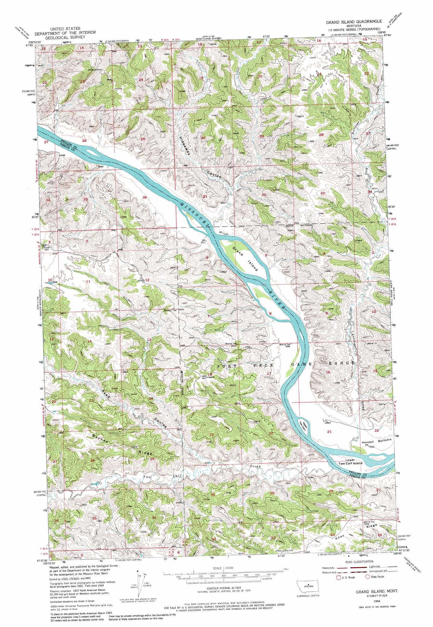
USGS Topo Quad 47108f7 - 1:24,000 scale
| Topo Map Name: | Grand Island |
| USGS Topo Quad ID: | 47108f7 |
| Print Size: | ca. 21 1/4" wide x 27" high |
| Southeast Coordinates: | 47.625° N latitude / 108.75° W longitude |
| Map Center Coordinates: | 47.6875° N latitude / 108.8125° W longitude |
| U.S. State: | MT |
| Filename: | o47108f7.jpg |
| Download Map JPG Image: | Grand Island topo map 1:24,000 scale |
| Map Type: | Topographic |
| Topo Series: | 7.5´ |
| Map Scale: | 1:24,000 |
| Source of Map Images: | United States Geological Survey (USGS) |
| Alternate Map Versions: |
Grand Island MT 1954, updated 1956 Download PDF Buy paper map Grand Island MT 1954, updated 1974 Download PDF Buy paper map Grand Island MT 1954, updated 1984 Download PDF Buy paper map Grand Island MT 2011 Download PDF Buy paper map Grand Island MT 2014 Download PDF Buy paper map |
1:24,000 Topo Quads surrounding Grand Island
Butch Reservoir |
John Coulee |
Crazyman Coulee |
Hays |
Zortman |
Sturgeon Island |
Cow Island |
Shetland Divide |
D Y Junction |
Hays Se |
Reppe Butte |
Baker Monument |
Grand Island |
Bell Ridge West |
Bell Ridge East |
Bakers Spring |
Thompson Coulee |
Mitchell Crossing |
Hessler Ridge |
Carter Coulee |
Fergus Ne |
Roy Nw |
Griffee Coulee |
Sloan Reservoir |
Kachia Reservoir |
> Back to 47108e1 at 1:100,000 scale
> Back to 47108a1 at 1:250,000 scale
> Back to U.S. Topo Maps home
Grand Island topo map: Gazetteer
Grand Island: Bends
Kendall Bottoms elevation 695m 2280′Grand Island: Islands
Grand Island elevation 706m 2316′Lower Two Calf Island elevation 694m 2276′
Upper Two Calf Island elevation 704m 2309′
Grand Island: Post Offices
Delos Post Office (historical) elevation 709m 2326′Grand Island: Rapids
Picotts Rapids elevation 692m 2270′Grand Island: Streams
Antelope Creek elevation 695m 2280′Two Calf Creek elevation 687m 2253′
Grand Island: Summits
Fortress Butte elevation 807m 2647′Grand Island: Valleys
Hideaway Coulee elevation 696m 2283′Reed Coulee elevation 715m 2345′
Grand Island: Wells
22N22E22AA__01 Well elevation 809m 2654′22N22E25DD__01 Well elevation 718m 2355′
22N23E08DB__01 Well elevation 698m 2290′
Grand Island digital topo map on disk
Buy this Grand Island topo map showing relief, roads, GPS coordinates and other geographical features, as a high-resolution digital map file on DVD: