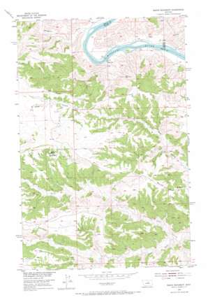
Baker Monument Topo Map Montana
To zoom in, hover over the map of Baker Monument
USGS Topo Quad 47108f8 - 1:24,000 scale
| Topo Map Name: | Baker Monument |
| USGS Topo Quad ID: | 47108f8 |
| Print Size: | ca. 21 1/4" wide x 27" high |
| Southeast Coordinates: | 47.625° N latitude / 108.875° W longitude |
| Map Center Coordinates: | 47.6875° N latitude / 108.9375° W longitude |
| U.S. State: | MT |
| Filename: | o47108f8.jpg |
| Download Map JPG Image: | Baker Monument topo map 1:24,000 scale |
| Map Type: | Topographic |
| Topo Series: | 7.5´ |
| Map Scale: | 1:24,000 |
| Source of Map Images: | United States Geological Survey (USGS) |
| Alternate Map Versions: |
Baker Monument MT 1954, updated 1956 Download PDF Buy paper map Baker Monument MT 1954, updated 1973 Download PDF Buy paper map Baker Monument MT 2011 Download PDF Buy paper map Baker Monument MT 2014 Download PDF Buy paper map |
1:24,000 Topo Quads surrounding Baker Monument
> Back to 47108e1 at 1:100,000 scale
> Back to 47108a1 at 1:250,000 scale
> Back to U.S. Topo Maps home
Baker Monument topo map: Gazetteer
Baker Monument: Dams
Gumbo Dam elevation 896m 2939′Baker Monument: Pillars
Baker Monument elevation 939m 3080′Baker Monument: Populated Places
Power Plant (historical) elevation 713m 2339′Baker Monument: Ridges
Barnes Ridge elevation 903m 2962′Baker Monument: Streams
South Fork Two Calf Creek elevation 743m 2437′Woodhawk Creek elevation 697m 2286′
Baker Monument: Wells
22N22E34BB__01 Well elevation 744m 2440′22N22E34CB__01 Well elevation 802m 2631′
Baker Monument digital topo map on disk
Buy this Baker Monument topo map showing relief, roads, GPS coordinates and other geographical features, as a high-resolution digital map file on DVD:


