Dry Fork Ridge Topo Map Montana
To zoom in, hover over the map of Dry Fork Ridge
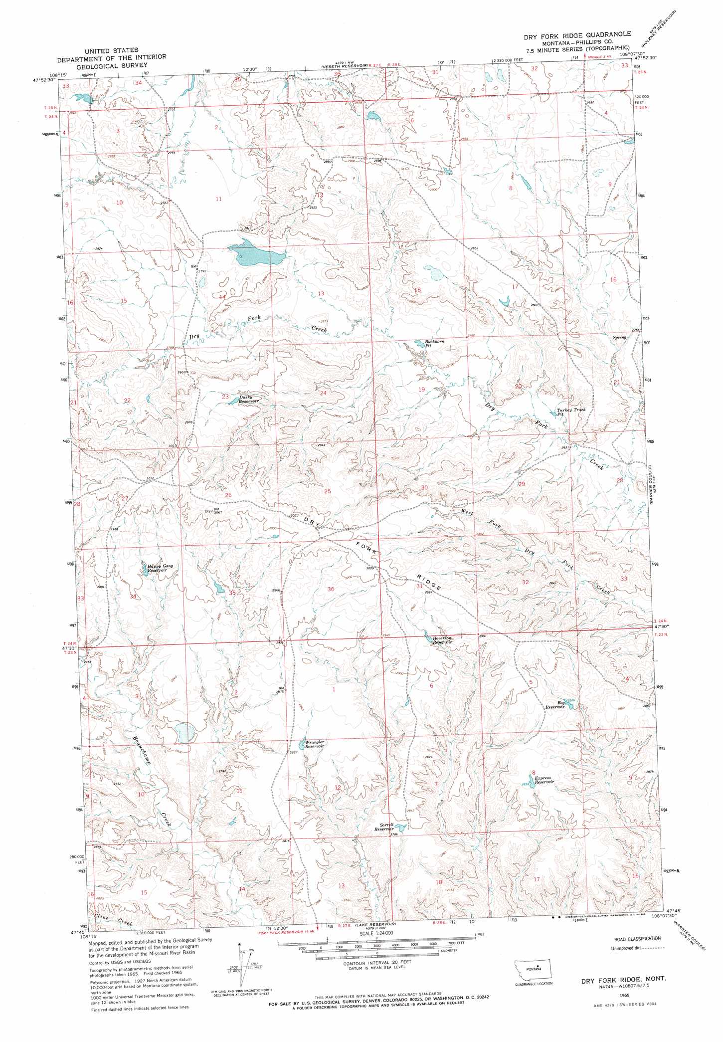
USGS Topo Quad 47108g2 - 1:24,000 scale
| Topo Map Name: | Dry Fork Ridge |
| USGS Topo Quad ID: | 47108g2 |
| Print Size: | ca. 21 1/4" wide x 27" high |
| Southeast Coordinates: | 47.75° N latitude / 108.125° W longitude |
| Map Center Coordinates: | 47.8125° N latitude / 108.1875° W longitude |
| U.S. State: | MT |
| Filename: | o47108g2.jpg |
| Download Map JPG Image: | Dry Fork Ridge topo map 1:24,000 scale |
| Map Type: | Topographic |
| Topo Series: | 7.5´ |
| Map Scale: | 1:24,000 |
| Source of Map Images: | United States Geological Survey (USGS) |
| Alternate Map Versions: |
Dry Fork Ridge MT 1965, updated 1969 Download PDF Buy paper map Dry Fork Ridge MT 2011 Download PDF Buy paper map Dry Fork Ridge MT 2014 Download PDF Buy paper map |
1:24,000 Topo Quads surrounding Dry Fork Ridge
Ball Coulee |
Ester Lake |
Phillips |
Seymour Reservoir |
Button Butte |
Bear Mountain |
Coburn Butte |
Veseth Reservoir |
Holzhey Reservoir |
Emond Ranch |
Robinson School |
Bison Bone Reservoir |
Dry Fork Ridge |
Barber Coulee |
Dione Reservoir |
Sagebrush Reservoir |
Blizzard Reservoir |
Lake Reservoir |
Karsten Coulee |
Pea Ridge |
Kepple Bottoms |
Hanson Flat |
Dry Coulee |
Chain Buttes |
Locke Ranch |
> Back to 47108e1 at 1:100,000 scale
> Back to 47108a1 at 1:250,000 scale
> Back to U.S. Topo Maps home
Dry Fork Ridge topo map: Gazetteer
Dry Fork Ridge: Basins
Buckhorn Pit elevation 825m 2706′Turkey Track Pit elevation 813m 2667′
Dry Fork Ridge: Dams
Current Dam elevation 837m 2746′Isaac Frye Number 1 Dam elevation 897m 2942′
Isaac Frye Number 4 Dam elevation 866m 2841′
PR-11 Dam elevation 841m 2759′
Dry Fork Ridge: Reservoirs
Bog Reservoir elevation 861m 2824′Dusky Reservoir elevation 885m 2903′
Express Reservoir elevation 860m 2821′
Happy Gang Reservoir elevation 879m 2883′
Hoverson Reservoir elevation 885m 2903′
Sorrell Reservoir elevation 849m 2785′
Wrangler Reservoir elevation 860m 2821′
Dry Fork Ridge: Ridges
Dry Fork Ridge elevation 922m 3024′Dry Fork Ridge: Streams
Trine Creek elevation 817m 2680′Dry Fork Ridge: Valleys
Garey Coulee elevation 810m 2657′Dry Fork Ridge: Wells
23N28E06CCAD01 Well elevation 869m 2851′Dry Fork Ridge digital topo map on disk
Buy this Dry Fork Ridge topo map showing relief, roads, GPS coordinates and other geographical features, as a high-resolution digital map file on DVD: