Crazyman Coulee Topo Map Montana
To zoom in, hover over the map of Crazyman Coulee
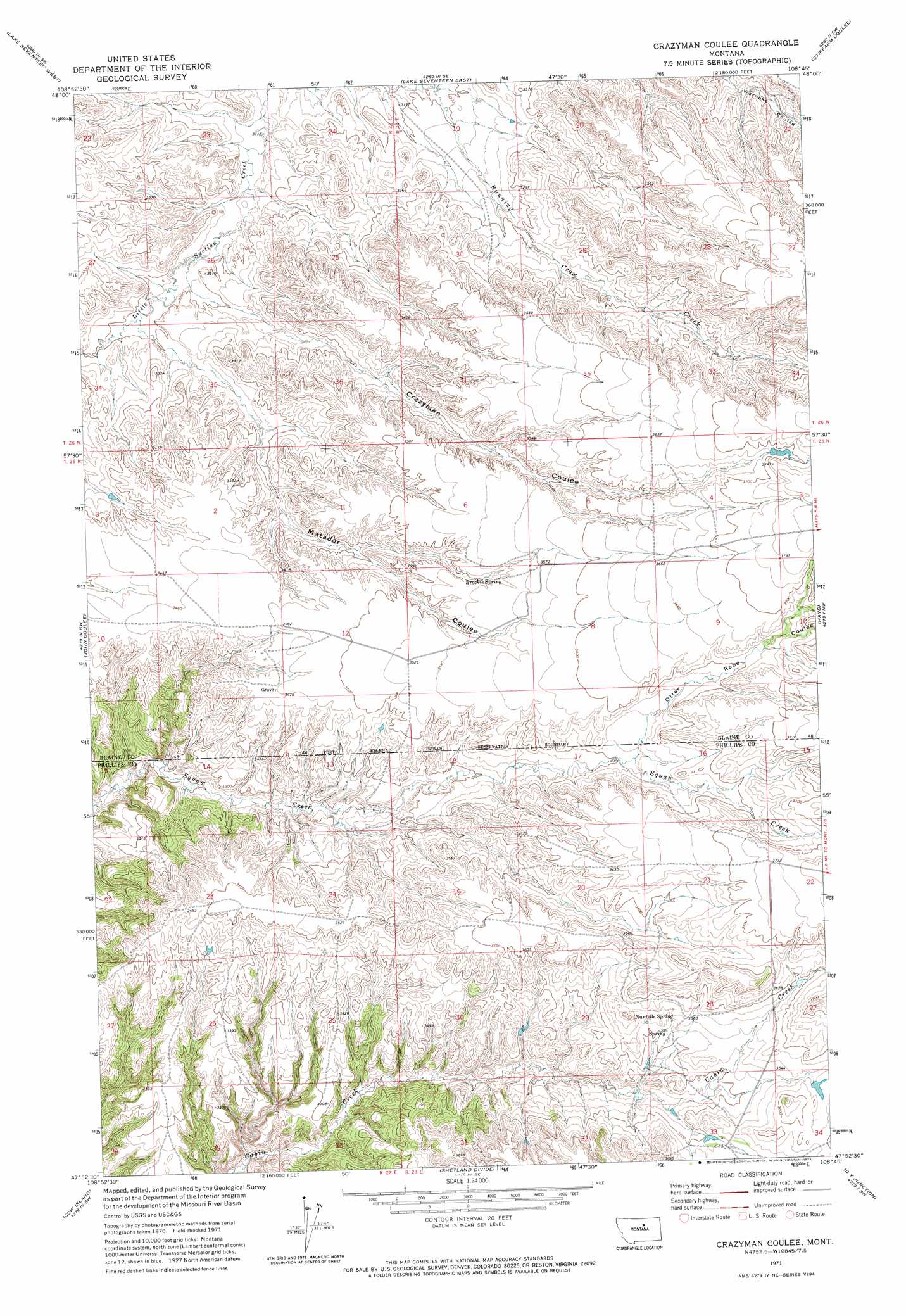
USGS Topo Quad 47108h7 - 1:24,000 scale
| Topo Map Name: | Crazyman Coulee |
| USGS Topo Quad ID: | 47108h7 |
| Print Size: | ca. 21 1/4" wide x 27" high |
| Southeast Coordinates: | 47.875° N latitude / 108.75° W longitude |
| Map Center Coordinates: | 47.9375° N latitude / 108.8125° W longitude |
| U.S. State: | MT |
| Filename: | o47108h7.jpg |
| Download Map JPG Image: | Crazyman Coulee topo map 1:24,000 scale |
| Map Type: | Topographic |
| Topo Series: | 7.5´ |
| Map Scale: | 1:24,000 |
| Source of Map Images: | United States Geological Survey (USGS) |
| Alternate Map Versions: |
Crazyman Coulee MT 1971, updated 1974 Download PDF Buy paper map Crazyman Coulee MT 2011 Download PDF Buy paper map Crazyman Coulee MT 2014 Download PDF Buy paper map |
1:24,000 Topo Quads surrounding Crazyman Coulee
Suction Butte |
Putnam Lake |
Lake Seventeen Ne |
Lodge Pole Nw |
Lodge Pole Ne |
Rattlesnake |
Lake Seventeen West |
Lake Seventeen East |
Stiffarm Coulee |
Lodge Pole |
Butch Reservoir |
John Coulee |
Crazyman Coulee |
Hays |
Zortman |
Sturgeon Island |
Cow Island |
Shetland Divide |
D Y Junction |
Hays Se |
Reppe Butte |
Baker Monument |
Grand Island |
Bell Ridge West |
Bell Ridge East |
> Back to 47108e1 at 1:100,000 scale
> Back to 47108a1 at 1:250,000 scale
> Back to U.S. Topo Maps home
Crazyman Coulee topo map: Gazetteer
Crazyman Coulee: Post Offices
Nantelle Post Office (historical) elevation 1073m 3520′Crazyman Coulee: Springs
Brockie Spring elevation 1080m 3543′Nantelle Spring elevation 1082m 3549′
Crazyman Coulee: Valleys
Crazyman Coulee elevation 975m 3198′Matador Coulee elevation 975m 3198′
Otter Robe Coulee elevation 1078m 3536′
Crazyman Coulee: Wells
25N22E12CABA01 Well elevation 1065m 3494′25N22E13DDB_01 Well elevation 1017m 3336′
25N23E21CAAC01 Well elevation 1104m 3622′
26N23E30DBD_01 Well elevation 1035m 3395′
Crazyman Coulee digital topo map on disk
Buy this Crazyman Coulee topo map showing relief, roads, GPS coordinates and other geographical features, as a high-resolution digital map file on DVD: