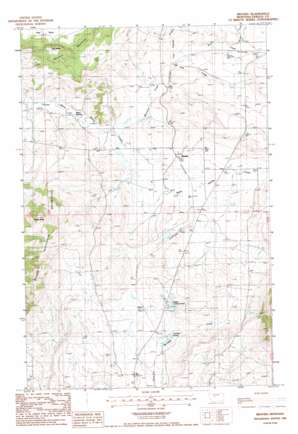
Brooks Topo Map Montana
To zoom in, hover over the map of Brooks
USGS Topo Quad 47109b4 - 1:24,000 scale
| Topo Map Name: | Brooks |
| USGS Topo Quad ID: | 47109b4 |
| Print Size: | ca. 21 1/4" wide x 27" high |
| Southeast Coordinates: | 47.125° N latitude / 109.375° W longitude |
| Map Center Coordinates: | 47.1875° N latitude / 109.4375° W longitude |
| U.S. State: | MT |
| Filename: | o47109b4.jpg |
| Download Map JPG Image: | Brooks topo map 1:24,000 scale |
| Map Type: | Topographic |
| Topo Series: | 7.5´ |
| Map Scale: | 1:24,000 |
| Source of Map Images: | United States Geological Survey (USGS) |
| Alternate Map Versions: |
Brooks MT 1985, updated 1986 Download PDF Buy paper map Brooks MT 2011 Download PDF Buy paper map Brooks MT 2014 Download PDF Buy paper map |
1:24,000 Topo Quads surrounding Brooks
> Back to 47109a1 at 1:100,000 scale
> Back to 47108a1 at 1:250,000 scale
> Back to U.S. Topo Maps home
Brooks topo map: Gazetteer
Brooks: Dams
Colver Dam elevation 1219m 3999′Lower Carter Pond Dam elevation 1217m 3992′
Upper Carter Pond Dam elevation 1230m 4035′
Brooks: Parks
Maidens Gold Historical Marker elevation 1219m 3999′Brooks: Populated Places
Baxter elevation 1232m 4041′Brooks elevation 1206m 3956′
Brooks: Post Offices
Brooks Post Office (historical) elevation 1211m 3973′Brooks: Reservoirs
Carters Pond elevation 1226m 4022′Upper Carters Pond elevation 1238m 4061′
Brooks: Springs
17N18E19DBC_01 Spring elevation 1153m 3782′17N18E19DBCA01 Spring elevation 1153m 3782′
Lyle Spring elevation 1340m 4396′
Warm Spring elevation 1152m 3779′
Brooks: Streams
Fish Creek elevation 1188m 3897′Last Chance Creek elevation 1189m 3900′
Moccasin Creek elevation 1160m 3805′
North Fork Bull Creek elevation 1211m 3973′
Brooks: Summits
Rocky Butte elevation 1476m 4842′Brooks: Wells
16N18E08CAA_01 Well elevation 1263m 4143′16N18E08CAB_01 Well elevation 1276m 4186′
16N18E13DBB_01 Well elevation 1334m 4376′
16N18E15ACCB01 Well elevation 1239m 4064′
16N18E15BDBB01 Well elevation 1239m 4064′
17N17E24ACC_01 Well elevation 1144m 3753′
17N17E25AACC01 Well elevation 1182m 3877′
17N18E23ADB_01 Well elevation 1245m 4084′
17N18E27CBD_01 Well elevation 1208m 3963′
17N18E30CAC_01 Well elevation 1209m 3966′
17N18E33ADC_01 Well elevation 1191m 3907′
17N18E34ACA_01 Well elevation 1208m 3963′
Brooks digital topo map on disk
Buy this Brooks topo map showing relief, roads, GPS coordinates and other geographical features, as a high-resolution digital map file on DVD:


