Spring Creek Junction Topo Map Montana
To zoom in, hover over the map of Spring Creek Junction
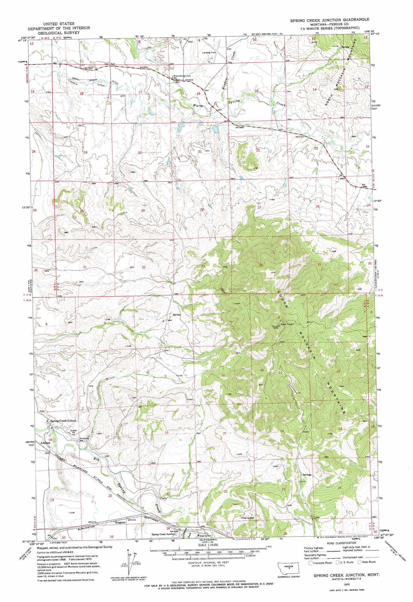
USGS Topo Quad 47109b5 - 1:24,000 scale
| Topo Map Name: | Spring Creek Junction |
| USGS Topo Quad ID: | 47109b5 |
| Print Size: | ca. 21 1/4" wide x 27" high |
| Southeast Coordinates: | 47.125° N latitude / 109.5° W longitude |
| Map Center Coordinates: | 47.1875° N latitude / 109.5625° W longitude |
| U.S. State: | MT |
| Filename: | o47109b5.jpg |
| Download Map JPG Image: | Spring Creek Junction topo map 1:24,000 scale |
| Map Type: | Topographic |
| Topo Series: | 7.5´ |
| Map Scale: | 1:24,000 |
| Source of Map Images: | United States Geological Survey (USGS) |
| Alternate Map Versions: |
Spring Creek Junction MT 1970, updated 1973 Download PDF Buy paper map Spring Creek Junction MT 2011 Download PDF Buy paper map Spring Creek Junction MT 2014 Download PDF Buy paper map |
1:24,000 Topo Quads surrounding Spring Creek Junction
Soda Spring Coulee |
Wild Bill Flat West |
Wild Bill Flat East |
Hilger Nw |
Christina |
Hoosac |
Toney Bench |
Seventytwo Hills |
Kendall |
Hilger |
Harwood Bench |
Danvers |
Spring Creek Junction |
Brooks |
New Year |
Kolin |
Ross Fork |
Glengarry |
Lewistown |
Pike Creek |
Sipple |
Moore |
West Fork Beaver Creek |
Castle Butte |
Heath |
> Back to 47109a1 at 1:100,000 scale
> Back to 47108a1 at 1:250,000 scale
> Back to U.S. Topo Maps home
Spring Creek Junction topo map: Gazetteer
Spring Creek Junction: Canals
Bank Ranch Ditch elevation 1110m 3641′Lincoln Ditch elevation 1114m 3654′
Spring Creek Junction: Dams
Crazy Creek Reservoir Dam elevation 1120m 3674′Petticoat Junction Dam elevation 1146m 3759′
Spring Creek Junction: Populated Places
Amherst elevation 1103m 3618′Kingston elevation 1138m 3733′
Spring Creek Junction elevation 1129m 3704′
Spring Creek Junction: Post Offices
Stahlville Post Office (historical) elevation 1103m 3618′Spring Creek Junction: Ranges
South Moccasin Mountains elevation 1509m 4950′Spring Creek Junction: Streams
Cottonwood Creek elevation 1109m 3638′Duck Creek elevation 1073m 3520′
Meadow Creek elevation 1100m 3608′
Spring Creek Junction: Wells
16N17E17BCD_01 Well elevation 1096m 3595′16N17E18BAD_01 Well elevation 1073m 3520′
16N17E18BDDA01 Well elevation 1074m 3523′
16N17E19DCD_01 Well elevation 1136m 3727′
16N17E19DCD_02 Well elevation 1136m 3727′
16N17E21ADD_01 Well elevation 1146m 3759′
16N17E22DCD_01 Well elevation 1205m 3953′
16N17E28ABC_01 Well elevation 1133m 3717′
17N17E18DADB01 Well elevation 1128m 3700′
Spring Creek Junction digital topo map on disk
Buy this Spring Creek Junction topo map showing relief, roads, GPS coordinates and other geographical features, as a high-resolution digital map file on DVD: