Fergus Ne Topo Map Montana
To zoom in, hover over the map of Fergus Ne
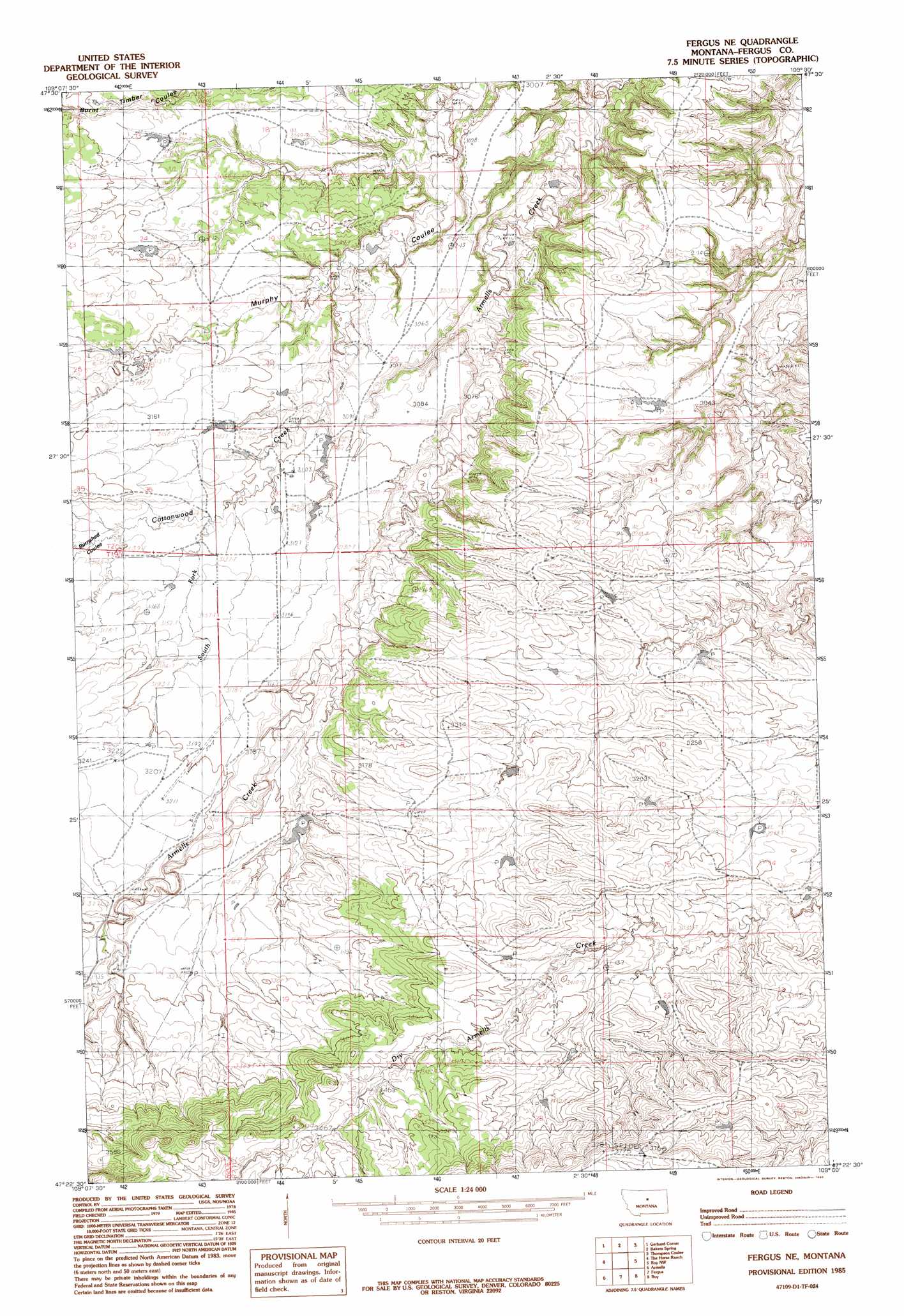
USGS Topo Quad 47109d1 - 1:24,000 scale
| Topo Map Name: | Fergus Ne |
| USGS Topo Quad ID: | 47109d1 |
| Print Size: | ca. 21 1/4" wide x 27" high |
| Southeast Coordinates: | 47.375° N latitude / 109° W longitude |
| Map Center Coordinates: | 47.4375° N latitude / 109.0625° W longitude |
| U.S. State: | MT |
| Filename: | o47109d1.jpg |
| Download Map JPG Image: | Fergus Ne topo map 1:24,000 scale |
| Map Type: | Topographic |
| Topo Series: | 7.5´ |
| Map Scale: | 1:24,000 |
| Source of Map Images: | United States Geological Survey (USGS) |
| Alternate Map Versions: |
Fergus NE MT 1985, updated 1985 Download PDF Buy paper map Fergus NE MT 2011 Download PDF Buy paper map Fergus NE MT 2014 Download PDF Buy paper map |
1:24,000 Topo Quads surrounding Fergus Ne
Taffy Ridge |
Woodhawk Hill |
Reppe Butte |
Baker Monument |
Grand Island |
Winifred East |
Gerhard Corner |
Bakers Spring |
Thompson Coulee |
Mitchell Crossing |
Christina |
The Horse Ranch |
Fergus Ne |
Roy Nw |
Griffee Coulee |
Hilger |
Armells |
Fergus |
Roy |
Bohemian Corners |
New Year |
Judith Peak |
Lewis Peak |
Grass Range Nw |
Grass Range Ne |
> Back to 47109a1 at 1:100,000 scale
> Back to 47108a1 at 1:250,000 scale
> Back to U.S. Topo Maps home
Fergus Ne topo map: Gazetteer
Fergus Ne: Dams
Petranek Dam elevation 957m 3139′Petranek Reservoir Dam elevation 938m 3077′
Satterfield Dam elevation 1006m 3300′
Fergus Ne: Streams
Cottonwood Creek elevation 906m 2972′South Fork Cottonwood Creek elevation 948m 3110′
Fergus Ne: Valleys
Burnshed Coulee elevation 958m 3143′Fergus Ne: Wells
19N20E13DD__01 Well elevation 989m 3244′19N20E24DB__01 Well elevation 1012m 3320′
19N21E17BBA_01 Well elevation 998m 3274′
20N21E19DA__01 Well elevation 927m 3041′
20N21E26CA__01 Well elevation 902m 2959′
20N21E29BC__01 Well elevation 924m 3031′
20N21E29DA__01 Well elevation 938m 3077′
20N21E32DB__01 Well elevation 916m 3005′
Fergus Ne digital topo map on disk
Buy this Fergus Ne topo map showing relief, roads, GPS coordinates and other geographical features, as a high-resolution digital map file on DVD: