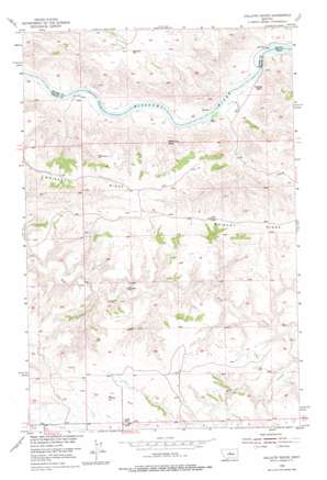
Gallatin Rapids Topo Map Montana
To zoom in, hover over the map of Gallatin Rapids
USGS Topo Quad 47109f4 - 1:24,000 scale
| Topo Map Name: | Gallatin Rapids |
| USGS Topo Quad ID: | 47109f4 |
| Print Size: | ca. 21 1/4" wide x 27" high |
| Southeast Coordinates: | 47.625° N latitude / 109.375° W longitude |
| Map Center Coordinates: | 47.6875° N latitude / 109.4375° W longitude |
| U.S. State: | MT |
| Filename: | o47109f4.jpg |
| Download Map JPG Image: | Gallatin Rapids topo map 1:24,000 scale |
| Map Type: | Topographic |
| Topo Series: | 7.5´ |
| Map Scale: | 1:24,000 |
| Source of Map Images: | United States Geological Survey (USGS) |
| Alternate Map Versions: |
Gallatin Rapids MT 1954, updated 1956 Download PDF Buy paper map Gallatin Rapids MT 1954, updated 1976 Download PDF Buy paper map Gallatin Rapids MT 2011 Download PDF Buy paper map Gallatin Rapids MT 2014 Download PDF Buy paper map |
1:24,000 Topo Quads surrounding Gallatin Rapids
> Back to 47109e1 at 1:100,000 scale
> Back to 47108a1 at 1:250,000 scale
> Back to U.S. Topo Maps home
Gallatin Rapids topo map: Gazetteer
Gallatin Rapids: Capes
Leslie Point elevation 894m 2933′Gallatin Rapids: Pillars
Jones Cone elevation 842m 2762′Sugarloaf Rock elevation 768m 2519′
Gallatin Rapids: Rapids
Bear Rapids elevation 724m 2375′Dauphin Rapids elevation 719m 2358′
Gallatin Rapids elevation 724m 2375′
Little Dog Rapids elevation 722m 2368′
Gallatin Rapids: Ridges
Whiskey Ridge elevation 1013m 3323′Gallatin Rapids: Summits
Oil Well Hill elevation 1017m 3336′Gallatin Rapids: Valleys
Flax Coulee elevation 939m 3080′Gallatin Rapids: Wells
22N17E35DDDD01 Well elevation 1011m 3316′Gallatin Rapids digital topo map on disk
Buy this Gallatin Rapids topo map showing relief, roads, GPS coordinates and other geographical features, as a high-resolution digital map file on DVD:


