Council Island Topo Map Montana
To zoom in, hover over the map of Council Island
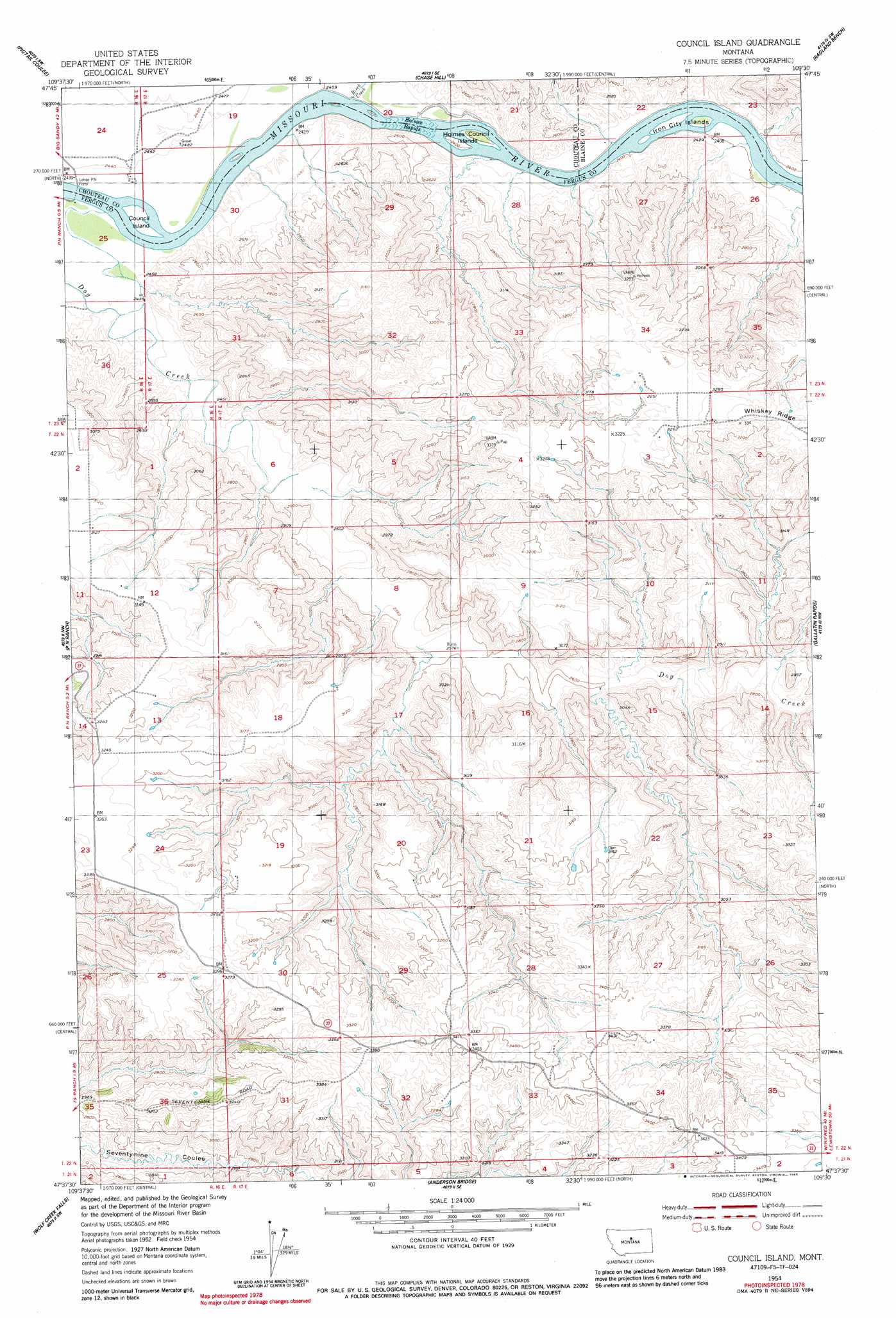
USGS Topo Quad 47109f5 - 1:24,000 scale
| Topo Map Name: | Council Island |
| USGS Topo Quad ID: | 47109f5 |
| Print Size: | ca. 21 1/4" wide x 27" high |
| Southeast Coordinates: | 47.625° N latitude / 109.5° W longitude |
| Map Center Coordinates: | 47.6875° N latitude / 109.5625° W longitude |
| U.S. State: | MT |
| Filename: | o47109f5.jpg |
| Download Map JPG Image: | Council Island topo map 1:24,000 scale |
| Map Type: | Topographic |
| Topo Series: | 7.5´ |
| Map Scale: | 1:24,000 |
| Source of Map Images: | United States Geological Survey (USGS) |
| Alternate Map Versions: |
Council Island MT 1954, updated 1956 Download PDF Buy paper map Council Island MT 1954, updated 1985 Download PDF Buy paper map Council Island MT 2011 Download PDF Buy paper map Council Island MT 2014 Download PDF Buy paper map |
1:24,000 Topo Quads surrounding Council Island
Seifort Reservoir |
Eskay Nw |
Eskay Ne |
Saddle Rock |
Nolan Reservoir |
Iliad |
Pigtail Coulee |
Chase Hill |
Ragland Bench |
Leroy |
Starve Out Flat |
P N Ranch |
Council Island |
Gallatin Rapids |
Taffy Ridge |
Spring Coulee |
Wolf Creek Falls |
Anderson Bridge |
Winifred West |
Winifred East |
Soda Spring Coulee |
Wild Bill Flat West |
Wild Bill Flat East |
Hilger Nw |
Christina |
> Back to 47109e1 at 1:100,000 scale
> Back to 47108a1 at 1:250,000 scale
> Back to U.S. Topo Maps home
Council Island topo map: Gazetteer
Council Island: Bridges
Winifred Bridge elevation 734m 2408′Council Island: Islands
Council Island elevation 734m 2408′Holmes Council Islands elevation 731m 2398′
Iron City Islands elevation 728m 2388′
Council Island: Rapids
Holmes Rapids elevation 736m 2414′McKeevers Rapids elevation 728m 2388′
Council Island: Streams
Birch Creek elevation 736m 2414′Dog Creek elevation 734m 2408′
Council Island digital topo map on disk
Buy this Council Island topo map showing relief, roads, GPS coordinates and other geographical features, as a high-resolution digital map file on DVD: