Iliad Topo Map Montana
To zoom in, hover over the map of Iliad
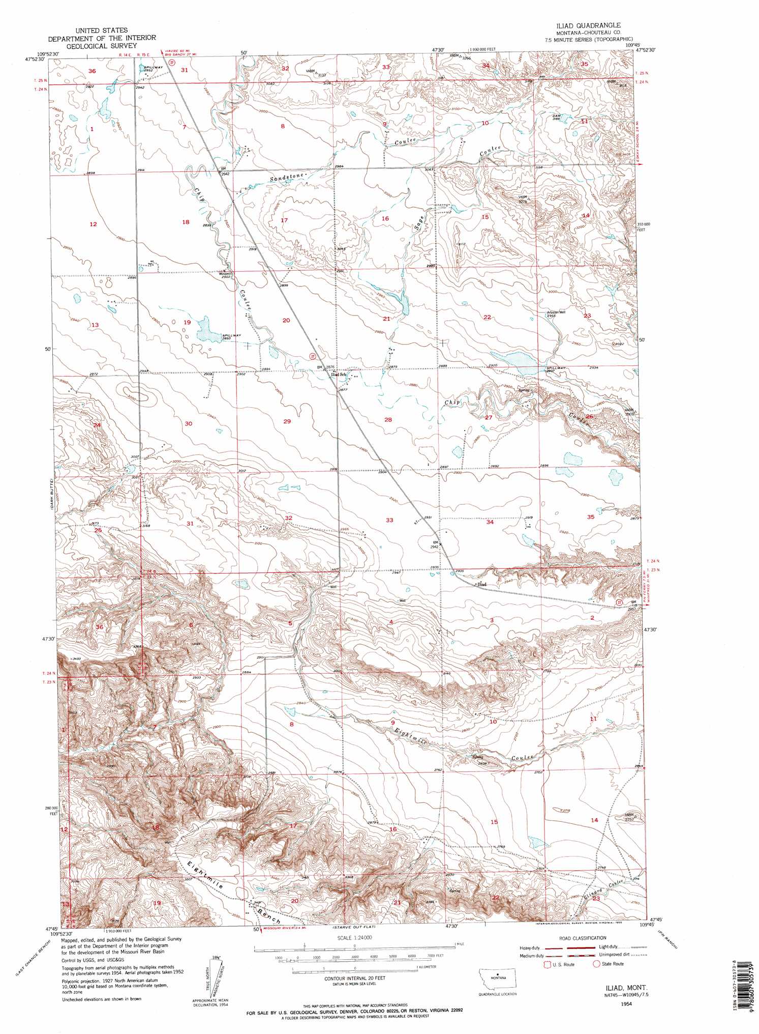
USGS Topo Quad 47109g7 - 1:24,000 scale
| Topo Map Name: | Iliad |
| USGS Topo Quad ID: | 47109g7 |
| Print Size: | ca. 21 1/4" wide x 27" high |
| Southeast Coordinates: | 47.75° N latitude / 109.75° W longitude |
| Map Center Coordinates: | 47.8125° N latitude / 109.8125° W longitude |
| U.S. State: | MT |
| Filename: | o47109g7.jpg |
| Download Map JPG Image: | Iliad topo map 1:24,000 scale |
| Map Type: | Topographic |
| Topo Series: | 7.5´ |
| Map Scale: | 1:24,000 |
| Source of Map Images: | United States Geological Survey (USGS) |
| Alternate Map Versions: |
Iliad MT 1954, updated 1955 Download PDF Buy paper map Iliad MT 1954, updated 1955 Download PDF Buy paper map Iliad MT 2011 Download PDF Buy paper map Iliad MT 2014 Download PDF Buy paper map |
1:24,000 Topo Quads surrounding Iliad
Lonetree Coulee |
Studhorse Butte |
Ryan Butte |
Tiger Butte |
Warrick |
Pilot Rock |
Eagleton Nw |
Seifort Reservoir |
Eskay Nw |
Eskay Ne |
Eagle Buttes |
Dark Butte |
Iliad |
Pigtail Coulee |
Chase Hill |
Square Butte Ne |
Last Chance Bench |
Starve Out Flat |
P N Ranch |
Council Island |
Square Butte Se |
Steele Lake Coulee |
Spring Coulee |
Wolf Creek Falls |
Anderson Bridge |
> Back to 47109e1 at 1:100,000 scale
> Back to 47108a1 at 1:250,000 scale
> Back to U.S. Topo Maps home
Iliad topo map: Gazetteer
Iliad: Dams
Comet Dam elevation 897m 2942′Jappe Dam elevation 842m 2762′
Tortilla Dam elevation 883m 2896′
Iliad: Populated Places
Iliad elevation 897m 2942′Iliad: Post Offices
Iliad Post Office (historical) elevation 897m 2942′Iliad: Valleys
Sage Coulee elevation 878m 2880′Sandstone Coulee elevation 888m 2913′
Iliad: Wells
23N15E08DBBD01 Well elevation 870m 2854′23N15E23CBA_01 Well elevation 872m 2860′
24N15E33CBDA01 Well elevation 906m 2972′
Iliad digital topo map on disk
Buy this Iliad topo map showing relief, roads, GPS coordinates and other geographical features, as a high-resolution digital map file on DVD: