Nolan Reservoir Topo Map Montana
To zoom in, hover over the map of Nolan Reservoir
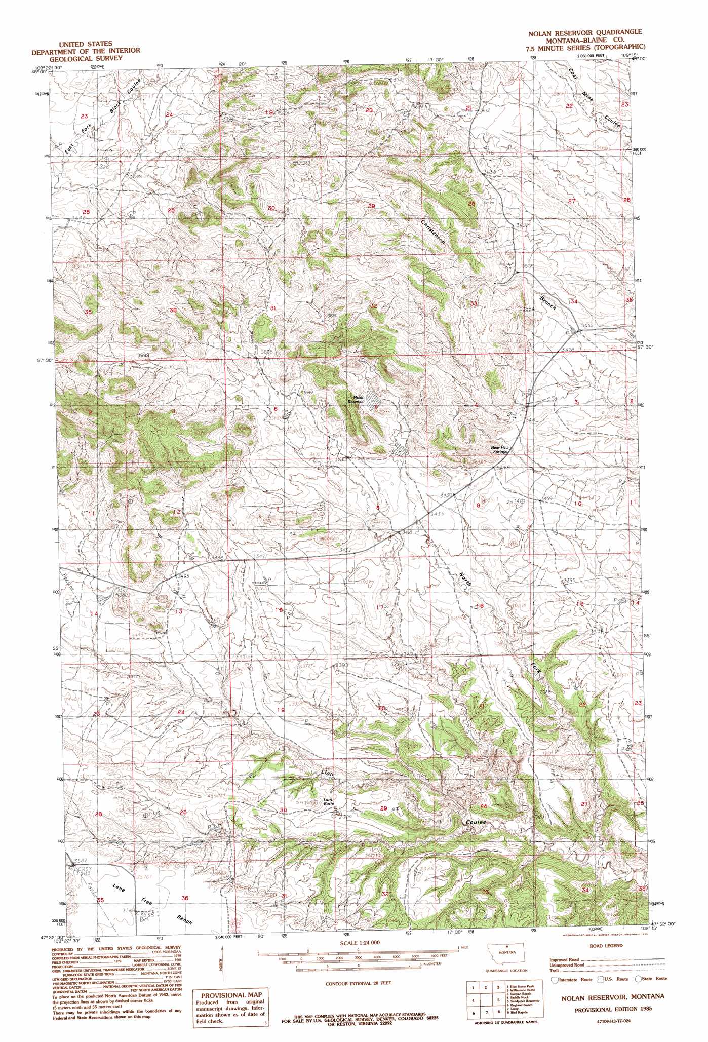
USGS Topo Quad 47109h3 - 1:24,000 scale
| Topo Map Name: | Nolan Reservoir |
| USGS Topo Quad ID: | 47109h3 |
| Print Size: | ca. 21 1/4" wide x 27" high |
| Southeast Coordinates: | 47.875° N latitude / 109.25° W longitude |
| Map Center Coordinates: | 47.9375° N latitude / 109.3125° W longitude |
| U.S. State: | MT |
| Filename: | o47109h3.jpg |
| Download Map JPG Image: | Nolan Reservoir topo map 1:24,000 scale |
| Map Type: | Topographic |
| Topo Series: | 7.5´ |
| Map Scale: | 1:24,000 |
| Source of Map Images: | United States Geological Survey (USGS) |
| Alternate Map Versions: |
Nolan Reservoir MT 1985, updated 1985 Download PDF Buy paper map Nolan Reservoir MT 2011 Download PDF Buy paper map Nolan Reservoir MT 2014 Download PDF Buy paper map |
1:24,000 Topo Quads surrounding Nolan Reservoir
Big John Butte |
Maddux |
Corrigan Mountain |
Scotty Butte |
Suction Butte |
Warrick |
Blue Stone Peak |
Williamson Butte |
Runyan Bench |
Rattlesnake |
Eskay Ne |
Saddle Rock |
Nolan Reservoir |
Sandpiper Reservoir |
Butch Reservoir |
Chase Hill |
Ragland Bench |
Leroy |
Bird Rapids |
Sturgeon Island |
Council Island |
Gallatin Rapids |
Taffy Ridge |
Woodhawk Hill |
Reppe Butte |
> Back to 47109e1 at 1:100,000 scale
> Back to 47108a1 at 1:250,000 scale
> Back to U.S. Topo Maps home
Nolan Reservoir topo map: Gazetteer
Nolan Reservoir: Populated Places
Riedel (historical) elevation 1120m 3674′Nolan Reservoir: Post Offices
Riedel Post Office (historical) elevation 1120m 3674′Nolan Reservoir: Reservoirs
Nolan Reservoir elevation 1088m 3569′Nolan Reservoir: Springs
Bear Paw Springs elevation 1061m 3480′Nolan Reservoir: Summits
Lion Butte elevation 1047m 3435′Nolan Reservoir digital topo map on disk
Buy this Nolan Reservoir topo map showing relief, roads, GPS coordinates and other geographical features, as a high-resolution digital map file on DVD: